|
|
Proximity/LUCA Main Page |
Using TIGER/Line Shapefiles & Creating Streets Shapefiles The TIGER/Line shapefiles being distributed for use by LUCA participants closely parallel the structure of the forthcoming public use TIGER/Line shapefiles (TGRSHP -- not yet released as of 12/26/07). The public use TIGER/Line shapefiles are described at http://www.census.gov/geo/www/tiger/tgrshp.html. The TGRSHP files include the EDGES (all lines) shapefile but no roads/streets shapefile. The CommunityViewer new Edge2Street feature enables the user to create a streets shapefile from the edges shapefile, used in combination with the address (ADDR) and faces (FACES) "associated database files." The Edge2Street operation first filters out shapes/lines from the EDGES shapefile that are not roads/streets. Next the Edge2Street operation extends the base EDGE shapefile attribute table (shapefile dbf) to include all of the EDGE sourced fields plus adding and populating several other fields useful for geocoding and related street segment operations. For LUCA operations, a streets shapefile is required to use as a geographic base file for geocoding. This is the only practical way to accurately assign census block geocodes to structures/address locations. CV Project Showing Primary TGRSHP Layers/Shapefiles 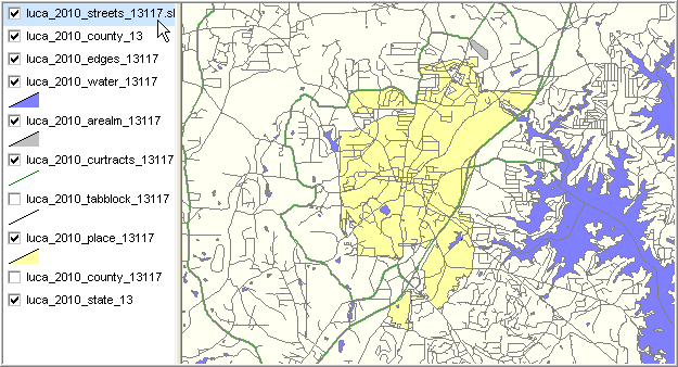
Zoom-in View without Edges (All Lines) Layer; Streets Layer with Street Names - profile at right for Canton street segment (by pointer) showing Edge-sourced fields 
Additional fields in above Canton street segment dbf, sourced from ADDR and FACES "associated database files" - Note availability of left- and right-side attributes unavailable in Edges shapefile alone. 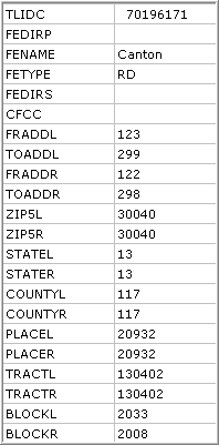
View of all fields in the Canton street segment dbf 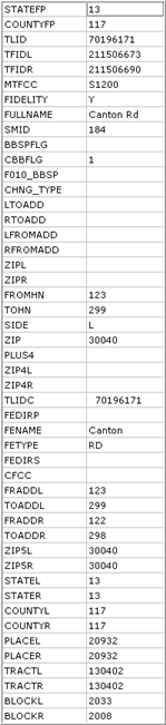
|
|
|