|
|
|
Cedar Rapids & Iowa City, Iowa Metropolitan Areas -- Neighborhood & Community Demographics Views of the Cedar Rapids, Iowa and Iowa City, Iowa metro areas, produced using the Proximity CommunityViewer software, are presented on this Web page. Layers are shown in the Legend at left (only some appear in this view). Map window shows active layers "stacked." Light yellow counties are the extended region counties. Light green counties comprise the current official Cedar Rapids, IA metropolitan statistical area. The Iowa City, IA metropolitan statistical area, blue-green counties, is to the south of Cedar Rapids MSA. 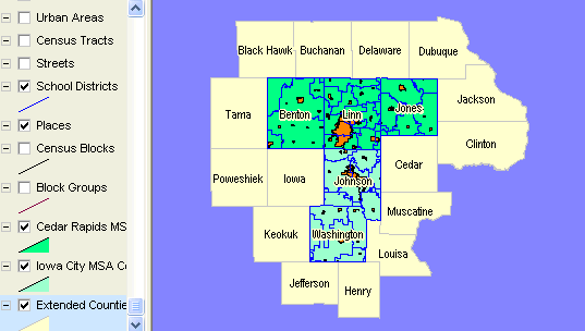
Places, Urbanized Areas and Urban Clusters 
Schools and School districts. 
ZIP Code Areas. 
Median Household Income by Block Group. 
Population by Census Block with Places; Zoom-in to Cedar Rapids. 
Zoom into Cedar Rapids city streets, schools and United Way location. 
Further zoom showing schools, streets, and profiling one school. 
Same view as above, profiling street segment where school is located. 
[goto top] |
|
|