|
|
Arlington County Attendance Areas
|
Washington, DC Metro Area -- Regional & Local GeoDemographics Applications reviewed on this Web page demonstrate use of CommunityViewer with geography in the Washington, DC metro area with zoom-in to neighborhood areas. The 2003 official definition of the focus area is the Washington-Arlington-Alexandria, DC-VA-MD-WV Metropolitan Statistical Area (MSA). This MSA is comprised of two metropolitan divisions: Bethesda-Frederick-Gaithersburg, MD (13644) and Washington-Arlington-Alexandria, DC-VA-MD-WV (47894). Initial view at project start-up. 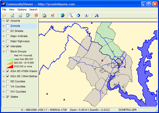
Addition of schools (note legend layer clicked on): 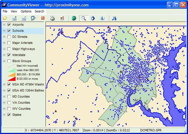
Thematic map showing median household income for the MSA by block group: 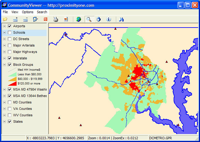
Zoom-in to the Interstate 495 beltway area: 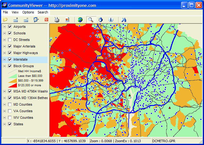
Further zoom to Washington DC, area north of Capitol area ... all DC streets layer on ... next graphic shows zoom to pointer location in this view: 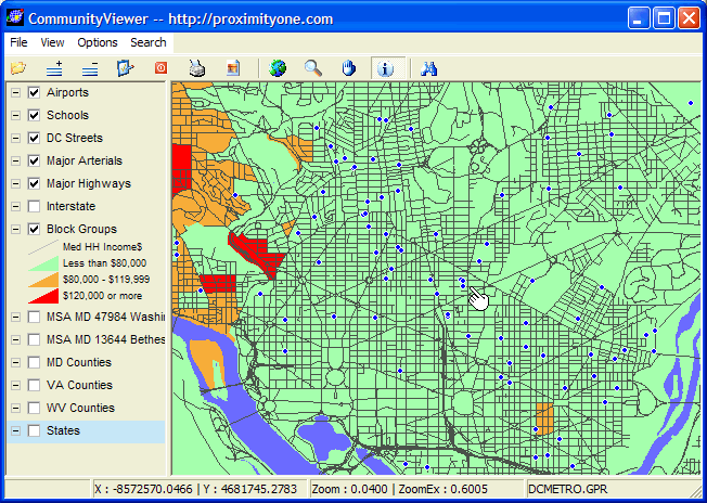
Further zoom – Cook Elementary School, profiled with identify tool: 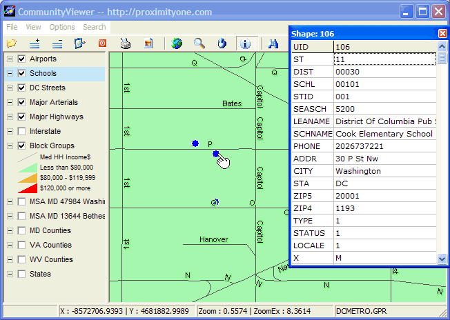
Street segment where Cook Elementary is located is profiled 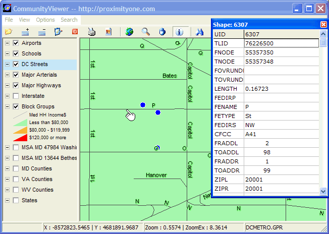
Additional street segment attributes: 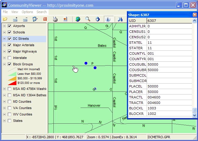
Focus area shifts to Montgomery County. All streets layer turned on. 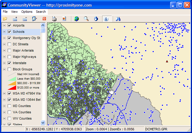
Zoom into area showing Greencastle Elementary School; profiled using identify tool. 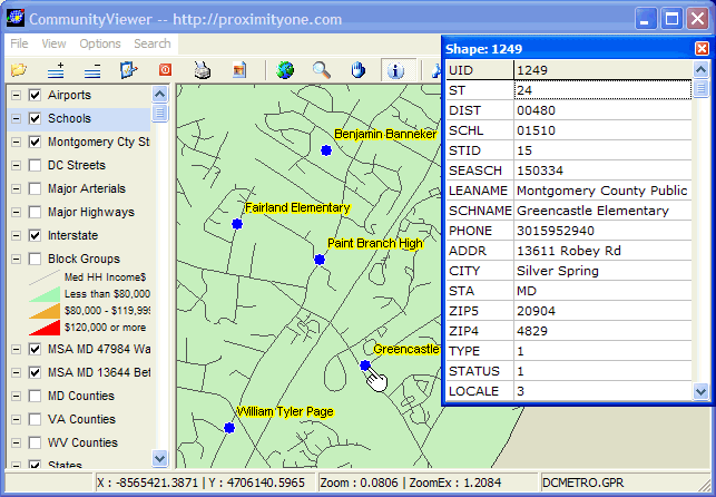
Street segment where Greencastle Elementary is located is profiled: 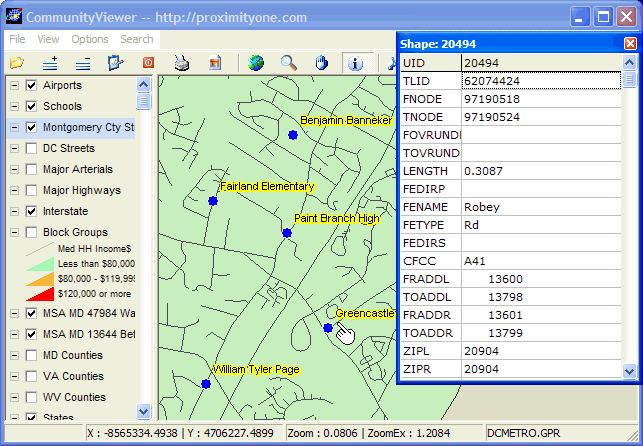
Further zoom shows additional street detail in school vicinity: 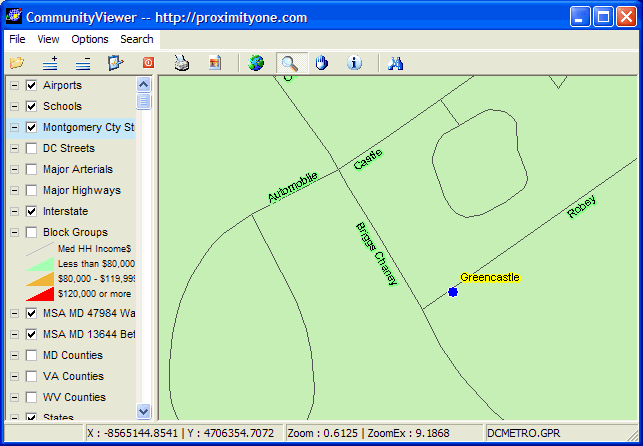
Same area, showing block group boundaries with median household income for block group as label value. 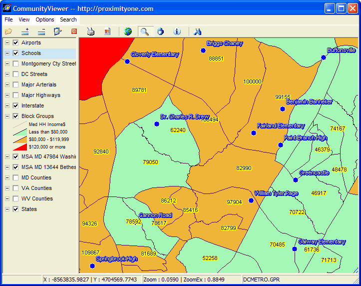
Arlington County Attendance Areas. Attendance area boundaries are established by individual districts. These areas often coincide with neighborhoods. AA boundaries change often in districts with rapid population change. The next few views show Arlington County attendance areas. Arlington County Elementary Schools - red outline 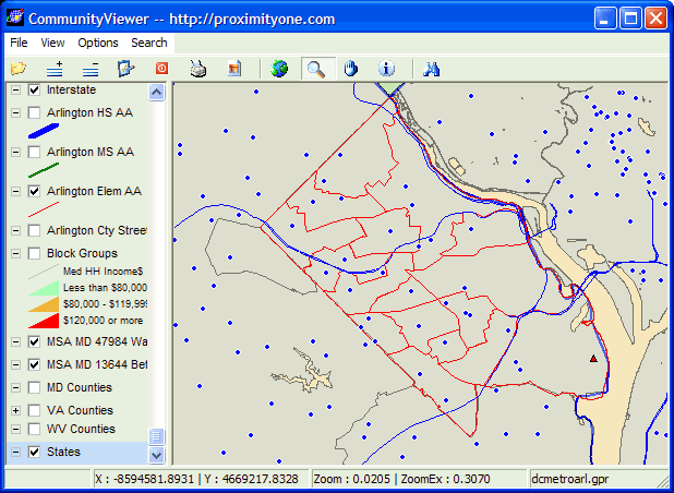
Arlington County Middle Schools (with elementary AAs) - green outline 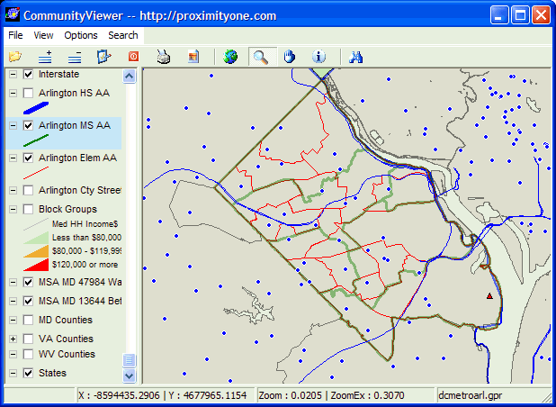
Arlington County High Schools (with elementary and middle school) - blue outline 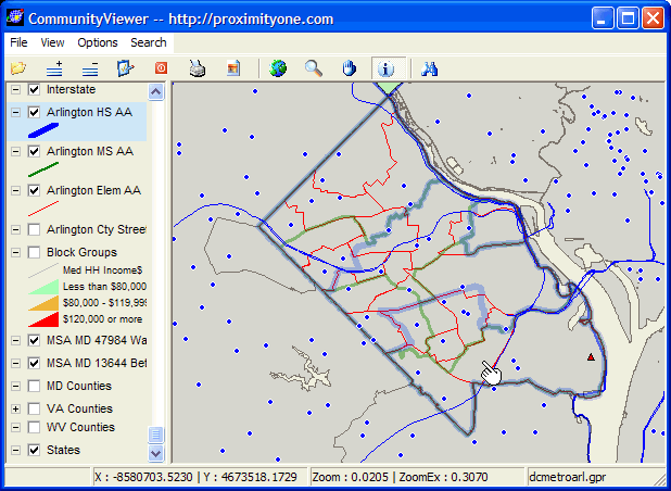
Zoom to area in south Arlington (pointer in above map); addition of block group thematic map -- identify tool used to profile block group with higher median household income (DP3058=$122,200) 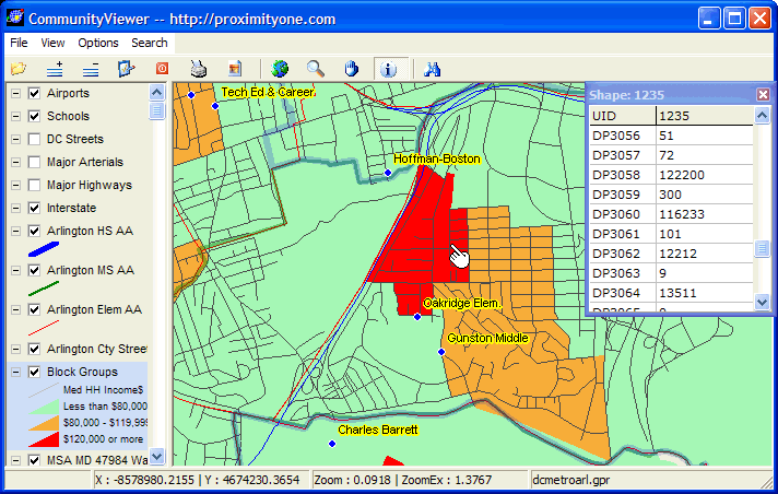
[goto top] |
|
|