|
|
|
Decision Making Information Solutions: Metro Focus -- integrated GIS & analytical software and geodemographics
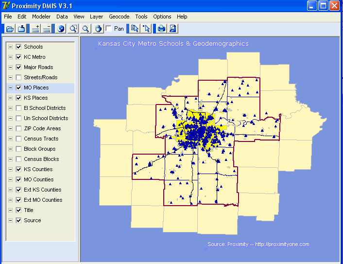
Click on the graphic at the right to see a sample start-up screen for the Kansas City MO-KS DMIS Metro Package. The DMIS Metro Geodemographic Packages are available for any U.S. metro (or custom defined region). Register for DMIS Metro Demo. Movie-oriented demos of Kansas City-related GIS/geodemographics software/database applications are available. Run the movie on your computer to get an overview features and capabilities.
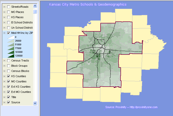
Assessing Socioeconomic Characteristics. Click on the map at the right to see a thematic map of the Kansas City metro ZIP codes by median household income. Flexibly label and show other types of geographic layers such as streets. View income characteristics, ancestry, employment by industry and occupation, educational attainment, housing characteristics, diversity patterns by multiple types of geography.
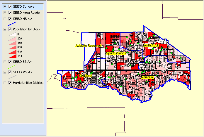
The DMIS map at the right shows a thematic map of population by census block for Spring Branch ISD, Texas (click for larger view). Custom developed attendance area boundary files are added to the standard DMIS components. High school attendance areas appear with blue borders. It is easy to see and understand population distribution with attendance areas using these tools.
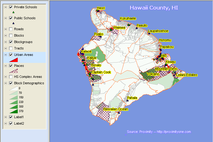
The map at the right shows schools in the context of places and urban areas in Hawaii County, Hawaii (click for larger view). One layer shows a thematic map of population by census block. This view makes it easy to understand, and convey to others, the extent and location of urbanization. Real estate and property management. Add a point layer that would show the location of properties to be sold. In person, by printing a map/display, or by making a movie, show clients location information as well as features of neighborhoods and areas defined as you like. Click on a property and see an image, listing, or profile that you add.
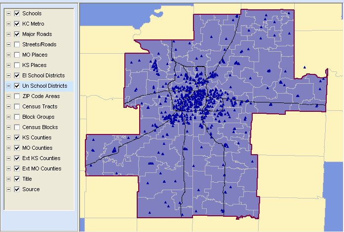
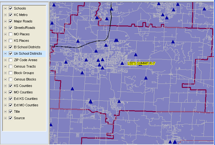
Show locations of schools relative to properties for sale. The basic school database is already loaded providing enrollment and school attributes for more than 700 K-12 schools in the KC metro. Show demographic and school composite characteristics for a selected school district, a set of school districts, or query for districts meeting certain criteria. The preloaded demographic database for school districts (as well as other types of geography) includes approximately 500 subject matter items.
The DMIS software and data are developed by Proximity. This is a complete standalone integrated software and database resource operating on most any Windows based computer. It has a minimal learning curve and can be put to work immediately. No other software or data are required to use it.
Standard GIS layers (in standard shapefile structure) include:
[goto top] |
|
|