Memphis Metro Area

Contents
Selected CommunityViewer project/application views in Tennessee.
Click toggle in Table of Contents at left to view sub-state applications.
Integrating Census 2010 TIGER Shapefiles and ACS 2009 5-year demographics.
Selected Memphis Area Views
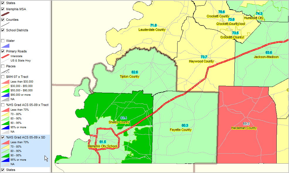
Educational Attainment by School District - Memphis Area Percent high school graduate (population 25 years and over) by census tract. Data based on 2009 American Community Survey (http://proximityone.com/acs.htm) 5-year estimates, centric to mid-2007. See related ranking table http://proximityone.com/sd_tn.htm.
See color patterns in highlighted layer in legend at left of map view.
|
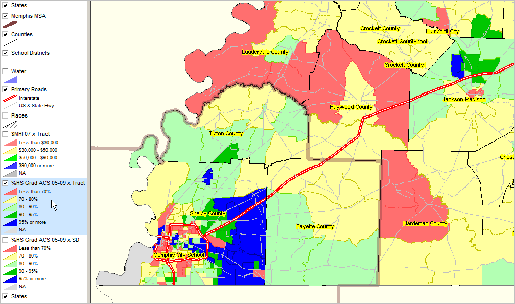
Educational Attainment by Census Tract - Memphis Area Percent high school graduate (population 25 years and over) by census tract. Data based on 2009 American Community Survey (http://proximityone.com/acs.htm) 5-year estimates, centric to mid-2007. See related ranking table http://proximityone.com/ustr0509_tn.htm.
See color patterns in highlighted layer in legend at left of map view.
|
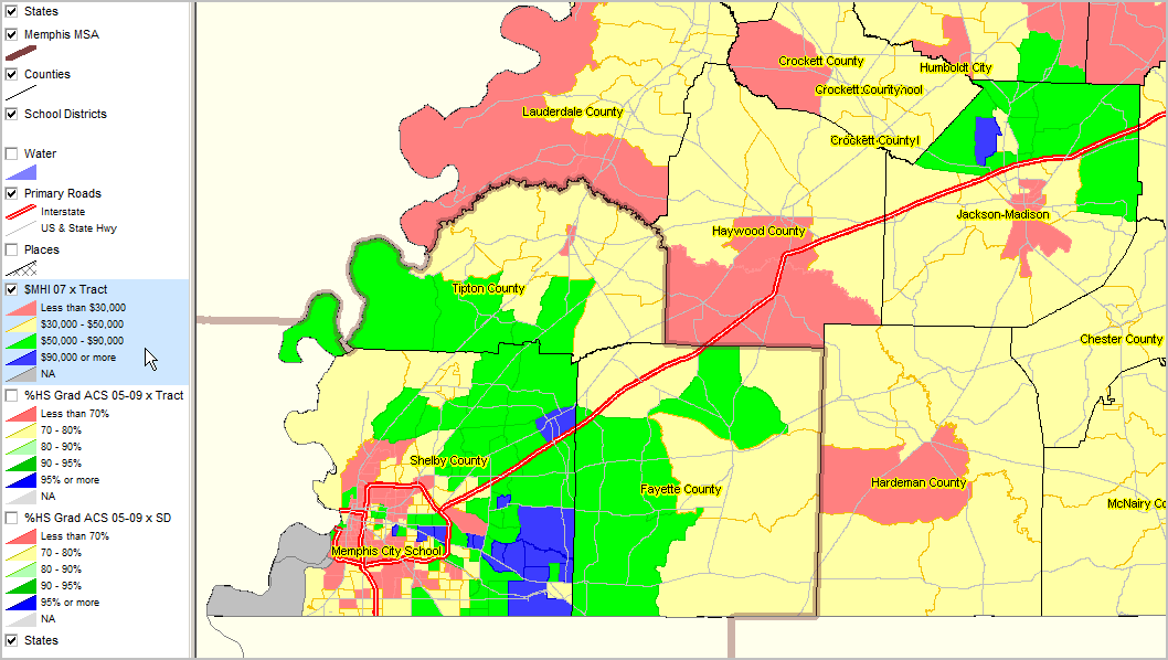
Median household income ($MHI) by census tract. Data based on 2009 American Community Survey (http://proximityone.com/acs.htm) 5-year estimates, centric to mid-2007. See related ranking table http://proximityone.com/ustr0509_tn.htm.
See $MHI color patterns in highlighted layer in legend at left of map view
|
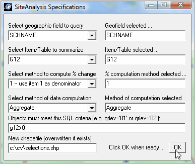
Site Analysis specifications set (processing on schools layer)
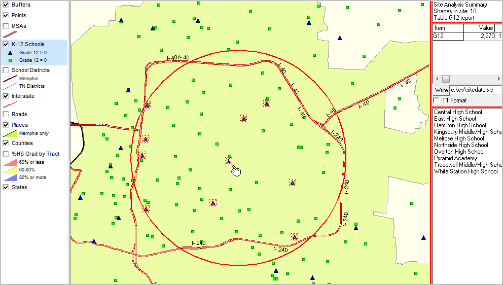
Schools are selected in a manner that selects all schools inside the beltway area - see graphic below. Selected schools show as cross-hatched. Upper right table shows cumulative 12th grade school enrollment of 2,270. Schools selected/tallied are listed in lower right table. An extract/selected schools point shapefile and Excel file are also generated for subsequent use.
|
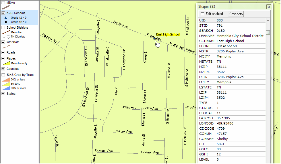
Zoom-in to location of school shown toward center in previous map view. Streets layer clicked on. Identify tool used to display mini-profile of the selected school.
|