Urban-Suburban-Rural Schools

Contents
Examining School Urban-Suburban-Rural Patterns using GIS Tools
Are your schools of interest urban, suburban or rural? Many stakeholders are interested in analyzing schools based on an urbanicity or locale measure. The National Center for Education Statistics (U.S. Department of Education) has long used a locale code for both schools and schools districts in the Common Core of Data program. A substantially improved locale code was introduced in 2006.
The locale concept has better applicability to schools than school districts since many school districts are combinations of urban, suburban or rural territories. Possibly a better way to assign a locale code to a school district would be a measure showing how much of the district is in an urban area (by census block) as defined by the Census Bureau. This also has the limitation that census block urban/rural status is updated by Census only once every 10 years.
Using CV XE GIS and demographic pattern analysis ... this section shows examples of why the NCES school locale code should be examined at more than face value -- even at the school level. To illustrate, views in this section show how some schools coded as suburban are well within the urbanized area in selected areas across the U.S. and should be designated as urban.
See related Schools & School Districts section -- http://proximityone.com/sddmi.htm
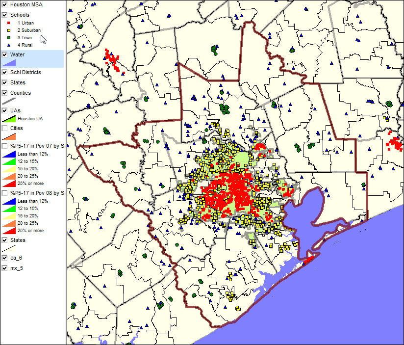
Houston 10-county MSA brown boundary Houston urbanized green fill pattern Schools layer shows Urban-Suburban-Rural status by marker type (see pointer in legend panel at left) -- based on NCES locale code (see code definitions further down in this section).
|
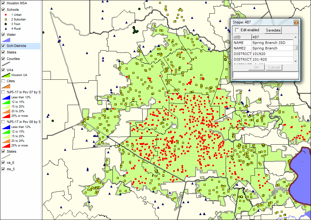
Focus view on Harris County (gray boundary) School districts appear with black boundary. Mini-profile of Spring Branch ISD displayed (see pointer on map) Note yellow marker schools showing as suburban in the Spring Branch ISD area
|
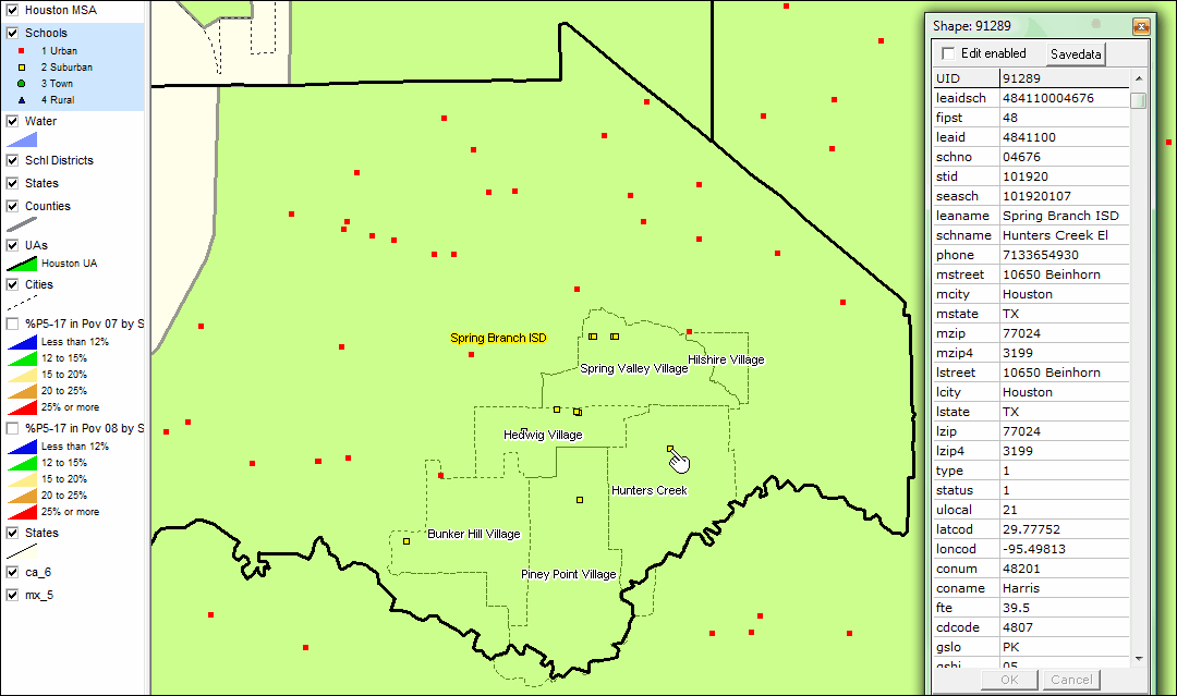
Spring Branch ISD black boundary Identify tool used to show mini-profile of Hunters Creek EL school -- an example of an urban school classified as subsurban Hunters Creek School located in Hilshire Village. See details below map view.
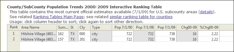
Hilshire Village is a small incorporated place within Harris County. The following graphic showing demographic attributes of Hilshire can be viewed in the interactive ranking table at http://proximityone.com/places.htm.
|
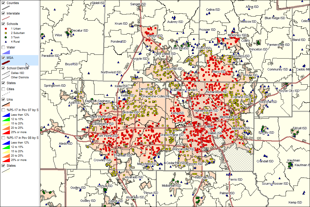
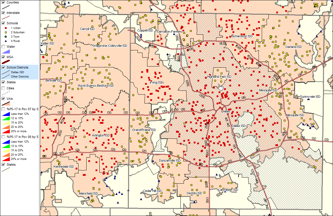
Focus on Dallas Urbanized Area. Dallas ISD school district appears with cross hatch pattern. Next view shows zoom-in
Note Highland Park ISD, contained within Dallas ISD, schools all appear as suburban. See pointer. Yet all surrounding schools are coded as urban.
|
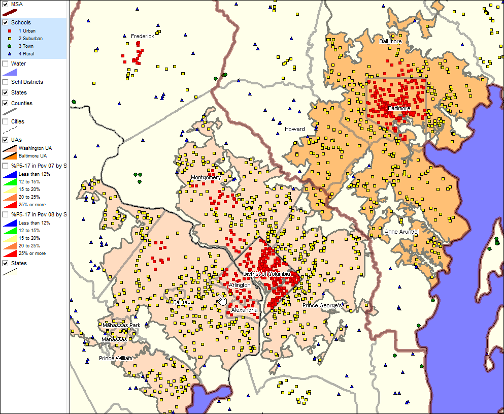
The following view shows the Washington, DC and Baltimore, MD urbanized area with orange fill pattern. Most schools coded urban within the UAs is due to the school being within the 'principal city' -- Alexandria, Arlington or Washington, DC in the case of the Washington UA. Schools in much of Fairfax County (see pointer) are located in neighborhoods/service areas indistinguishable in urbanicity from those in the principal city areas. Similarly, most schools in Maryland near the DC boundary are very urban in character. Principal city designation should not be a criteria in assigning urbanicity.
|
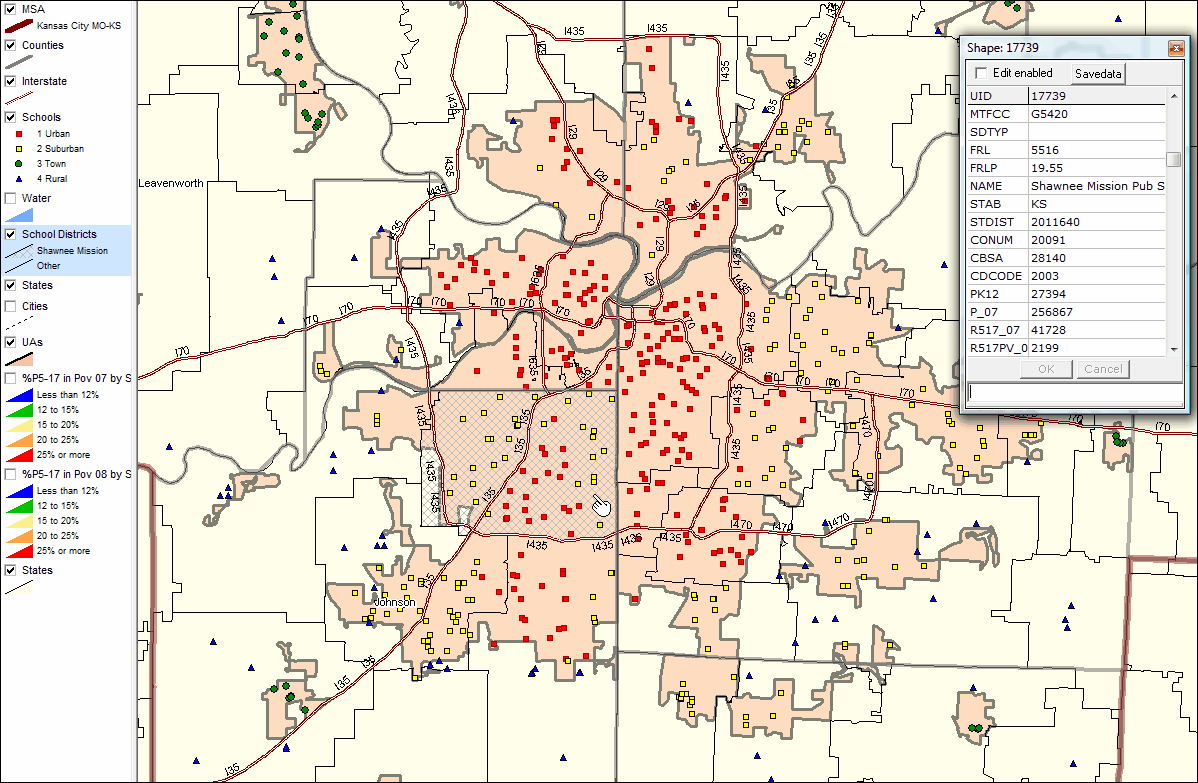
The following view shows schools in the Kansas City, MO-KS area. See next zoom-in view with school districts added to view.
The next view shows a zoom-in relative to the view above. School districts are shown with black boundaries. Shawnee Mission, KS school district shows a different fill pattern (see legend at left). A mini-profile is shown for that district. See pointer in school district. Schools above pointer have indistinguishable urbanicity from those in districts to the north and east of Shawnee Mission. They should all be coded red, urban. Again, the argument might be that if a school serves an entirely urban area, it should be classified as urban.
|

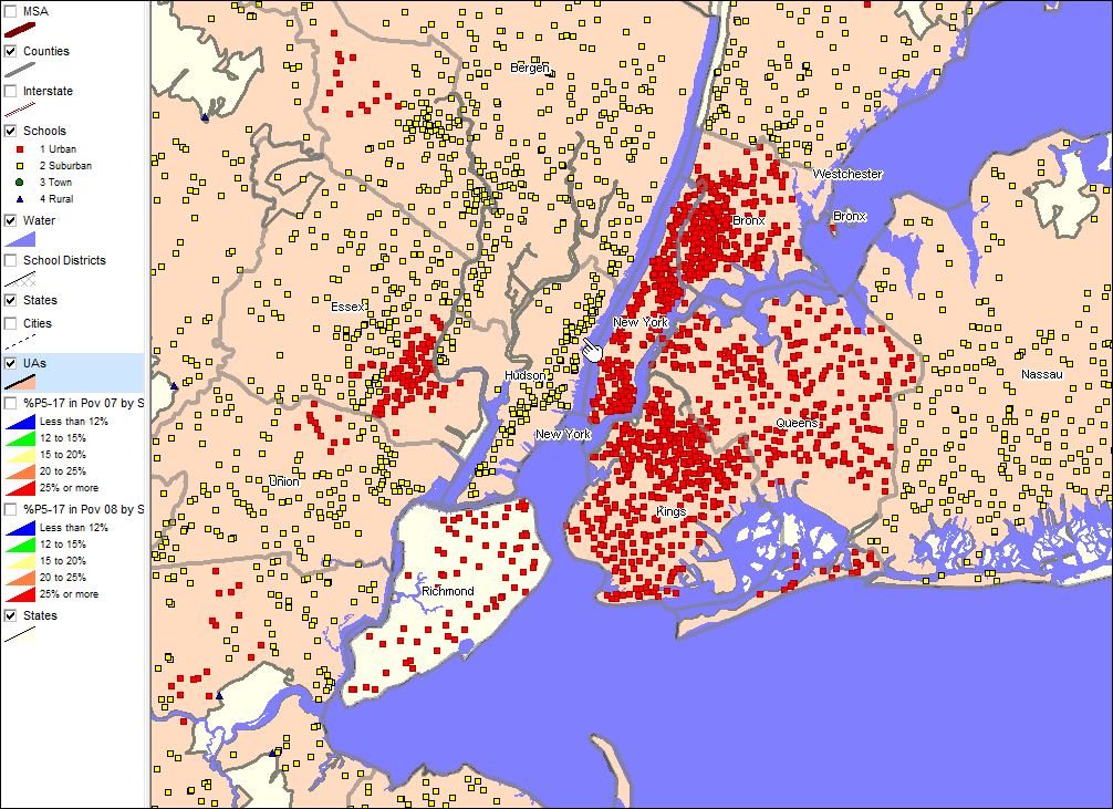
The entire area in the next view is within the New York MSA. See pointer. No school in Hudson County, NJ is urban?
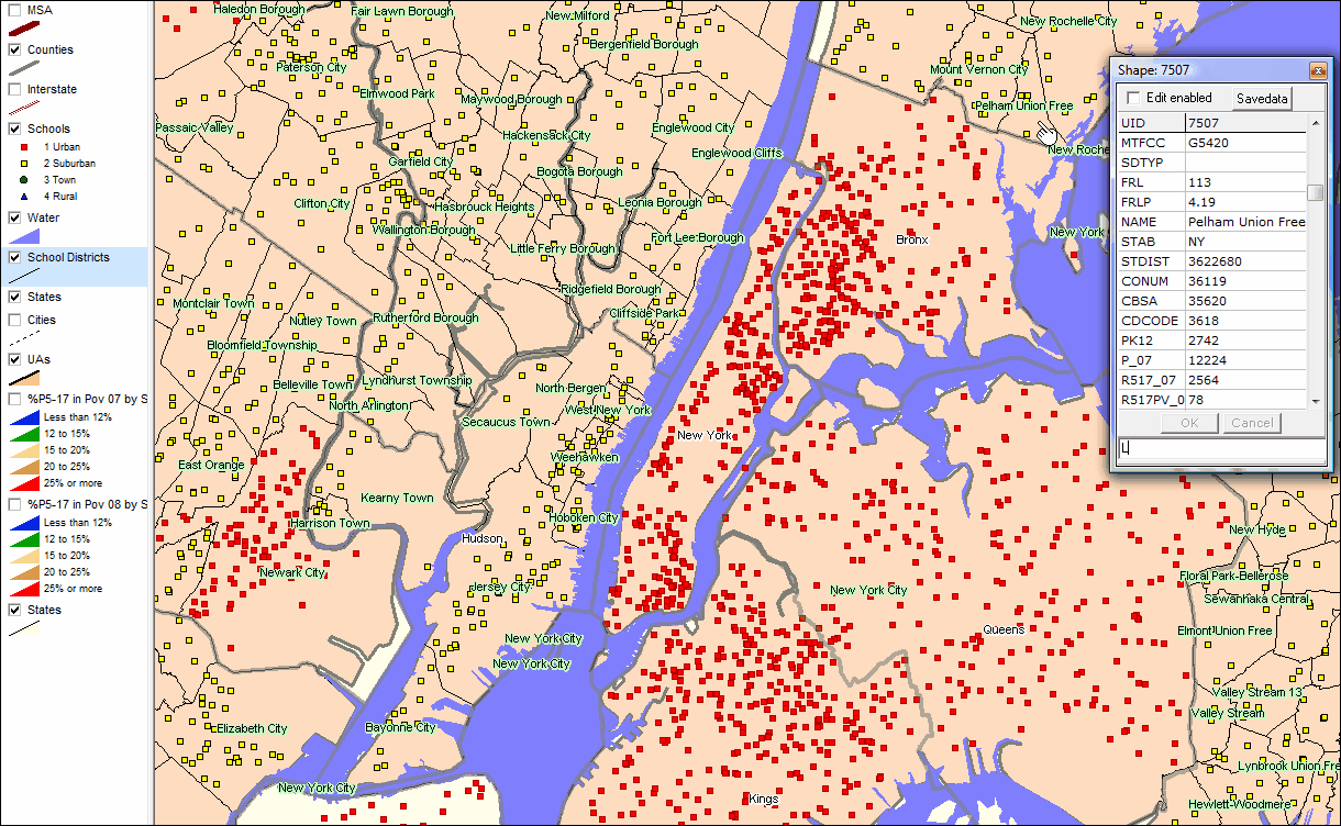
Zoom-in view of above showing school districts and school district names.
|
Three county Miami MSA.
|

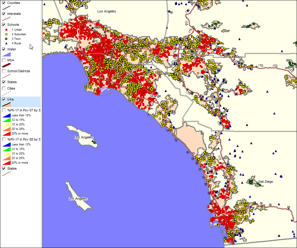
Los Angeles to San Diego Area
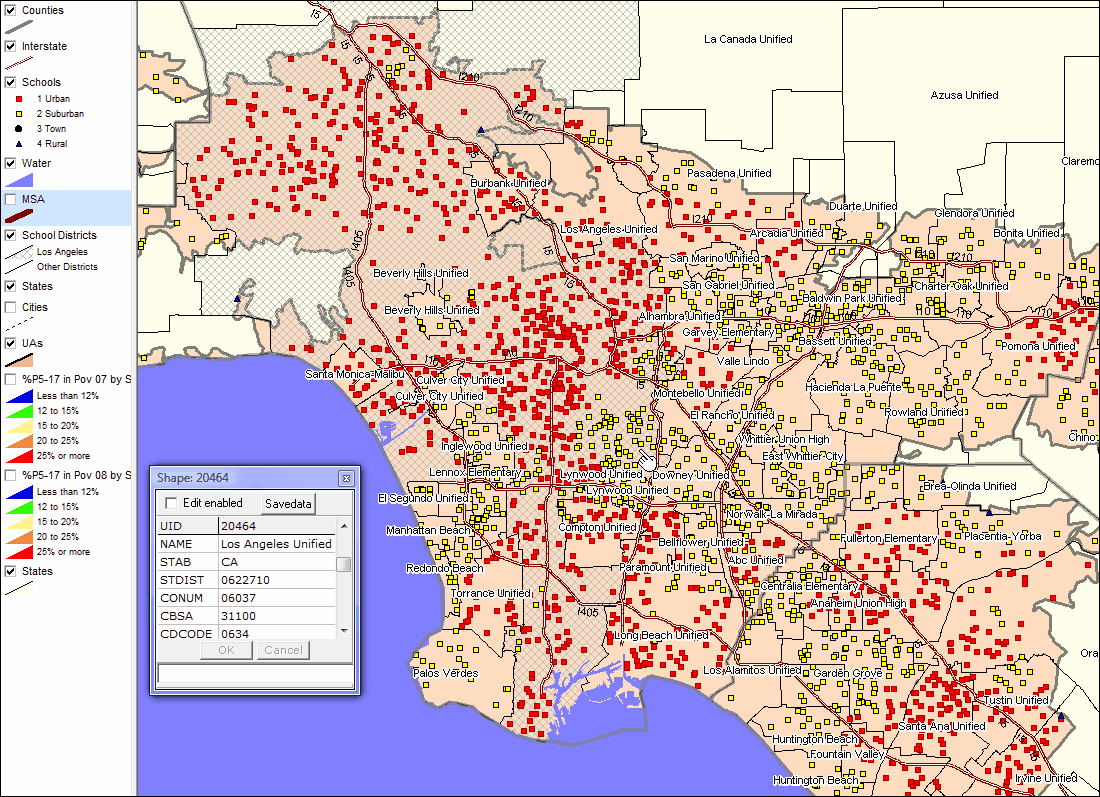
Next view shows zoom-in to Los Angeles County. Los Angeles school district appears with cross-hatch pattern. See pointer. Many schools in this district, having similar overall urbanicity, appear coded as as suburban. Schools south of LA Unified also appear coded as suburban; this is due to the schools being outside of the MSA principal city.
|
NCES (U.S. Department of Education) Locale Code
11 = City, Large Territory inside urbanized area and inside a principal city with population of 250,000 or more.
12 = City, Mid-size Territory inside urbanized area and inside a principal city with population < 250,000 and >= 100,000.
13 = City, Small Territory inside urbanized area and inside a principal city with population less than 100,000.
21 = Suburb, Large Territory outside a principal city and inside urbanized area with population of 250,000 or more.
22 = Suburb, Mid-size Territory outside a principal city and inside urbanized area with a population < 250,000 and >= 100,000.
23 = Suburb, Small Territory outside a principal city and inside an urbanized area with a population less than 100,000.
31 = Town, Fringe Territory inside an urban cluster that is less than or equal to 10 miles from urbanized area.
32 = Town, Distant Territory inside an urban cluster that is > 10 miles and <= 35 miles from urbanized area.
33 = Town, Remote Territory inside an urban cluster that is more than 35 miles from urbanized area.
41 = Rural, Fringe rural territory that is <= 5 miles from UA and <= 2.5 miles from UC.
42 = Rural, Distant rural territory that is > 5 miles but <= 25 miles from UA and > 2.5 miles but <= 10 miles from UC.
43 = Rural, Remote rural territory that is > 25 miles from UA and > 10 miles from UC.
UA: Urbanized Area
UC: Urban Cluster
Rural is defined as outside of urban areas (UA & UC)