|
|


ProximityOne GMaps |

|

|

|

|

|
||
ProximityOne GMaps |
|
|
|
|

|

|
|
|
ProximityOne GMaps |
|
|
|
|
|
||
ProximityOne GMaps |
|
|
|
|
|
|
|
|
||
| Decision-Making Information | |
|
ProximityOne information resources & solutions (888) DMI-SOLN (888) 364-7656 |
ProximityOne GMaps -- integrating your data with Google Maps
ProximityOne GMaps is a Windows application developed to facilitate integration of your data with Google Maps. GMaps is available as a standalone Windows application and as an integrated component within Demographic Data Analyst (http://proximityone.com/dda/guide). Soon GMaps will operate on iOS devices including iPhone, iPad, and Mac computers among others. Later this year android devices will be supported.
GMaps uses the Google Maps Service. Users of GMaps are bound to the terms of Google service. GMaps is not in any way affiliated with Google Maps ownership or operation. See Terms of Use.
GMaps is a productivity tool that can be used by businesses, researchers, consultants, schools, school districts, educators, education stakeholders, associations, special interest groups, campaign and political organizations, government agencies ... to name a few. There is no fee or registration to use the GMaps. GMaps illustrates one way that you can more easily and flexibility integrate your data with Google Maps on desktop computers and mobile devices.
We develop custom applications similar to GMaps to fit specific needs. Contact us to discuss your needs at http://proximityone.com/contact.htm (888-364-7656).
Get Started Using GMaps Today
Run the installer -- http://proximityone.com/gmaps/1/p1gmaps_setup.exe
Optionally register for updates or ask questions -- http://proximityone.com/contact.htm
... mention GMaps registration in the text section.
See this example of using GMaps to integrate school locations/attributes with Google Maps.
GMaps Start-up View ... menu bar shows access to features not directly available to users of Google Maps on the Web.
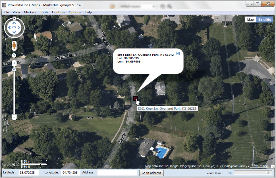
View of Overland Park, KS area (Kansas City, MO-KS metro)
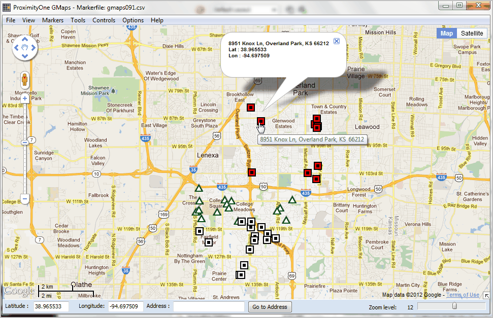
Using zoom tools to navigate to highlighted marker shown above. Changing map view from road to hybrid.
The start-up view is controlled by values in the GMaps configuration file which is read when GMaps starts. The configuration file contains values set by the user in the Settings form.
