|
|
|
Hawaii Schools and Attendance Zones: Mililani Area 25-percent of population in elementary school statistical area (ESSA) 3 of Mililani, Hawaii high school complex area (HSCA) are Native Hawaiian whereas the other 3 ESSAs in Mililani HSCA have 16-percent or less Native Hawaiian population. Without having data summarized by ESSA, decisionmakers and stakeholders cannot know about these relative distributions of the population. Rather than speculating about where to focus attention on Native Hawaiian programs, these data provide guidance in making decisions. As these data are not available from the Census Bureau or other sources, these insights would not be possible without applying the methodologies and tools developed by Proximity. Almost 27-percent of the families in ESSA 3 are single parent families whereas ESSA 4 has only 13-percent single parent families. These data provide reasons why students in some ESSAs might be more challenged that students in other ESSAs. Development and use of elementary school statistical areas for the Mililani, Hawaii area are summarized in this Web page. Elementary school statistical areas (ESSAs) are geographic areas defined on a statistical basis that parallel the concept of elementary school attendance areas for a school district. ESSAs, a concept introduced by Proximity and described in this section, have been defined by Proximity and have no official standing as Hawaii elementary school attendance areas. 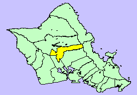 The Mililani high school complex area (HSCA) is located in Honolulu County (Oahu), Hawaii
(highlighted in yellow in the map at right).
This geographic area was defined as a pseudo school district area for tabulation
of Census 2000 school district tabulation data. Prior to presentation of data summarized
in this section, demographic data for pseudo elementary school attendance areas have never
been tabulated. Data and maps reviewed below show how ESSAs may be defined an used to better
understand the demographic composition of the area served by Mililani elementary schools.
The Mililani high school complex area (HSCA) is located in Honolulu County (Oahu), Hawaii
(highlighted in yellow in the map at right).
This geographic area was defined as a pseudo school district area for tabulation
of Census 2000 school district tabulation data. Prior to presentation of data summarized
in this section, demographic data for pseudo elementary school attendance areas have never
been tabulated. Data and maps reviewed below show how ESSAs may be defined an used to better
understand the demographic composition of the area served by Mililani elementary schools.
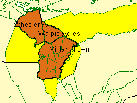
The Mililani HSCAs are first reviewed and then background and more detailed data are provided. The Mililani HSCA was subdivided into the 4 ESSAs shown below (green outline). 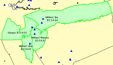
Characteristics of the Mililani HSCA ESSAs are shown in the following table. For each school/ESSA, the reported enrollment and population ages 5-10 are shown by year from 1999-2000 annually through 2004-2005 (projection). Mililani 'Ike Elementary opened in 2003-04 at the Mililani Mauka Elementary location.
The Census 2000 population by census block is shown in the next graphic. 
A zoom into the more densely inhabited area is shown in the next graphic. 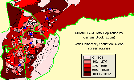
Using specialized software developed by Proximity, census block level data is summarized for each of the 4 ESSAs. An Excel spreadsheet is generated by the software. Shown below, the spreadsheet provides the basic demographics -- housing units, tenure, population by race/ethnicity, etc. -- summarized by ESSA and for the Mililani HSCA. Click on the graphic for a larger view of the spreadsheet. Click here to view the spreadsheet using Excel. 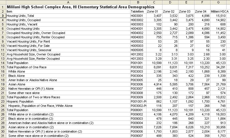
The basic set of demographics include approximately 150 items. More detailed information on the scope of data is available at http://proximityone.com/dp2000et.htm. More About the Mililani Area and Schools The Mililani high school complex area is shown with the blue outline in the following map. Streets and roads are shown, as well as 6 schools. 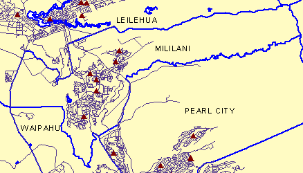
The following two graphics show the relationship of three contiguous 'census designated places' in the Mililani area. The map at the right shows census tracts as green boundaries. 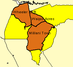
School names are shown in the next graphic. Mililani 'Ike Elementary opened in 2003-04 at the Mililani Mauka Elementary location. View of area with census blocks appears below. 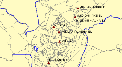
View of area with schools and streets appears below. 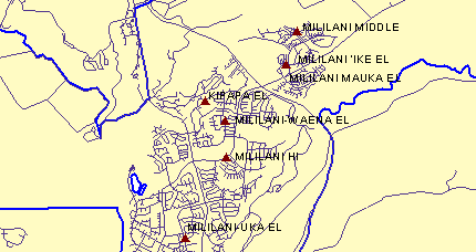
The Mililani area is a part of the Honolulu Urbanized Area (UA). Green boundaries in the next map show the UA boundary. The schools are located within the Honolulu UA and area to the east is rural territory. 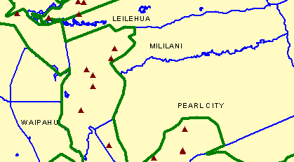
[goto top] |
|
|