|
|
|
Point to Census Block Coder -- use the PTBC software to convert your latitude-longitude points to census block geocodes The PTBC software described here has been generalized to the Point to Geocode software. See http://proximityone.com/ptg.htm for more information. The Point to Block Coder (PTBC) is a program that translates latitude-longitude points to census block geocodes. See the graphic below for an example. The census block code returned provides the state FIPS code, county FIPS code, census tract code and block. As a result, PTBC also provides a way to determine the location of points by state, county, tract and block group as well as census block. Applications. Consider a situation where attributes (such as population by race) of several thousand addresses need to be summarized by census block. Obtain the latitude-longitude of the addresses and then process the records using PTBC to obtain the block (and other) geocodes. Aggregate your point data to summary statistics at the block or other geographic levels. Integrate Census-sourced demographics for the block summary records with your data. Contact us for additional information. Add "PTBC" in the notes section. 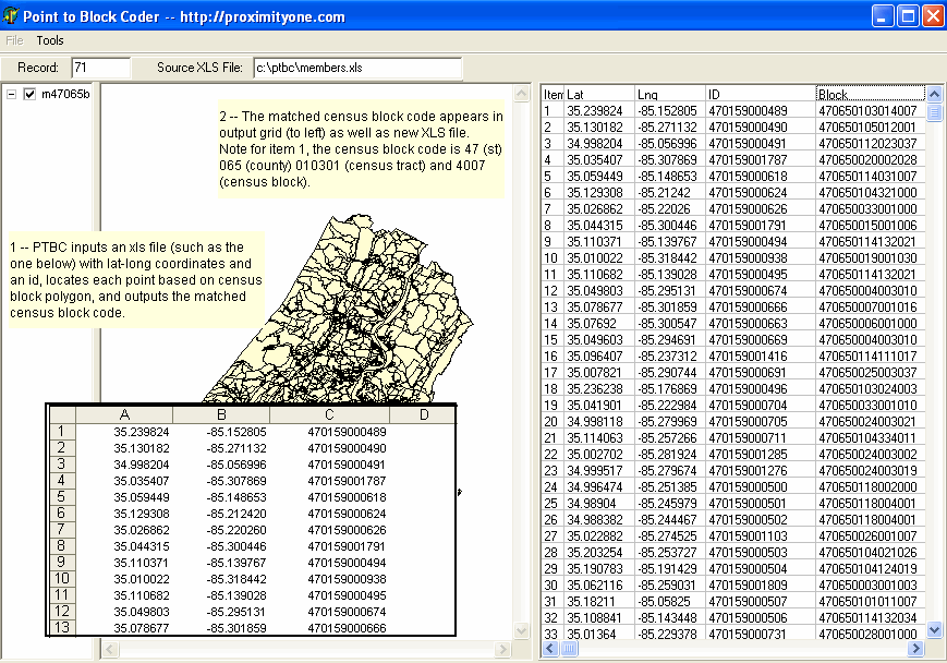
|
|
|