|
|
School District Decision Making Information |
Socio-Economic Status Analysis Using GIS Methods of analyzing socio-economic status of school districts are described in SDViewer applications. SDViewer can be used to flexibly define a socio-economic status (SES) measure and then rank a set of school districts based on a user selected normalization area (such as a state or a specific district). This is a useful method to determine the "challenge index" for one school district relative to a group of districts. This document reviews a methodology, using geographic information system (GIS) tools, to examine relationships that can reveal patterns regarding multiple geographic entities comprising or impacting on the school district. Socio-economic status measures are influenced by different types of geographic relationships. For example, most school districts are comprised of many neighborhoods. Often the SES measures will differ substantially between neighborhoods and the the district overall. Similarly, school district may transcend county boundaries and/or have parts of two or more cities within the school district area. The types of relationships shown here between school districts and census block groups could be analyzed between school districts and any other type of geographic area covering the same collective territory. For Census 2000, school districts were defined as a set of census blocks. Other areas making use of census block building geography include places, towns, urban areas, census tracts, ZIP code tabulation areas, counties, and other areas. Two SES measures are used here: percent population with limited English proficiency (LEP) and percent population in poverty (PIP). LEP is presented in a thematic map of the county by school district. A transparency setting is used so that it is possible to "see through" the layer. PIP is presented in a thematic map of the same county by census block group. Block groups are used to illustrate the methodology. Alternative geographies could be used. Westchester County, New York is shown in the following graphic. 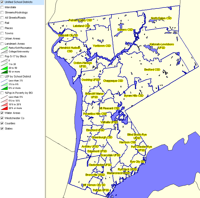
The next view shows a thematic map of the county: LEP by school district. 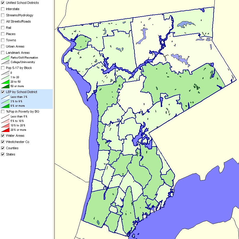
The next view shows a thematic map of the county: PIP by block group. 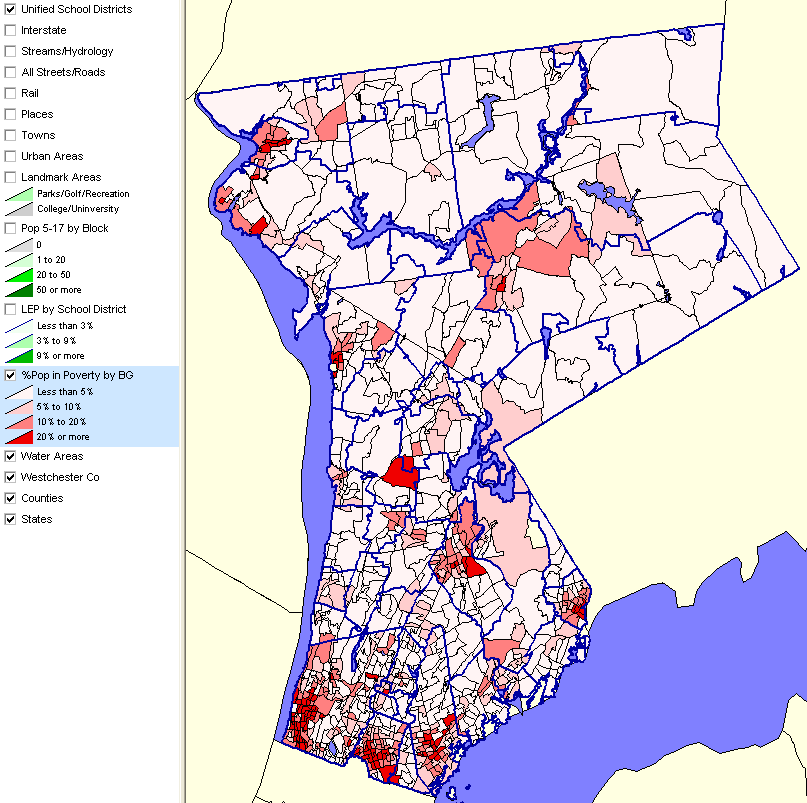
The next view shows a thematic map of the county with both the LEP and PIP layer turned on. Note the pattern in Bedford CSD (upper, center; see map at top for names). It is easy to pick out one darker brown area. This area shows a high composite value for the LEP for that school district and PIP for the block group. 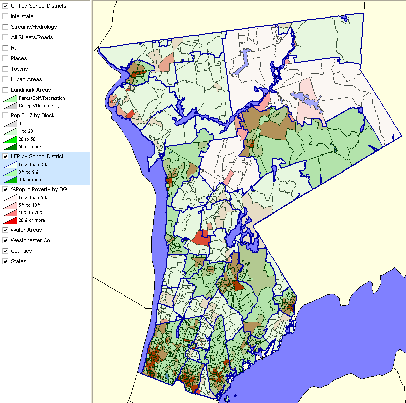
Use the Proximity CommunityViewer software and related Proximity geodemographics to perform these types of analyses for any region in the U.S. [goto top] |
|
|