|
Getting Started |
  
|
|
Getting Started |
|
Much of this document make use of a CommunityViewer (CV) Geographic Information System (GIS) project. The CV project is comprised of a set of shapefiles represented in the legend (left panel in graphic below) as layers. The primary CV project is focused on the State of Texas, with further smaller area geography focused on the Houston Metropolitan Statistical Area (MSA), with further smaller area geography focused on Harris County. The following graphic shows the Harris County Census 2000 population by block as a thematic map in the right map panel.
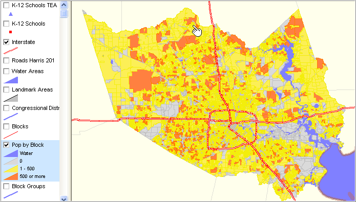
A project can be focused on any set of geographic scope and/or set of geographic objects. A similar structure could be developed for another state(s), county region, and further drill-down.
The Interstate highways appear above the county by block map because 1) both layers/themes are checked on and 2) the highway layer is placed above the block layer in the legend. Layer order can be rearranged.
We are interested in the GIS tools to provide visual patterns such as the one presented above. But the GIS enables much more than thematic maps and pattern analysis. The following views are zoom-in views of the area near the pointer in the above map.
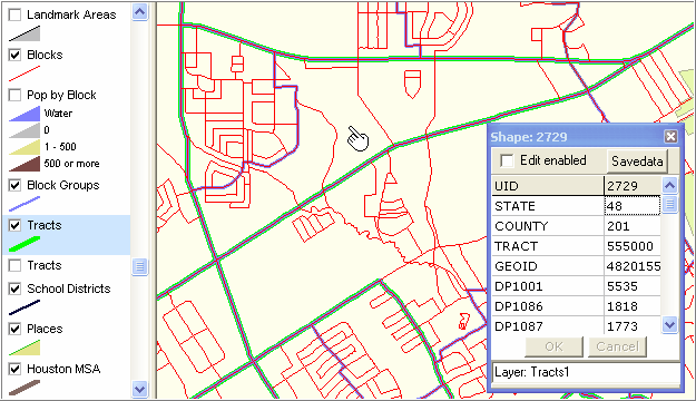
Tract 555000 in Harris County (green boundary) and mini profile
Census block groups with blue boundaries
Census blocks with red boundaries
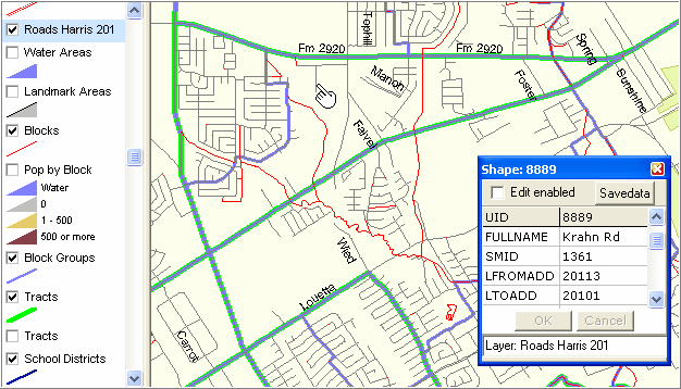
View similar to above with Roads layer on; note roads are typically block boundaries.
Identify tool used to profile a street segment.
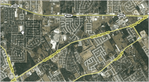
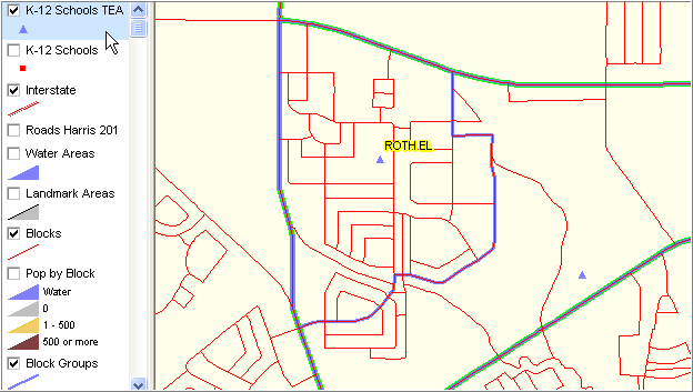
This area is shown below in a Google maps graphics capture. Roth El school is shown by the hand.
Clicking on the K-12 Schools layer, the CV project shows a similar view but with statistical areas.
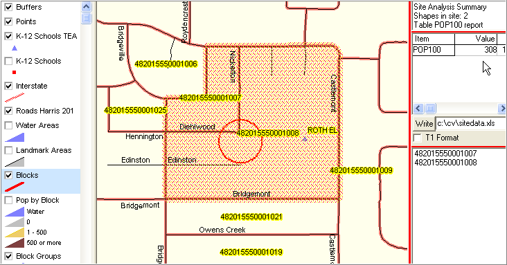
Using the Site Analysis tool, reviewed in detail later, the total population is determined for 2 adjacent blocks.
The total population is shown in upper right (308) and the block geocodes are listed in the lower right panel.
Additional areas can be added and values recomputed.
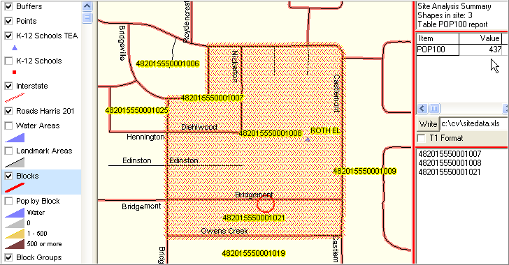
With the project structured as it is, this type of site analysis can be applied anywhere in Harris County (77,000 census blocks).
Page url: http://proximityone.com/txdmi/guide/index.html?getting_started.htm