|
|
|
Streets Shapefiles Structure and Content Applications Register to Download Demo Order AMC Software |
Address Match-Code Applications -- Health Clinics in Houston, Texas Areas
The AMC software is used with the clinics file. The addresses are matched to the street segments on which they are located using the Proximity streets shapefiles. AN address matched clinics file is generated that contains the original record content, latitude-longitude, and geographic codes. The geographic codes include census tract and census block. The ArcView software is used to display a map of the Houston area by census tract. The Proximity streets file is added as a layer. The clinics address matched dbase file is opened as an event theme. The map display appears as shown below. Clinic locations are shown as red icons. 
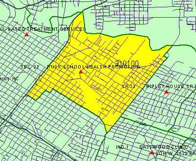
A zoom into census tract 3101.00 is shown in the next map. Clinic names appear next to the clinic location. 
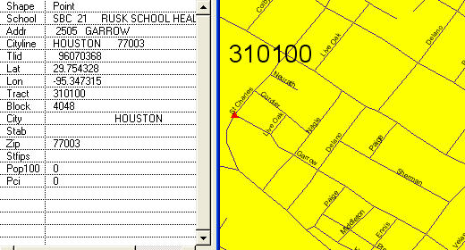
A further zoom is shown in the next map depicting street name detail. The identify feature operation is used to view attributes of a clinic located at Rusk school. 
Additional Information Proximity develops geodemographic-economic data and analytical tools and helps organizations knit together and use diverse data in a decision-making and analytical framework. We develop custom demographic/economic estimates and projections, develop geographic and geocoded address files, and assist with impact and geospatial analyses. Wide-ranging organizations use our tools (software, data, methodologies) to analyze their own data integrated with other data. Contact Proximity (888-364-7656) with questions about data covered in this section or to discuss custom estimates, projections or analyses for your areas of interest. |
|
|