Table/Grid

Contents
The Table/Grid is used to open the fields in a shapefile/SQLite file underlying the Active Layer. Layers are shown in the Legend Panel.
The Table/Grid feature operates on the Active Layer.
Make a layer the Active Layer by clicking on the Layer Name in the Legend Panel.
Start the Table/Grid clicking SQL button located at top right on the toolbar.
Availability
Viewer and Level 1, 2, 3; specific operations vary by Level
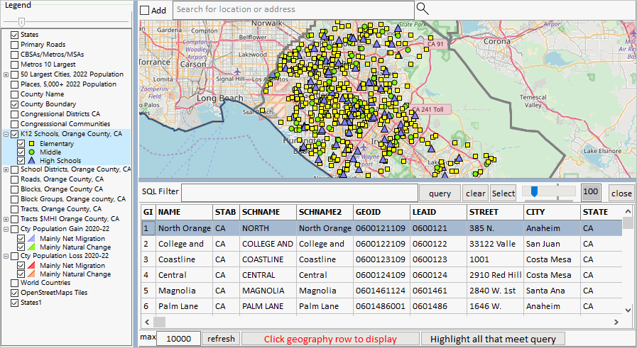
The graphic below illustrates use of the Table/Grid with a K-12 school layer (point shapefile).
Starting the Table/Grid splits what was only the Map Window in the Map Window and Table/Grid.
The Table/Grid is organized similar to a spreadsheet and shows
.. one row for each shape in the shapefile dbf.
.. one column for each field in the shapefile dbf.
The relative parts of the Map Window-Table/Grid panel can be adjusted by sliding the splitter bar positioned between them.
Using the Table/Grid
Exporting data in the Table
To export the data shown in the grid, right-click anywhere in the grid and then click on the "Export" prompt that appears.
If you export to CSV, then you can import the file to Excel and modify features of, e,g, GEOID, as TEXT preserving lead zeroes.
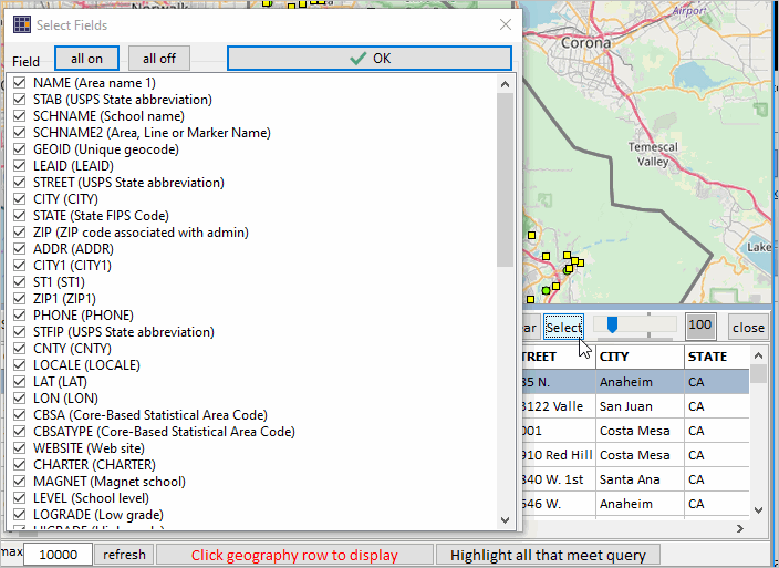
Select Fields (Select button)