Site Analysis Using Census Blocks

Contents
SiteAnalysis is used to analyze characteristics of user selected geographic objects (shapes in shapefiles) and create demographic-economic analysis maps and reports. SiteAnalysis is available as an integrated component within CV XE or as a standalone operation.
This section is focused on applications using the SiteAnalysis tools to examine census blocks using ProximityOne census block point shapefiles.
This section uses more advanced topics, features and terminology covered elsewhere in the Guide.
We presently make these census block shapefiles available on a state by state basis.
By using a point/marker shapefile (where the block area is represented by an internal lat-lon point) processing is much faster and the view less cluttered.
These state by block shapefiles are proprietary to ProximityOne and contain demographic subject matter from Census 2010 and 2019 demographic estimates developed by ProximityOne. A wider set of demographics is available.
Subject matter field in this application include:
GEOID -- 15 character block code
POP10 --Census 2010 population
HU10 -- Census 2010 housing units
POP19 -- 2019 population estimate
HU19 -- 2019 housing units
GQ19 -- 2019 group quarters units
UA -- urbanized area code (UA)
UASC -- UA size code
UATYPE -- UA/UC
UR -- UA status R/U
AREALAND -- land area square meter
AREAWATR -- water area square meters
INTPTLAT -- block internal point latitude
INTPTLON -- block internal point longitude
Step 1 Acquire the Data
Census Block Shapefile for State of Kansas with 2019 demographic updates.
There are 238,600 Census 2010 census blocks in Kansas.
Download the Census Block Shapefile for State of Kansas
Unzip this zip file to c:\cvxe\1
Verify that the file c:\cvxe\1\ksblockpts.shp exists.
Step 2 Start CVXE
Step 3 Start Analytics>Site Analysis (from main menu bar)
This step requires a Level 3 Key.
The SiteAnalytics form opens.
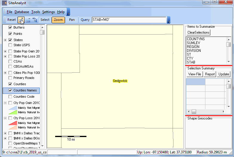
- Click the Zoom button on the toolbar and zoom to the Sedgwick County (Wichita) area
- uncheck the "Cty Pop Gain ..." and "Cty Pop Loss ..." layers
- check on the "Counties" and "Counties Names" layers
Position the map view so the screen appears as shown below.
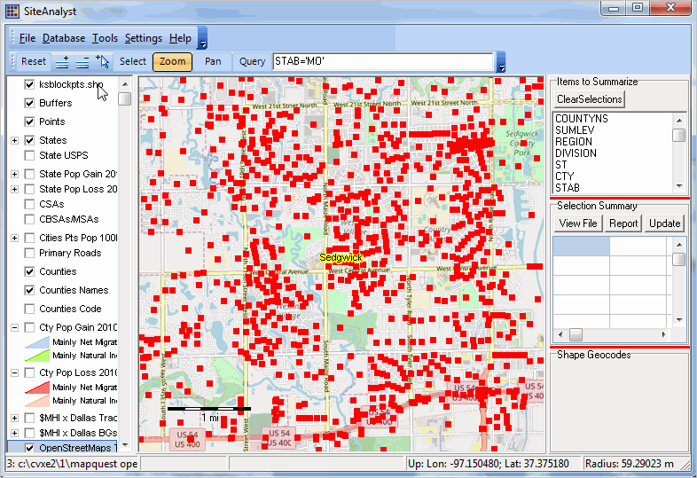
Click the + button on the toolbar (Add Layer) -- see pointer in above graphic
In the dialog form that appears, select the file c:\cvxe\1\ksblockpts.shp (Kansas by Census Blocks)
When the red markers appear, further zoom in on the name Sedgwick.
- check the top Open Street Maps layer on (lower down in legend panel)
The view now appears as shown below.
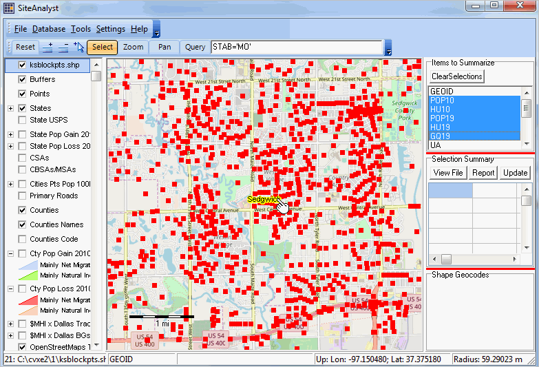
Click the layer named ksblockpts.shp once as shown at the top of the legend panel in above view.
The layer name turns blue.
The right top panel populates with fields/subject matter items in this layer.
Dbl-click the field named GEOID within that panel.
This action selects that field as the control or selection field.
Hold the Ctrl key down and click (once) the fields.
Click the Select button on the toolbar.
The view now appears as shown below.
Position the mouse on the "k" in The name Sedgwick as shown above.
The nest steps illustrate creating a one-mile radius site profile.
Left clicking the mouse in the "k" location, drag the mouse out (any direction) forming a circle with a one mile radius.
Use the scale bar to judge distance, exact distance is shown in the statusbar. A circle appears.
Now release mouse. When you release the mouse five things happen:
1 - a prompt appears asking for the name of the site report file name.
press enter taking the default -- c:\cvxe\1\$$siterecs.dbf
2 - block point in the selection circle are cross-hatched indicating they are selected.
3 - a summary of the aggregated values for the items selected appears in the middle box at right.
4 - a list of all of the blocks selected is shown in the lower box at right.
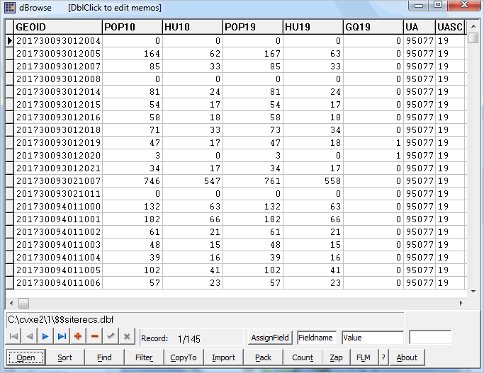
5 - data records for for the selected blocks are added to the file c:\cvxe\1\$$siterecs.dbf
The view now appears as shown below:
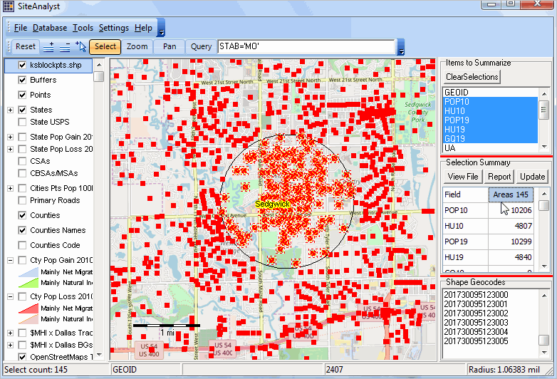
There are 145 blocks selected. In this selection of blocks (or in a radius of one mile from the starting point, there was a Census 2010 population of 10,206. The population in 2019 for the these blocks is estimated to be 10,299.
The tabular data for the selected blocks is shown as a graphic below from the file c:\cvxe\1\$$siterecs.dbf named at the start of these site selection.
Just in the Web Sessions to learn more about using this Site Analysis application and possible next steps.