|
|
|
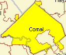
SDMIS -- School District Management Information System -- define, realign, and analyze school district attendance areas -- view and analyze integrated student, school, streets, and demographic data The School District Management Information System (SDMIS) is designed for K-12 school district management and analysis of student, school, attendance area, street, and demographic data. A focus of SDMIS is to integrate and tie together disparate data enabling a holistic capability. Important features of SDMIS include attendance area/zone development and redistricting; student, school, and streets view, add, modify, analysis; and demographics view, update, analysis. �� The SDMIS start-up view appears as shown in the graphic shown below. This view shows a zoom-in to two pseudo attendance areas in Comal ISD, Texas.
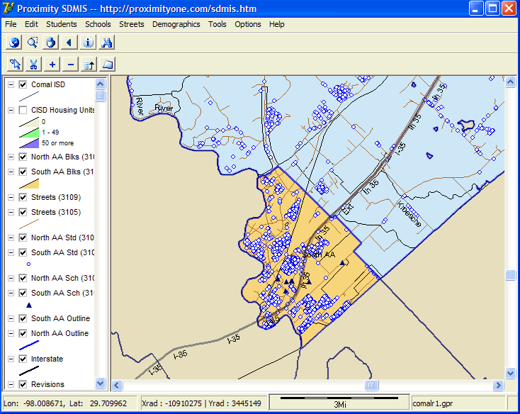
A Brief Orientation. The legend at the left shows these "layers": • North AA Blks -- census blocks, polygons, in "North Attendance Area" -- elemental polygons • South AA Blks -- census blocks in "South Attendance Area" -- elemental polygons • Streets (3109) -- streets in North Attendance Area • Streets (3105) -- streets in South Attendance Area • North AA Std -- students in North Attendance Area -- white markers with blue outline in map • South AA Std -- students in South Attendance Area -- white markers with blue outline in map • North AA Sch -- schools in North Attendance Area -- blue triangle markers in map • South AA Sch -- schools in South Attendance Area -- blue triangle markers in map • North AA Outline -- single polygon perimeter for North Attendance Area • South AA Outline -- single polygon perimeter for South Attendance Area Structuring and Revising Redistricting Attendance Areas. Use SDMIS to create and revise attendance area boundaries. Save your attendance area boundaries as shapefiles that you can view in the context of other data. The next graphic shows how "elemental" polygons can be moved from one attendance area to another. In this example, there is a "North Attendance Area" (shown as North AA in the legend at left) colored blue in the map and a "South Attendance Area" (shown as South AA in the legend) colored orange in the map.
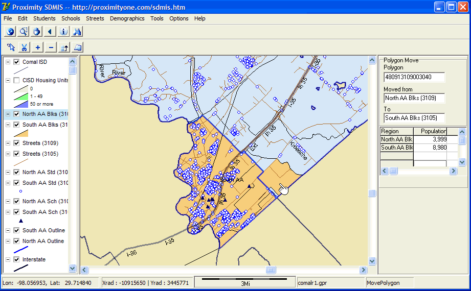
Attendance areas are defined as grouping of census blocks and split census blocks. The census block areas are referred to as elemental polygons. As of Census 2000, census blocks average 100 persons per block. In the above map, the block where the pointer is located has been reassigned from the blue North AA to the orange South AA. The move/reassignment is performed by clicking on the block to be reassigned (note that this block was blue in the previous map). Monitor the impact of revisions to attendance area demographics dynamically as you move/reassign blocks. The panel at the right summarizes what block was just moved and the impact on the population of each attendance area. See links in left column for additional information. [goto top] |
|
|