|
|
|
ZIP Code Geodemographic Resources 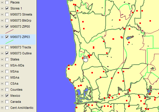 Did you know? ... the 2003 and more recent Census Bureau TIGER/Line files
carry updated ZIP Code tabulation area (ZCTA) boundaries.
In some areas the differences between 2000 and 2003 ZCTA boundaries are substantial.
Did you know? ... the 2003 and more recent Census Bureau TIGER/Line files
carry updated ZIP Code tabulation area (ZCTA) boundaries.
In some areas the differences between 2000 and 2003 ZCTA boundaries are substantial.
The map at the right shows the ZCTA03 boundaries in green and ZCTA00 boundaries in red for a portion of San Diego County. Many ZIP boundaries vary some and ZIP 92093 is new since Census 2000 (click for larger view). Click here to see a closer view of how the ZIP areas differ between 2000 and 2003. Contact Proximity to obtain 2003 vintage ZCTA boundary files for your mapping applications and Census 2000 census block demographics summarized for 2003 ZCTA areas. Select from the following ZIP Code geodemographic resources for additional information.
 ZIPLocator. Use the new
ZIPLocator to look-up ZIP codes
and determine 1999 or 2003 (current official) metropolitan statistical area codes (MSA).
ZIPLocator can also be used to process a file of ZIP codes and generate an
output file with MSA codes integrated into the same record with corresponding ZIP code.
ZIPLocator. Use the new
ZIPLocator to look-up ZIP codes
and determine 1999 or 2003 (current official) metropolitan statistical area codes (MSA).
ZIPLocator can also be used to process a file of ZIP codes and generate an
output file with MSA codes integrated into the same record with corresponding ZIP code.
ZIPLocator helps you find out how well your sales, other business activity, health-related incidence measures, and a wide range of other types of data match up with largest or fastest growing metros. ZIPLocator has virtually no learning curve. Install the software and integrated database and start using it. Click here to order ZIPLocator by credit card ($449). Contact Proximity for other payment options or with questions. Relationship of Demographic Data Files. The Demographic Profile Database provides the most comprehensive set of more widely used demographic data. The Basic Demographics file is just that, providing population, housing, land and water areas, and internal point latitude-longitude. The Extended Demographics file provides a wider range of demographic data, but with less depth than the Demographic Profile Database. The Age-Race-Sex Demographics file provides the most age-race-sex detail available from standard Proximity ZIP code data files. Proximity provides access to much more detailed demographic data on a custom basis. Please inquire if you do not see data that listed that meets your needs. Most Densely Populated ZIPs. The 10 most densely populated ZCTAs in the US, with a minimum population of 2,500 or more, are determined using the ZCTA demographic data file and are listed in the table presented below. All are located in State FIPS code 36, New York.
These ZCTAs are located mainly in Manhattan as shown in the following map. The 10 ZCTAs are highlighted in yellow with the code appearing at the left. 
5-Digit ZIP Demographic Profile Database [goto top] Click here to order now by credit card (DP1-DP4 set) or use registration form for payment by check. The 5-Digit ZIP Demographic Profile Database is comprised of 4 dbase structured files. This set of files contains the most widely used set of approximately 550 subject matter items derived from Census 2000 summary files. The database consists of four subject matter files containing data as organized and described in the following links. • DP-1 General Demographics Order ZIP DP1 • DP-2 Social Characteristics Order ZIP DP2 • DP-3 Economic Characteristics Order ZIP DP3 • DP-4 Housing Characteristics Order ZIP DP4 A sample display of the data may be accessed at http://proximityone.com/p1zip.htm. Proximity has structured these files in a manner that saves you time and gives you maximum flexibility to use the data. Optional file structures enable you to meet your application needs without restructuring the files. 5-digit ZIP Code Basic Demographics File [goto top] Click here to order now by credit card or use registration form for payment by check. The 5-digit ZIP Code tabulation area Basic Demographics file contains a record for each 5-digit ZIP Code tabulation area in the U.S. Each record includes the following fields derived from Census 2000 Summary File 1: USPS State Abbreviation 5-digit ZIP Code tabulation area code Total Population (2000) N9 Total Housing Units (2000) N9 Land Area (square meters) N14 Water Area (square meters) N14 Land Area (square miles) N12.6 Water Area (square miles) N12.6 Latitude (decimal degrees) N9.6 Longitude (decimal degrees) N10.6 5-Digit ZIP Code Extended Demographics Data File [goto top] Click here to order now by credit card or use registration form for payment by check. The 5-digit ZIP Code Extended Demographics Data File is a dBase structured file that contains the Census 2000 subject matter fields as described at http://proximityone.com/dp2000et.htm (DP-1 items). Data in the extended demographics file may be used to develop profiles such as this example for ZIP Code 77027 in Houston, TX (PDF). 5-Digit ZIP Code Age-Race-Sex Demographics Data File [goto top] Click here to order now by credit card or use registration form for payment by check. The 5-digit ZIP Code Age-Race-Sex Demographics Data File is a dBase structured file that contains the Census 2000 data for these categories: Male population Female population Population by age for these age ranges: 0-10 years 11-17 years 18-29 years 30-39 years 40-49 years 50-59 years 60-64 years 65-74 years 75 years and over for each of these race/ethnic categories: Not Hispanic White Black AIAN API Other 2+ Races Hispanic ZIP-Census Block Demographics and Equivalency File [goto top] Click here to order now by credit card or use registration form for payment by check. The ZIP-Census Block Demographics and Equivalency File enables a user to determine the set of Census 2000 census blocks that comprise a ZIP code area. The ZIP-Census Block Demographics and Equivalency File contains a record for each unique combination of a ZIP code area and census block (8.2 million geographic areas) Each record provides geographic area measurements, latitude-longitude, and the same set of demographic data fields (DP-1 items for each census block) as contained in the Extended Demographics file. ZIP-County-MSA (ZCM) Equivalency File [goto top] Click here to order now by credit card or use registration form for payment by check. The ZCM Equivalency File enables a user to determine the county(s) and metropolitan area in which the ZIP Code area is located. ZIP Code tabulation areas almost always exist within a single state but are independent of all other statistical and governmental entities except Census 2000 tabulation block. 27 percent of ZIP Code tabulation areas cross county or county equivalent boundaries nationwide. There are 47,010 unique ZIP Code tabulation areas-county combinations (32,038 are five-digit ZIP Code tabulation areas). The ZCM equivalency file contains 47,010 records. Of these five-digit ZIP Code tabulation areas, 42 cross state boundaries. ZIP-County-2003 MSA Equivalency File [goto top] Click here to order now by credit card or use registration form for payment by check. The ZCM2003 Equivalency File is similar to the ZCM file (above) but relates a ZIP code to the corresponding county(s) and 2003 vintage metropolitan areas in which the ZIP Code is located. Making ZIP Code Area Maps Proximity provides ZCTA 5-digit boundary files in shapefile format for use with popular mapping software and GIS applications. Shapefiles are available in two forms. The basic ZCTA shapefile contains no demographic data. The demographic ZCTA shapefile contains all of the demographic items listed at http://proximityone.com/dp2000et.htm. The map presented earlier on this webpage was prepared using the New York 5-digit ZCTA shapefiles. Another sample map display, and a downloadable sample ZCTA shapefile set for the Harris County, TX (Houston) may be accessed at http://proximityone.com/48201.htm#zips. The ZCTA 5-digit shapefiles may be purchased from Proximity. The national scope file is available for immediate electronic delivery. Use the register/order webform to order the file. Additional Information. See the ZCTA geography section of the Census 2000 Data Access and Use Webpage for more information about ZCTAs. goto top | |||||||||||||||||||||||||||||||||||||||||||||||||||||||||||||||||||||||||||||||||||||||
|
|