PUMA & PUMS
This section provides an example/tutorial on use of CVXE to develop a custom map focused on Public Use Microdata Area (PUMA) geography in association with the ACS Public Use Microdata Sample (PUMS). Map views in this section can be developed using the no fee CVXE Viewer as well as Levels 1, 2, 3. Use CVXE installer to install CVXE on your computer.
PUMAs and PUMS -- see also:
| • | Data Resources section in this Guide -- describing more about PUMAs and PUMS |
| • | File>GeoGateway -- used to access PUMA shapefile and create mapview. |
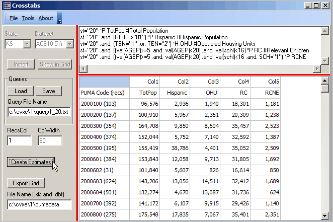
| • | Tools>Crosstabs -- used to develop PUMS summary data |
The view below shows the PUMAs added as layer to CVXE start-up project CVXE_US1.GIS (more information about the project). After adding the GeoGateway downloaded shapefile (see below), the pan/drag tool was used to create this view.
File>GeoGateway -- viewing location of PUMA relative to PUMS data
PUMAs shown by red boundary, yellow label. Shawnee County, KS coterminous with PUMS 00800.
See PUMS data for all Kansas PUMAs in views below.

How to create the above map view ... use GeoGateway ... 
Database>dBGrid -- processing PUMS data
Illustrating generation of summary statistics for Kansas PUMAs using ACS 2010 5-year PUMS data
Grid shows a row for each PUMA. PUMA 00800 (last row in view) is coterminous with Shawnee County, KS -- see view above.
Only two subject matter items selected for this demonstration application.
PUMA 00800 is estimated to have 175,548 total population and 17,835 Hispanic population.

The next view shows the APIGateway multi-sourced data for Shawnee County.
The ACS 2010 5-year published total population estimate is 175,537 -- almost identical to the PUMS-based estimate.

View of Kansas ACS 2010 PUMS dataset using dBrowse. Each record contains sample respondent field values.
These person records from PUMA 00800 (summarized in above view). Note person weight for first record=24.

