|
|


Listbox Operations |

|

|

|

|

|
||
|
Listbox Operations |
|
|
|
|

|

|
Listbox Operations
|
|
|
Listbox Operations |
|
|
|
|
|
||
|
Listbox Operations |
|
|
|
|
|
|
|
|
||
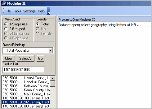
The M2 listbox is used to select geographic areas is shown in the lower left panel.
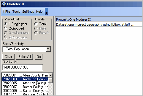
The listbox populates when an M2 dataset is opened. A line/row is added to the listbox for each geographic area contained in the M2 dataset.
Listbox Content
Each listbox item (line/row) is comprised of a set of characters:
| 1. | a 3-digit summary level (e.g., county is 050, census tract 140, unified school district 970 |
| 2. | the area geocode, followed by padding (dots) as required to fill the geocode to 11 characters |
| 3. | a space |
| 4. | area name |
Part 1 ... the summary level (e.g., ) is included to enable easier differentiation among types of geography. That is, an M2 dataset might have a mix of types of geographic areas and some might have the same name.
Part 2 ... the area geocode is the geographic reference code used to uniquely define the geographic area throughout the U.S. As a result, the length (number of characters) varies by type of geography. For example, 5 characters are required to uniquely identify a county (2 digit state FIPS code plus 3-digit county within state FIPS code).
For M2 applications, the longest of the area geocodes is 11 characters for the census tract (SSCCCTTTTTT). To create Part 2 size uniformity, all M2 listbox lines are 11 characters in length. If shorter than 11 characters, the Part 2 section is padded to the right. The default padding is the dot (.) character.
Part 4 ... the name for the area as defined by FF2/Census Bureau.
Listbox Organization
The listbox is initially populated based on the sequence of the FF2 DEC CSV files created by the user. For example, if all counties in a state are selected and then census tracts in a state are selected, the listbox will show the counties and then the tracts as ordered when FF2 generates the CSV files (FF2 will always generate 9 CSV files for use with M2).
The next view shows an example of this type (county plus tracts) initial ordering.
Listbox Usage
Dbl-click on one row/line to view data for that area.
Multi-select rows/lines to view data for that set of individual areas and the sum across those geographies.
Clear all selections by clicking the Clear button.
Use the SelectAll button to select all geographic areas in the listbox.
Click the Go button to display data for the existing selections. This is useful to compare the distributions of first the total population and then the population of a selected race/ethnicity.
