|
Option 1 Tax Parcels |
  
|
| Show/Hide Hidden Text |
|
Option 1 Tax Parcels |
|
| Show/Hide Hidden Text |
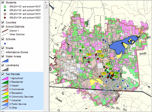
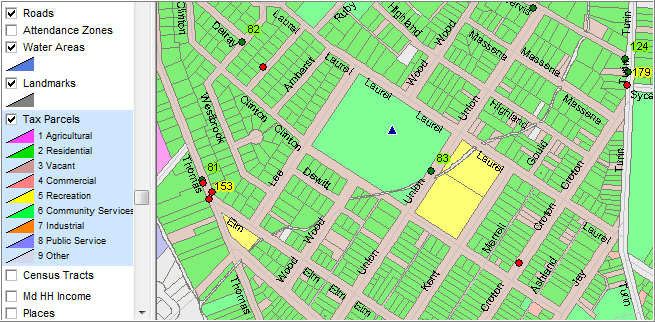
Benefits to the District; New Capabilities
| • | Examine land use patterns |
| • | Associate student locations/distributions with tax parcels |
Resources Provided by Proximity
Tax parcel shapefile integrated into Standard SDGIS
District Responsibilities
Obtains authorization to use tax parcel shapefile from county assessor(s) or designee
Pay usage fees (if any) to county assessor
Designate a district liaison
Examples
|
|
Page url: http://proximityone.com/sdgis/guide/index.htm?level_3.htm