Welcome to VDA Desktop GIS -- User Guide

Contents
Welcome to Visual Data Analytics (VDA) Discovery
Updated 10/14/2025
At your fingertips .. use VDAGIS Discovery to explore topics of interest using map/data analytics tools
| • | examining census tracts/neighborhoods |
| • | examining block groups |
| • | census block demographics |
| • | world by country |
| • | state demographic & economic trends |
| • | streets |
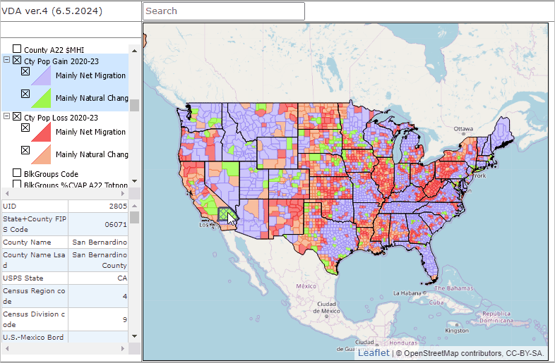
| • | how and why county population is changing |
| • | how city population is changing |
| • | school districts |
| • | changing metropolitan areas |
| • | congressional district characteristics |
| • | state legislative districts |
| • | congressional communities |
| • | urban/rural geography |
| • | comparing census tracts and ZIP Code areas |
In this document, you will learn to examine a range of subject matter for wide-ranging geography using iVDA with VDAGIS projects. See about terms of use, navigation and help in this section.
Here, for example, is a static graphic showing "How & Why County Population is Changing". Learn how to develop this view in this section.
iVDA is one part of a broader VDA GIS resource framework. See more about VDA GIS.
About VDA Desktop (VDAD)
VDA Desktop (VDAD) and VDA Web (VDAW) GIS have been developed, and are maintained/supported, by ProximityOne/Alexandria, VA USA and Tsukasa Consulting/Osaka, Japan.