Examining County Demographic-Economic Characteristics

Contents
In this section, you will learn to examine county demographic-economic characteristics using iVDA with the "US1" project.
See related county trends interactive table.
iVDA is one part of a broader VDA GIS resource framework. See more about VDA GIS.
In the iVDA frame below, proceed as follows.
Operation 1 -- viewing a selected county demographic-economic characteristics (ACS 2022 subject matter)
.. enter an address or location in the searchbar and press enter (try ZIP code 85258 .. in Scottsdale, AZ)
- the map window refreshes with a zoom-in to Maricopa County, AZ (county associated with search)
- location shown by marker
.. see county demographic-economic characteristics in lower left panel
.. optionally click "clipboard" and copy profile into a spreadsheet.
Operation 2 -- viewing a selected county population & components of change trends 2020-2023
.. assume same location/county
.. In the Legend Panel at the left, scroll down to "County %PopChg 20-23" layer and click name of layer
- do not check the checkbox
.. see county population & components of change trends 2020-2023 in lower left panel
.. optionally click "clipboard" and copy profile into a spreadsheet (possibly same as used in Operation 1)
Operation 3 -- viewing a selected county age-race/origin-gender characteristics
.. assume same location/county
.. In the Legend Panel at the left, scroll down to "County M23 MedAge" layer and click name of layer
- do not check the checkbox
.. see county -race/origin-gender characteristics in lower left panel
.. optionally click "clipboard" and copy profile into a spreadsheet (possibly same as used in Operation 1)
Visual Data Analytics Web GIS
iVDA is presented below in an interactive mapping window .. watch video
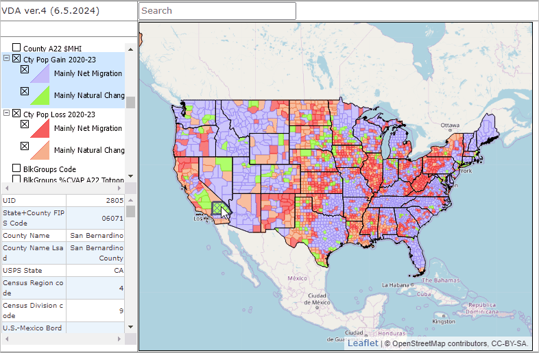
Below is a static graphic example of using iVDA.
.. click the globe button below map
.. check on the "Cty Pop Gain 2020-2023" layer
.. check on the "Cty Pop Loss 2020-2023" layer