Add Shapes

Contents
Tools>Add Shapes creates a point, line or polygon shapefile by clicking on map window.
Availability
Level 3
Usage
Main menu Tools>Add Shapes
Related Information
http://proximityone.com/cvshapes.htm
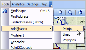
Choose Tools>AddShapes
... then Points, Lines or Polygons
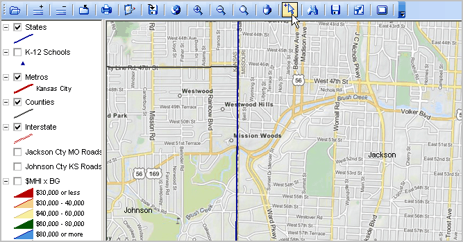
A GIS project must be open to use AddShapes. For illustration purposes, open the c:\cvxe\1\cvxe_us2.gis project. Navigate to a view similar to the one shown below. Click the Select Mode mouse tool as shown in the graphic. Other navigation mouse tools may be selected during the process of adding shapes but it is important that the mouse be in Select Mode when clicking points on the map window.
Use Tools>AddShapes and then select Points, Lines or Polygons. This starts the process. For more information about creating a new point shapefile, arc/line shapefile or polygon shapefile, click a link shown below.