Birmingham

Contents
Selected CommunityViewer project/application views in Alabama.
Click toggle in Table of Contents at left to view sub-state applications.
Integrating Census 2010 TIGER Shapefiles, ACS 2009 5-year demographics and related data.
See related interactive ranking tables:
| • | Alabama school district demographics: http://proximityone.com/sd_al.htm. |
| • | Alabama census tract demographics: http://proximityone.com/ustr0509_al.htm. |
Selected Birmingham Area Views
More about metros and Situation & Outlook
| • | Metropolitan Area Guide: http://proximityone.com/metros/guide |
| • | MetroView: demographic-economic profiles & patterns -- http://proximityone.com/metroview.htm |
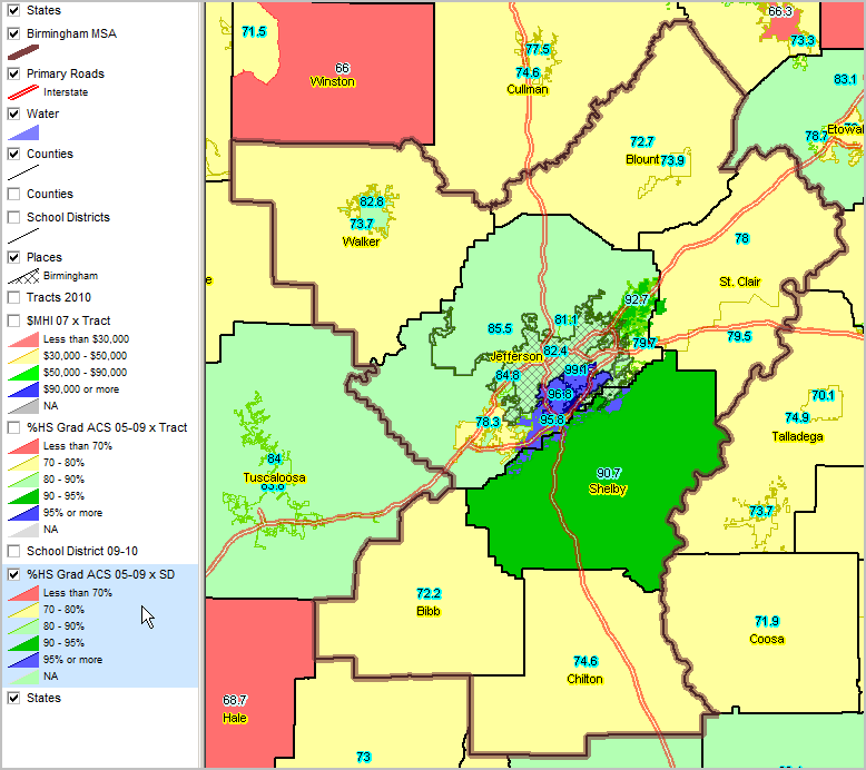
Educational Attainment by School District Percent high school graduate (population 25 years and over) by school district. Data based on 2009 American Community Survey (http://proximityone.com/acs.htm) 5-year estimates, centric to mid-2007.
Birmingham Metro bold brown boundary Birmingham city shown with cross-hatch pattern
|
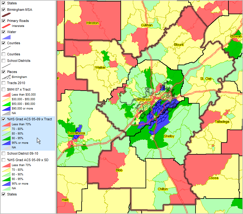
Educational Attainment by Census Tract Percent high school graduate (population 25 years and over) by census tract. Data based on 2009 American Community Survey (http://proximityone.com/acs.htm) 5-year estimates, centric to mid-2007.
Birmingham Metro bold brown boundary Birmingham city shown with cross-hatch pattern
|
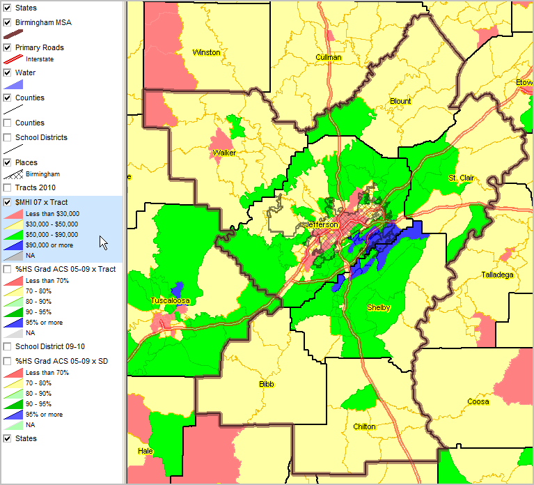
Median Household Income ACS 2005-09 (mid-2007) ... using ACS census tract estimates released December 2010 (http://proximityone.com/acs.htm).
Birmingham Metro bold brown boundary Birmingham city shown with cross-hatch pattern
|
Birmingham city shown as cross-hatched pattern. $MHI pattern by census tract shown by color fill pattern (see legend) Zoom-in to school location showing census blocks and streets in next view.
|
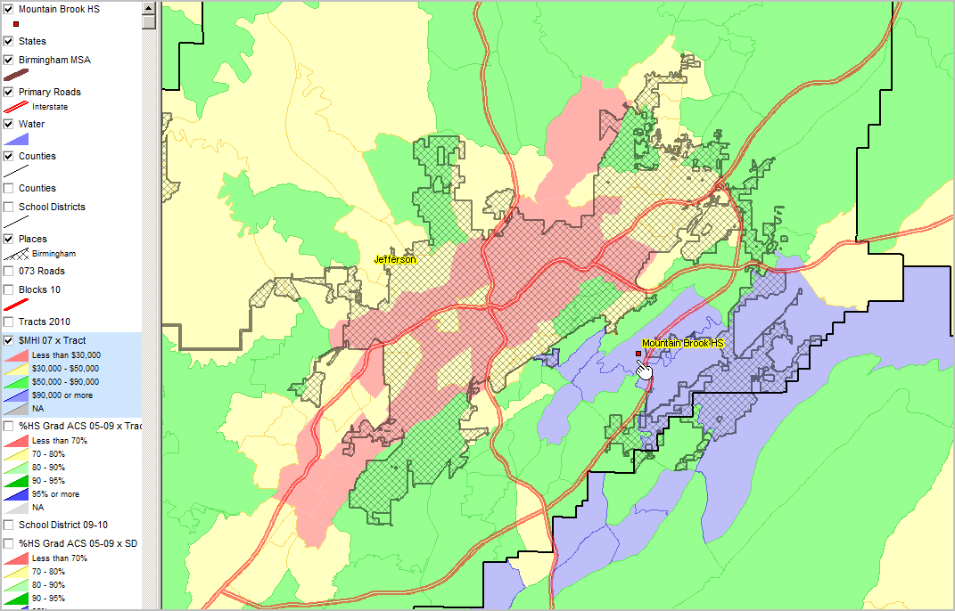
Zoom-in to Jefferson County, AL. School location shown by red marker in context of streets. Pointer located in census block (bold semi-transparent red boundary). Census block profile shown using CV identify tool. Birmingham city shown as cross-hatched pattern. $MHI pattern by census tract shown by color fill pattern (see legend)
|
