Colorado Selected Views

Contents
Illustrating use of CommunityViewer to view/analyze K-12 schools, school districts in context of school district community with drill down to intersection level of detail.
Census tracts green boundary yellow label; landmark areas gray (airport by pointer and wholly contained in tract 30.03); places beige/orange fill pattern
|
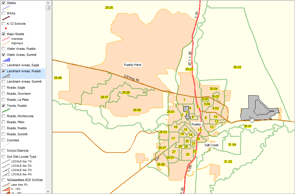
Illustrates use of different 'see through' pattern for landmark areas (cross hatch); airport by pointer. Illustrates us of query applied to all places/cities, showing only Pueblo city (beige/orange fill pattern)
|
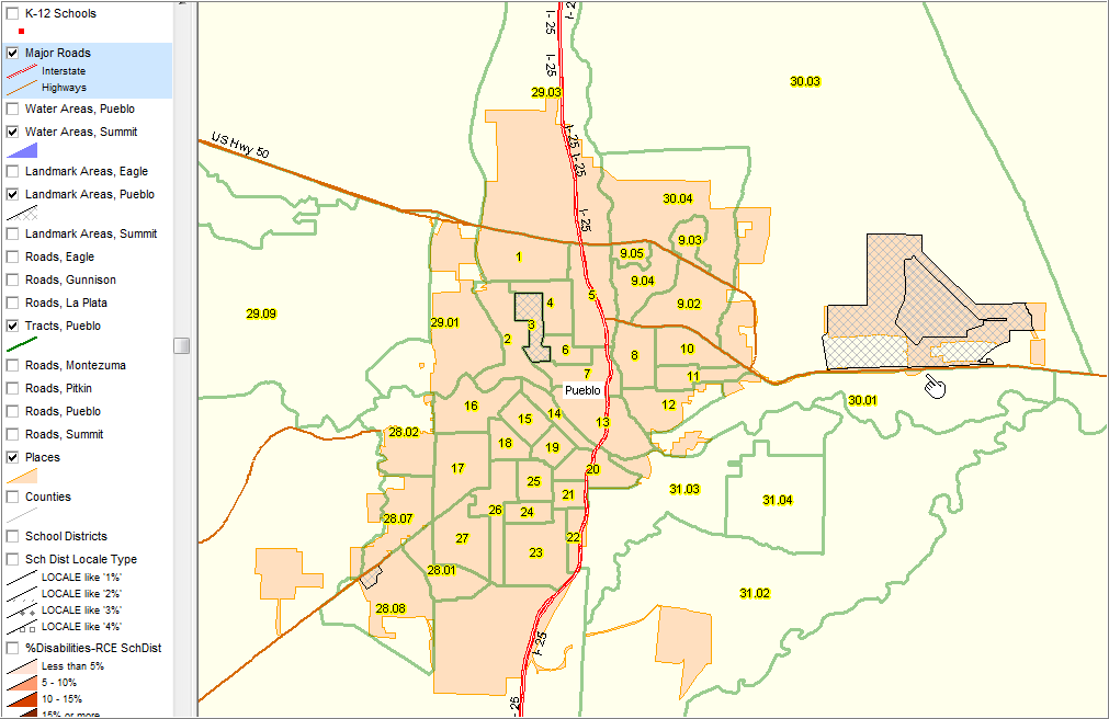
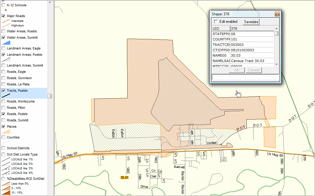
Illustrates adding detailed streets and use of identify tool to show mini-profile of census tract (pointer). Airport shown as cross hatch area; Pueblo city shown as beige/orange fill pattern.
|
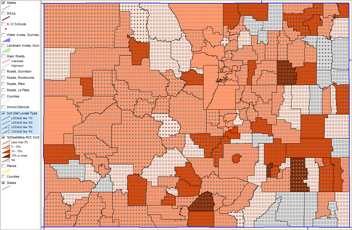
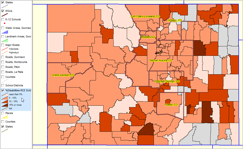
Colorado School Districts Selected Characteristics
MSAs shown with bold brown boundary. This view shows the percent of “grade relevant children enrolled in school” (RCE) with disabilities as a percent of total RCE in that district. See color patterns/interval definitions in highlighted layer in legend at left. These data are based on the Census 2000 school district special tabulation (http://proximityone.com/childrens_demographics/guide). Watch for updates. Data are now becoming available from a special tabulation of the Census Bureau American Community Survey (districts 20,000 population and over) providing an opportunity for updates and longitudinal analysis. More information: http://proximityone.com/sddmi.htm
|
Similar to previous view with addition of the same shapefile as a layer "above" the %Disabilities layer. The school district locale code (see details below map view) pattern is shown as symbols. While any graphic can be used as a symbol, "wingding" fonts are used here to illustrate. Using this method it is possible to view the combined/separate pattern using multiple subject matter items where a simple ratio does not work.
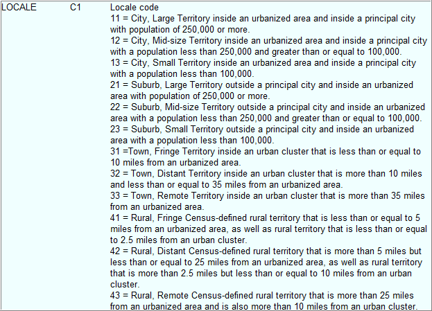
Locale codes -- see details
|