Pittsford CSD, NY

Contents
Illustrating use of CommunityViewer to view/analyze K-12 schools, school districts in context of school district community with drill down to tax parcel and intersection level.
View demographic-economic trends profile for Monroe County, NY; access other county demographic profiles via ranking table links.
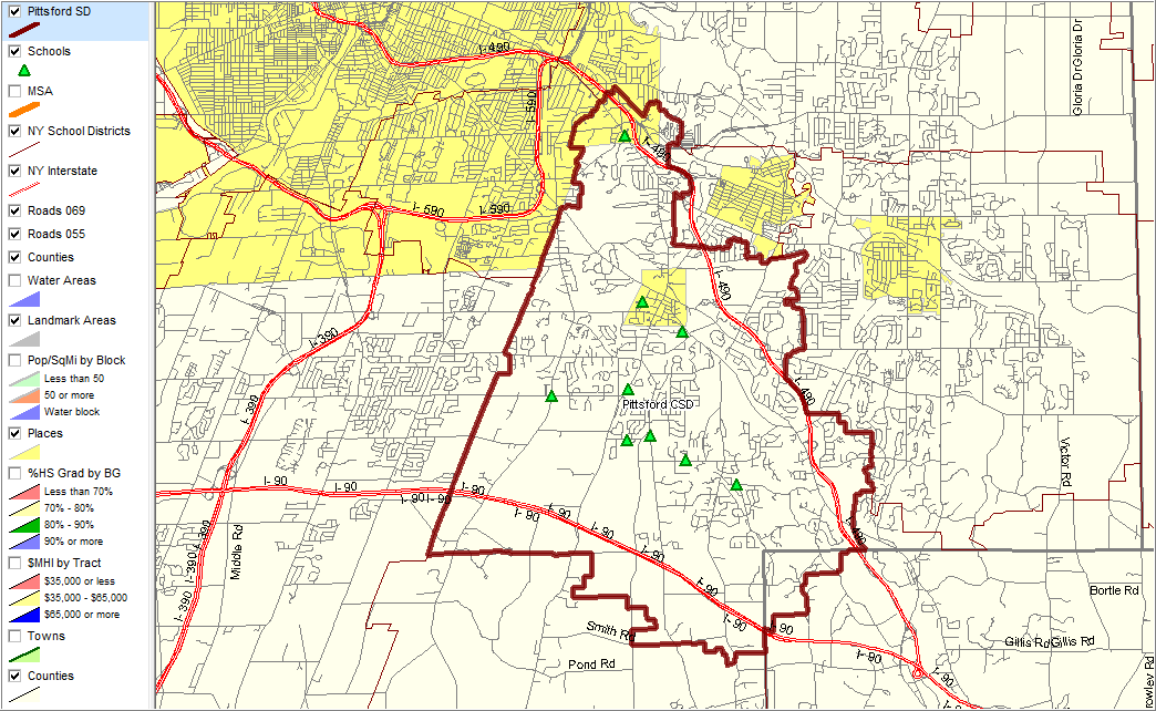
Pittsford CSD with red-brown bold boundary; cities/places with yellow fill pattern; schools as green markers
|
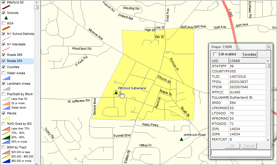
Illustrates using Identify tool to click on (see pointer in view) street segment and show mini-profile. Pittsford village yellow fill pattern; schools green markers.
|
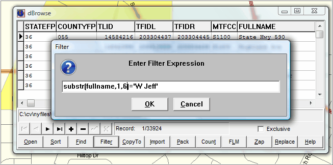
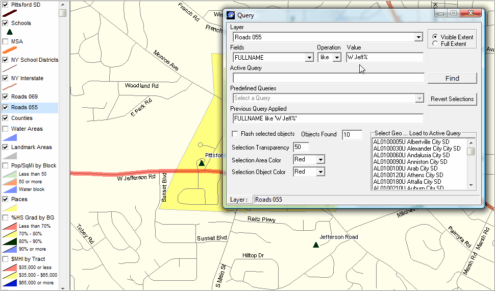
Illustrates use of Query/Find tool to locate a specific road. As shown in the Query form, a search is made for road segments where the field FULLNAME is like "W Jeff%". Also illustrates optional use of % wildcard feature to find road name with any value starting with "W Jeff". Note in map view W Jefferson road matches are highlighted in red.
|
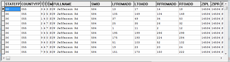
Illustrates use of CV dBrowse feature to view roads dataset in spreadsheet form. This query says to show all records (street segments) that start with the characters "W Jeff" in the road name.
The query results are shown in the next graphic. This view also shows that the left-side and right-side of the road segment to- and from- address range fields are included in the road data record. Optionally save this subset file for use with Excel/other software.
Using another feature of CV, not shown here, road segments can be "intersected" with any other layer such as attendance zones. That set of road segments can then be saved and published on a Web site showing which roads are in which attendance zones.
|