Public Use Microdata Areas

Contents
Using CV XE GIS to examine Public Use Microdata Areas
See related
-- Census 2010 vintage Public Use Microdata Area geography -- http://proximityone.com/puma2010.htm
-- using Public Use Microdata Sample data -- http://proximityone.com/pums.htm
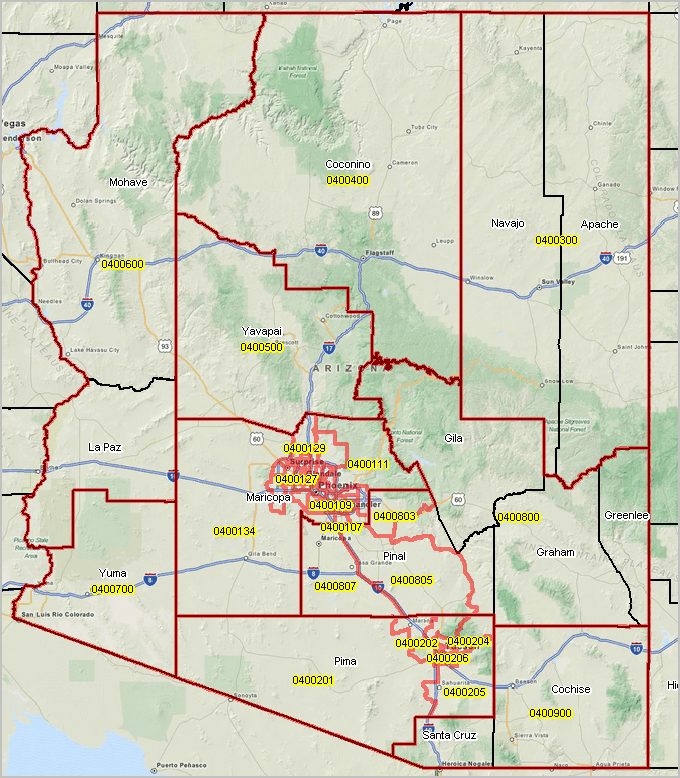
Arizona -- Census 2010 vintage PUMAs (see drill down views below)
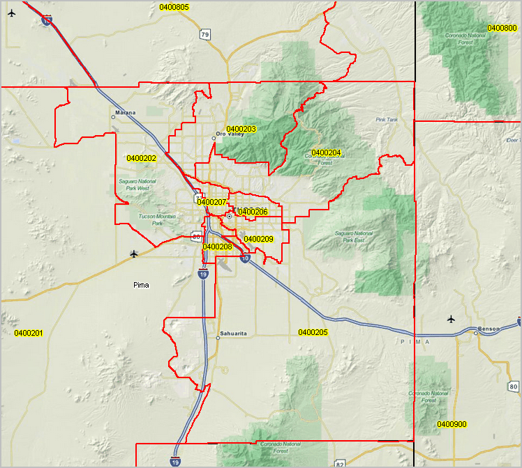
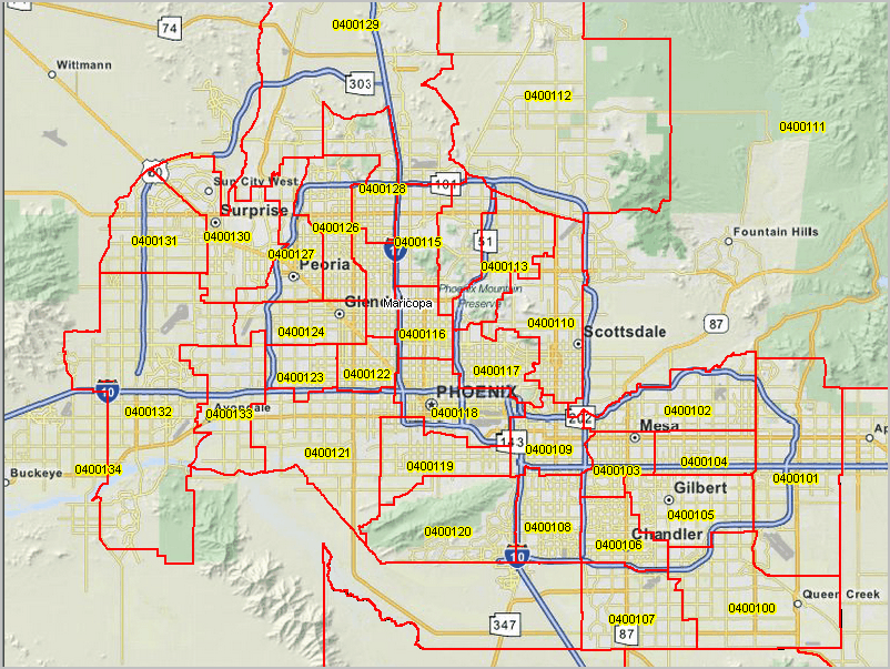
PUMAs red boundaries yellow labels; counties black boundaries
 .
.
Zoom-in to Phoenix/Maricopa County
Zoom-in to Tucson/Pima County