|
Mississippi Population -- State by Block |
  
|
|
Mississippi Population -- State by Block |
|
We start with a macro view of micro-level geography. This section introduces operations and views generated using CommunityViewer with a statewide map display showing patterns of population by census block.
Mississippi Population by Census Block
Of the 136,150 Census 2000 census blocks, 3,615 are water blocks. 53,871 census blocks had no population as of Census 2000. See these patterns in the following view generated using CommunityViewer project ms1_blks.gpr

Illustration of zoom-in to Greenville/Washington County showing streets and census blocks.
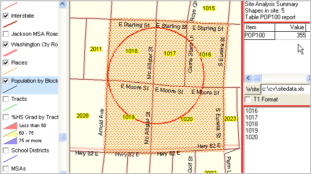
Use of CV site selection tool to select and summarize four census blocks.
Block codes listed lower right. Population sum listed upper right.
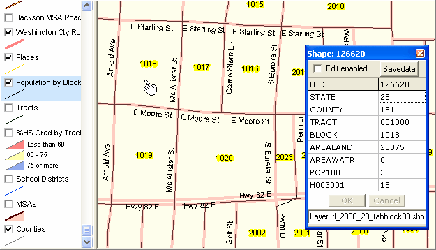
Using CV Identify tool to profile one of the selected blocks (see pointer - block 1018).
Page url: http://proximityone.com/commdev/guide/index.html?state_by_block.htm