|
K-12 School GeoDemographic Analysis Using CV |
  
|
|
K-12 School GeoDemographic Analysis Using CV |
|
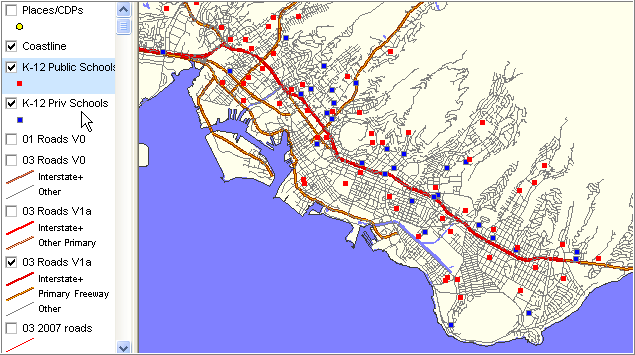
The hawaii1.gpr CV project includes two K-12 school layers. The K-12 public schools layer and K-12 private schools layer are shown in the legend and maps shown below. This section provides examples of selected school views using CV.
K-12 Public and Private Schools in Honolulu Zoom-in View
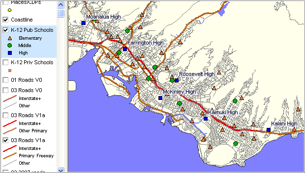
The basic layer renderings shown above only show schools as markers. While this can be useful, the power of pattern analysis is expanded by using the CV layer editor to extend the manner in which geographic objects are depicted. Examples are creating additional types of markers based on the type of school, selecting only schools that meet specific enrollment-related criteria, labeling school markers. The following example illustrates the results of such modification to the K-12 public schools layer.
K-12 Public School by School Grade Level Type
Illustrates using layer editor to define sections identifying school by grade level type.
Illustrates selectively labeling only high schools.
Page url: http://proximityone.com/hidmi/guide/index.html?k12_using_cv.htm