|
Street Segments |
  
|
|
Street Segments |
|
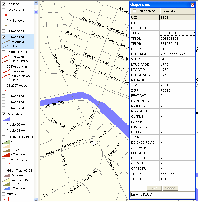
In the December 2008 vintage Honolulu County roads shapefile there are approximately 33,700 road segments. The following zoom-in view of Honolulu illustrates line/street segment labeling. The CV identify tool is used to profile a street segment. All attributes of the edge shapefile record are shown. The Proximity modified streets shapefile record extends the scope of this record (see Edge2Streetsection) by including a) other pertinent left- and -right side geocodes and b) the addition of derived TIGER/Line legacy field and field names like FENAME (feature name). The extended shapefile record makes it possible to use software that worked with previous version of streets shapefiles to work with the updated December 2008 vintage as well (not directly possible using the unmodified Census sourced version).
Page url: http://proximityone.com/hidmi/guide/index.html?roads_segment.htm