|
Hawaii Population -- State to Block |
  
|
|
Hawaii Population -- State to Block |
|
We start with a macro view of micro-level geography. This section introduces operations and views generated using CommunityViewer with a statewide map display showing patterns of population by census block.
Hawaii Population by Census Block
View using CommunityViewer project hawaii1_blks.gpr
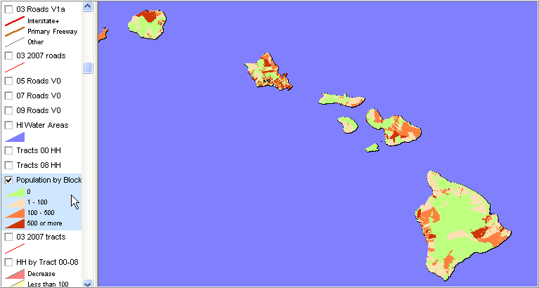
Census 2000 population. Approximately 18,000 census blocks.
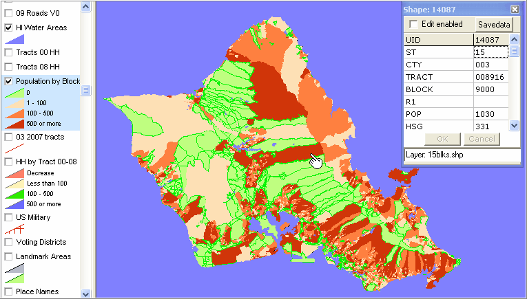
Zoom-in view of Honolulu County
Zoom to any level with CV project; mix with other geography and/or data; label and restructure legend/pattern view.
In the above view, compared to the 5-county view, zero-population blocks are highlighted with a darker green boundary and the water areas layer is showing (clicked on in legend).
The identify tool is used to profile attributes of one census block.
See zoom-in view of this tract by block in the Neighborhood/Tracts section.
Geography
Augmented, improved versions of the December 2008 vintage Census Bureau MTAIP updated TIGER/Line shapefiles, are used in the project fileset (for all applicable layers). For census blocks, the Census 2000 vintage tabulation block boundaries are used.
Page url: http://proximityone.com/hidmi/guide/index.html?state_block.htm