|
|


ZIP Code Applications |

|

|

|

|

|
||
|
ZIP Code Applications |
|
|
|

|

|

|
ZIP Code Applications
|
|
|
ZIP Code Applications |
|
|
|
|
|
||
|
ZIP Code Applications |
|
|
|
|
|
|
|
|
||
This section is focused on examples using Census 2010 ZIP Code Tabulation Areas. (ZCTAs). See more about ZCTAs at http://proximityone.com/gallery/guide/index.htm?census2010zcta.htm.
The toggle graphic -- ![]() -- and text colored in this manner indicate an expanding section.
-- and text colored in this manner indicate an expanding section.
Click the toggle or toggle line to view/close expanding sections.
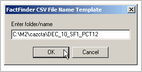
Applications in this section were developed by initially downloading the 9 PCT12 tables for all California ZIP Code tabulation areas. In that first step (downloading), the 9 files were saved to c:\m2\cazcta. In the M2 File>Create operation, the template prompt was modified as shown here:
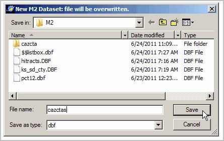
The new file was saved with M2 dataset name c:\m2\cazctas.dbf:
Using M2, the M2 dataset c:\m2\cazctas.dbf is opened using File>Open. |
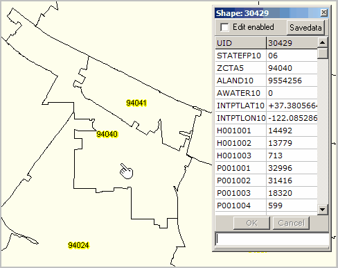
The following view has been developed using the CommunityViewer software (not part of M2) and shows two Santa Clara County, California ZIP code tabulation areas (ZCTAs) with labels 94040 and 94041. The CV identify tool is used to show a profile of the ZCTA 94040. In the profile for 94040, the total population (P001001) is shown as 32,996 total population. This map view of two selected ZCTAs is shown to show boundaries of the ZCTAs.
|
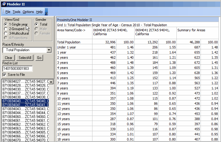
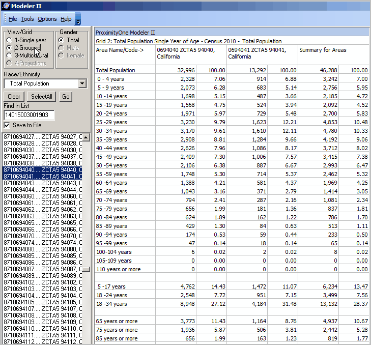
Side by Side Comparison of two ZIP code areas and their aggregate demographics -- Single Year of Age. To replicate this view (using M2 on your computer), click Clear then multi-select the ZIP codes 94040 and 94041.
|
Side by Side Comparison of two ZIP code areas and their aggregate demographics -- Age Groups To replicate this view using M2 on your computer, click Grid2 radiobutton -- upper left in View/Grid shown in the following view.
|
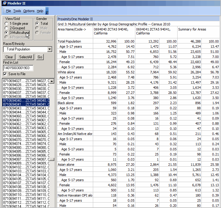
Side by Side Comparison of two ZIP code areas and their aggregate demographics -- Age Groups To replicate this view using M2 on your computer, click Grid3 radiobutton -- upper left in View/Grid shown in the following view.
|