|
Option 4 -- School District Community Demographics |
  
|
| Show/Hide Hidden Text |
|
Option 4 -- School District Community Demographics |
|
| Show/Hide Hidden Text |
Benefits to the District; New Capabilities
| • | View demographic patterns for any area of the district by census tract. |
| • | Use thematic maps to identify and understand demographic patterns by small area geography in the school district area. |
Resources Provided by Proximity
County by census tract boundary file for county(s) where district is located.
Shapefile includes wide-ranging integrated demographics:
Census 2000 Demographic Profile datasets (subject matter integrated for the school district and census tract shapefiles)
- general demographics -- http://proximityone.com/dp1.htm
- social characteristics -- http://proximityone.com/dp2.htm
- economic characteristics -- http://proximityone.com/dp3.htm
- housing characteristics -- http://proximityone.com/dp4.htm
District Responsibilities
Designate a district liaison
Examples
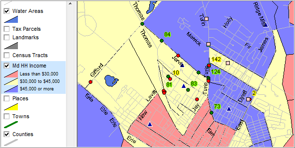
this view shows median household income. Choose for combinations of more than 400 items. understanding characteristics of the school district community
|
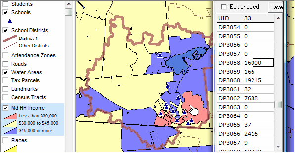
profile one geographic area; see specific data values for specific geographic areas by point and click
|
Page url: http://proximityone.com/sdgis/guide/index.htm?level_6.htm