Examining School District GeoDemographics

Contents
In this section, you will learn to examine school district geodemographics of interest using iVDA with the "Base" project.
We will use the school district and related layers. See related interactive table.
In this application we examine grade relevant children enrolled in school. See more about grade relevant children.
iVDA is one part of a broader VDA GIS resource framework. See more about VDA GIS.
In the iVDA frame below, enter an address or location in the searchbar and press enter.
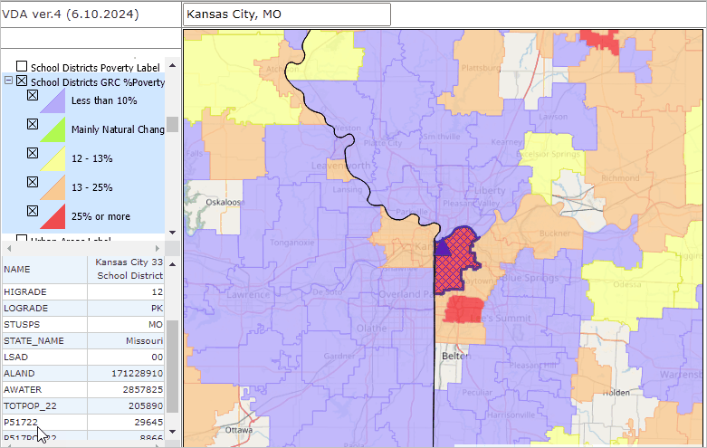
.. enter "Kansas City, MO" not case sensitive, no quotes
.. the map view zooms to the school district containing the location and places a blue triangle at the location.
In the Legend Panel at the left of the Map Window, scroll down to "School Districts GRC %Poverty" layer, check on, check + expanding intervals view.
.. the map refreshes showing patterns of grade relevant children, percent in poverty.
Click the blue marker and see the Kansas City MO School District highlights in the map
.. and a demographic profile is displayed in the lower left.
.. here you can examine selected demographic subject matter items.
.. as shown in the map patterns, 25% or more of Grade Relevant Children are in poverty.
.. as shown in the demographic profile, the 2022 school age population in poverty was 29,645 of a total population of 205,890.
Try your school districts of interest.
Visual Data Analytics Web GIS
iVDA is presented below in an interactive mapping window .. watch video
Below is a static graphic example of using iVDA as described above.