Urban Areas

Contents
This section provides an example/tutorial on use of CVXE to develop a custom map focused on Urban Areas. Applications in this section can be developed using the no fee CVXE Viewer as well as Levels 1, 2, 3. Use CVXE installer to install CVXE on your computer.
See more about urban areas. See list of urban area codes and names.
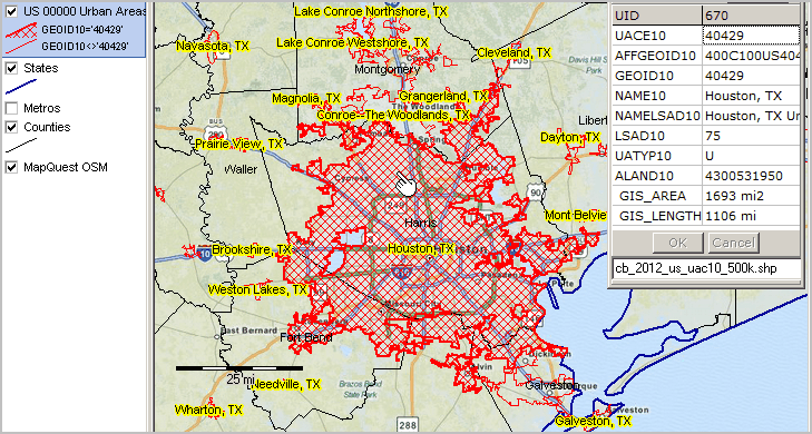
The view below shows the Census 2010 urban areas added as layer to CVXE start-up project CVXE_US1.GIS (more information about the project). After adding the GeoGateway downloaded shapefile (see below), the pan/drag tool was used to create this view of the Houston/Harris County Texas area.
The Layer Editor was used to create a query to render UA 40429 (Houston) with a cross-hatch pattern. The identify tool is used to click on the Houston UA and display the mini-profile.
Use CVXE tools to navigate to any region/CD of interest. Add other layers; custom geography and subject matter.
The Urban Areas shapefile may be accessed via GeoGateway.
The GeoGateway feature is available to CVXE Viewer and all CVXE Level users. More about using GeoGateway.
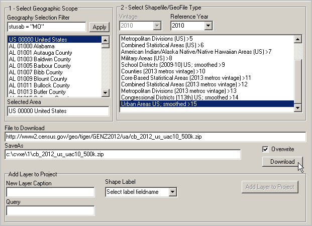
After downloading the shapefile, add the shapefile as a layer to the project (Add Layer to Project button). Close the GeoGateway form. The view shown at the top of this section was developed using the navigation tools and layer editor.
Schedule a One-to-One web meeting; get the results that are right for you.