Creating Project a GIS Project -- Oneida County NY

Contents
Making a map from scratch ...
This section provides an example of using CV XE software to quickly build a map for Oneida County, NY. For CV XE all levels the map, and more, can be saved as a GIS project. A GIS project is a file itself that contains references to map files (shapefiles) located on your computer. Once a GIS project has been created and saved, it can be immediately opened with CV using the File>Open operation.
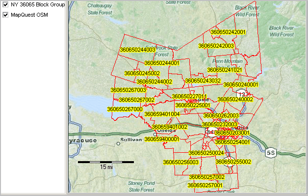
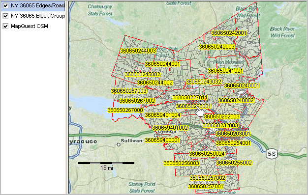
These operations show only two layers/shapefiles being added. Any available from the extensive list can be added (see below). An unlimited set of shapefile layers can be used to develop GIS projects in this manner. Block groups are of interest as they are the smallest geographic areas for which annual demographic-economic estimates are available for the U.S. wall-to-wall. The roads/streets are of interest as they provide intersection-to-intersection vector graphics that can be used for wide-ranging routing and location analysis operations.
Note that these dynamic "mapcompiler" operations are available 1) for worldwide applications and 2) cover wall to wall United States Census 2010 geography for CV XE viewer and levels 1 through 3 users. Level 3 users have access to updated 2013 shapefiles that reflect updated roads, current political boundaries (e.g., cities), school districts, 113th congress and related legislative boundaries and other types of shapefiles.
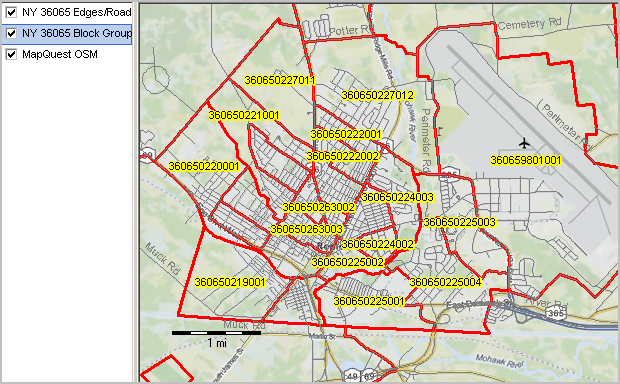
The following view (zoom-in to Rome, NY area) shows roads/streets layer above the Oneida County NY block group layer (red boundary) above the OpenStreetMap base layer. The legend panel at the left shows these layer names. This process is all done with the CV XE GeoGateway feature.
The steps to create the Oneida County map project are summarized in this section but not all steps are shown. See related step-by-step instructions in the Creating Projections section and about the GeoGateway feature operations.
The steps to create the map project are summarized in this section. See related step-by-step instructions in the Creating Projections section and about the GeoGateway feature operations.
Summary of Steps
1. Use File>Close to close any existing project.
2. Start File>GeoGateway to load the Oneida county block group shapefile onto your computer
3. Add the county block groups layer to a new project (OpenStreetMaps is used as base layer)
4. Load the Oneida roads shapefile onto your computer
5. Add the roads layer to the same project
6. Perform mapping and analytical operations
2. Start File>GeoGateway to load the Oneida county block group shapefile onto your computer
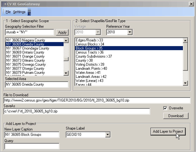
3. Add the county block groups layer to a new project (OpenStreetMaps is used as base layer)
4. Load the Oneida roads shapefile onto your computer
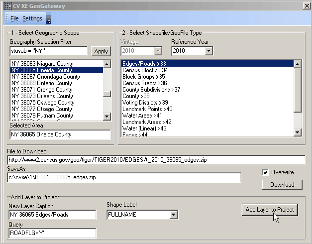
5. Add the roads layer to the same project
6. Perform mapping and analytical operations
If using CV XE Level 1 or above use File>Save and save the project.
Proceed with other CV XE operations on the project.