Baltimore

Contents
Selected CVXE GIS project/applications in Maryland.
Click toggle in Table of Contents at left to view different geography/applications.
Join in the conversation (click to follow):
| • | accessing, integrating & using geographic, demographic, economic data |
| • | decision-making information resources & solutions. |
This section is focused on integrating Census 2010 TIGER Shapefiles with Census 2010, ACS and related data.
See related interactive ranking tables:
| • | Maryland regional section: http://proximityone.com/srdmi/mddmi.htm |
| • | Maryland school district profiles: http://proximityone.com/md_sdc.htm |
See related interactive ranking tables:
| • | Maryland school district demographics: http://proximityone.com/sd_md.htm |
| • | Maryland census tract demographics: http://proximityone.com/ustr0509_md.htm |
| • | Census 2010 demographics: http://proximityone.com/cen2010_pl94171.htm |
(all US geography: state, congressional district, county, school district, city/place, metro)
Situation & Outlook Narrative Demographic-Economic Profiles (updated monthly)
-- http://proximityone.com/s&o_narrative_profiles.htm
Situation & Outlook Interactive Comparative Analysis Profiles
-- http://proximityone.com/s&o_comparative_profiles.htm
Selected Baltimore Area Views
More about metros and Situation & Outlook
| • | Metropolitan Area Guide: http://proximityone.com/metros/guide |
| • | MetroView: demographic-economic profiles & patterns -- http://proximityone.com/metroview.htm |
National to Intersection Level Multicultural Analysis Using Census 2010+
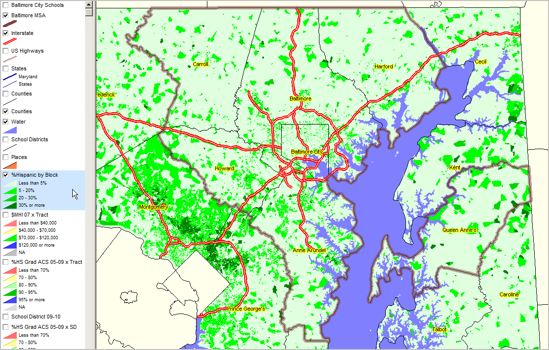
Baltimore, MD MSA & Washington, DC - MD section by Census Block; Baltimore, MD Metro shown with bold brown boundary Percent Hispanic Population data from Census 2010 P.L. 94-171. Hispanic population used to illustrate, select from 70+ multicultural race/ethnic combinations. See http://proximityone.com/cen2010_pl94171.htm for additional information and related ranking table. |
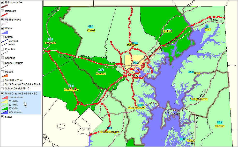
Patterns of Educational Attainment & Economic Prosperity by School District & Census Tract
Educational Attainment by School District Percent high school graduate (population 25 years and over) by school district. Data based on 2009 American Community Survey (http://proximityone.com/acs.htm) 5-year estimates, centric to mid-2007.
Baltimore Metro bold brown boundary
|
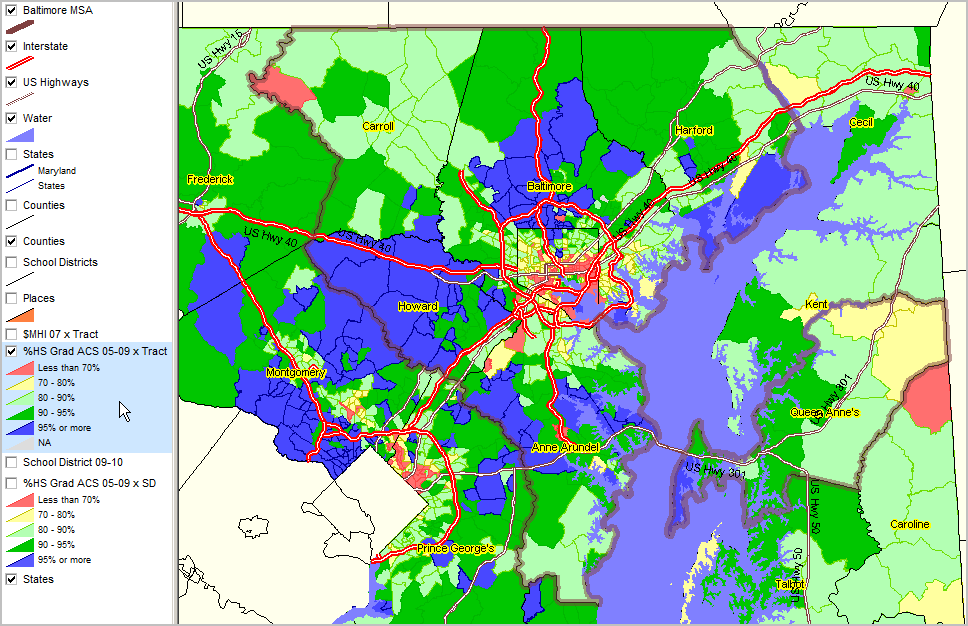
Educational Attainment by Census Tract Percent high school graduate (population 25 years and over) by census tract. Data based on 2009 American Community Survey (http://proximityone.com/acs.htm) 5-year estimates, centric to mid-2007.
Baltimore Metro bold brown boundary
|
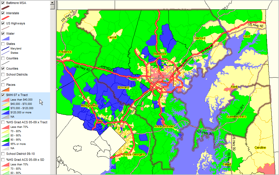
Median Household Income ACS 2005-09 (mid-2007) ... using ACS census tract estimates released December 2010 (http://proximityone.com/acs.htm).
Baltimore Metro bold brown boundary
|