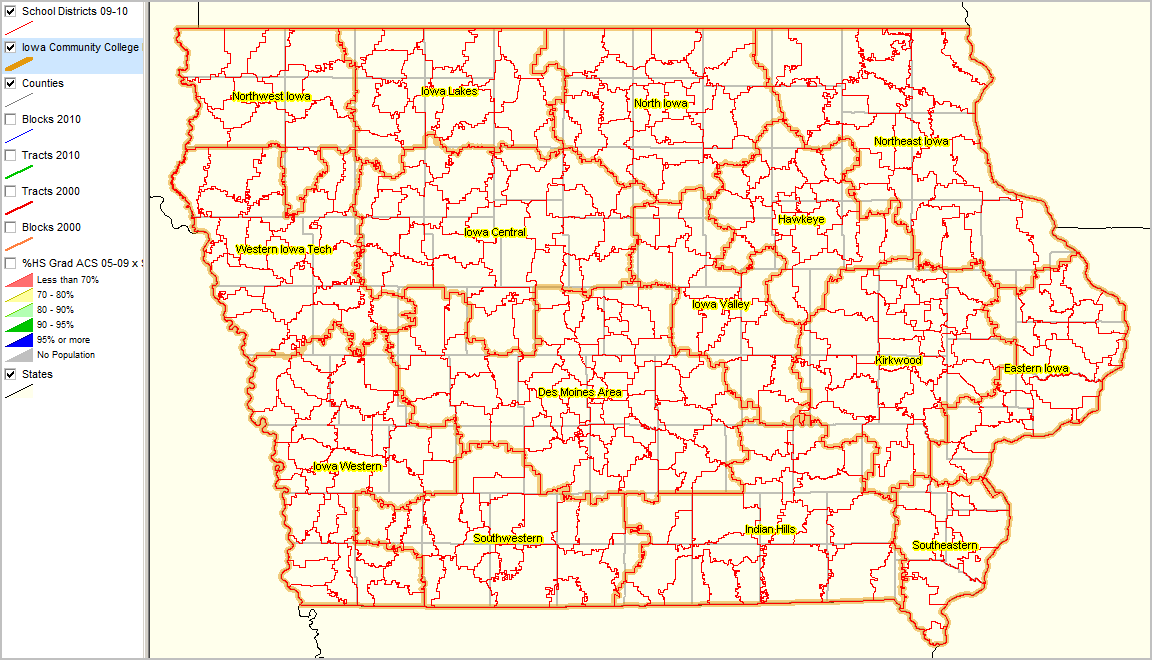
Community College Regions

Contents
Selected CommunityViewer project/application views in Iowa.
Click toggle in Table of Contents at left to view sub-state applications.
Integrating Census 2010 TIGER Shapefiles, ACS 2009 5-year demographics and Iowa Dept Ed School Data.
(Iowa statewide school data geocoded using CommunityViewer Geocoder, creating schools point shapefile)
See related interactive ranking tables:
| • | Iowa school district demographics: http://proximityone.com/sd_ia.htm |
| • | Iowa census tract demographics: http://proximityone.com/ustr0509_ia.htm |
Community College Regions (gold) Counties (gray) School Districts 2009-10 (red)
|
Develop following views for any Community College Area
Community College Regions (gold) Counties (gray) School Districts 2009-10 (red) Patterns of educational attainment by school district; see color key/patterns in legend at left of map.
|
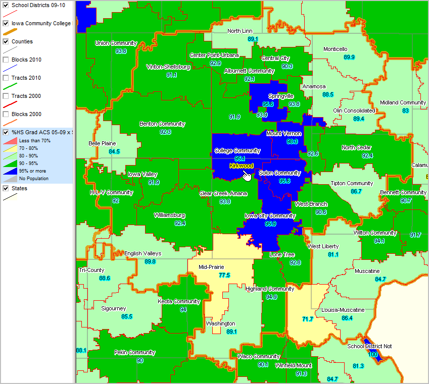
Community College Regions (gold) Counties (gray) School Districts 2009-10 (red) Patterns of educational attainment by school district; see color key/patterns in legend at left of map.
|
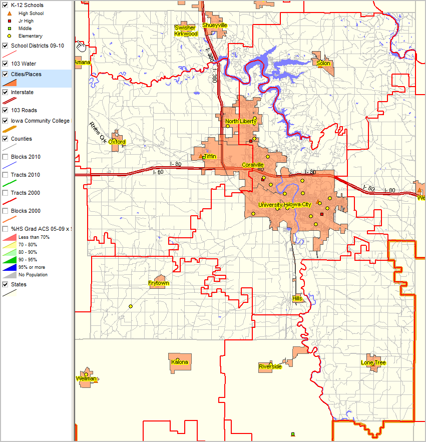
Orienteering Map Views ... note detail on small portion Johnson County not in Kirkwood CC area (lower right)
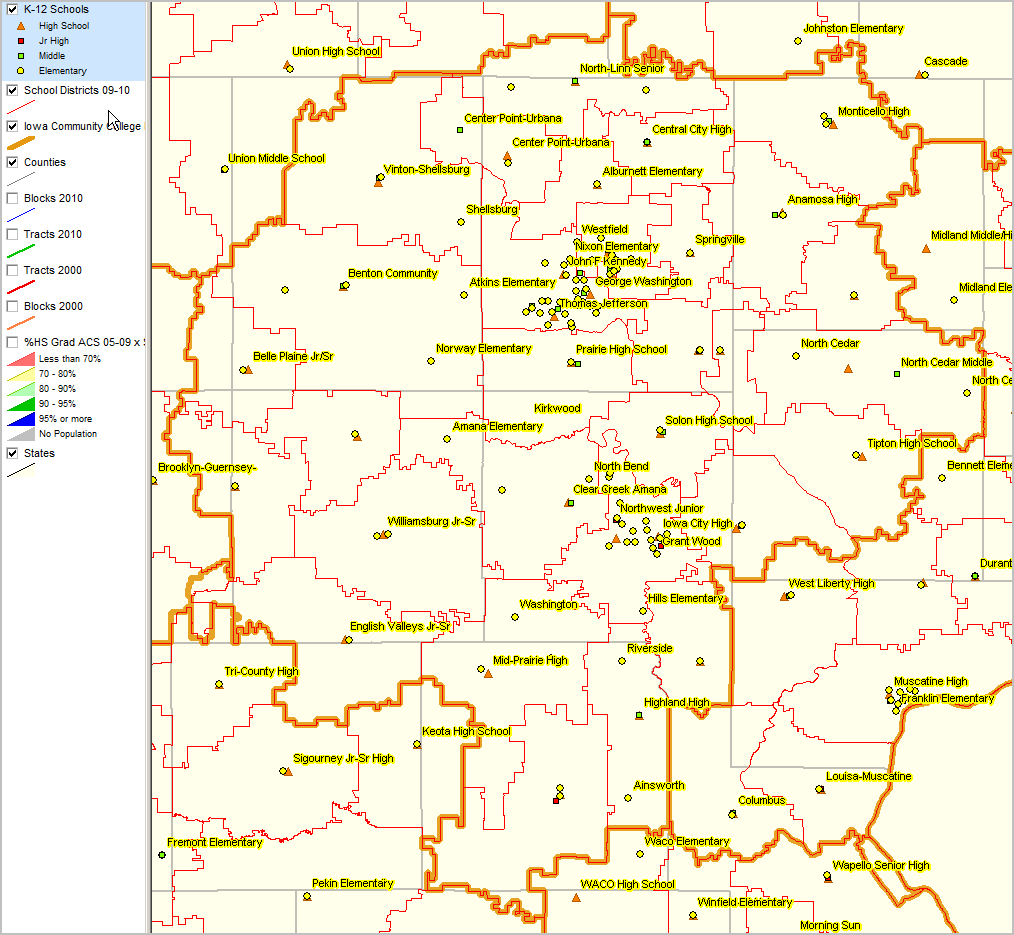
Community College Regions (gold) Counties (gray) Cities/Places (orange fill pattern with yellow labels) K-12 Schools (markers - see legend) School Districts 2009-10 (red) All roads (gray)
|