New Orleans

Contents
Selected CommunityViewer project/application views in Louisiana.
Click toggle in Table of Contents at left to view sub-state applications.
Integrating Census 2010 TIGER Shapefiles, ACS 2009 5-year demographics, Census 2010 demographics and related data.
See related interactive ranking tables:
| • | Louisiana school district demographics: http://proximityone.com/sd_la.htm. |
| • | Louisiana census tract demographics: http://proximityone.com/ustr0509_la.htm. |
| • | Census 2010 demographics: http://proximityone.com/cen2010_pl94171.htm |
(all US geography: state, congressional district, county, school district, city/place, metro)
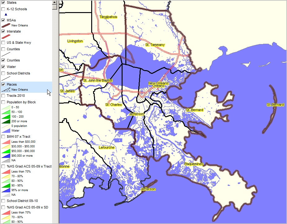
Selected New Orleans Area Views
More about metros and Situation & Outlook
| • | Metropolitan Area Guide: http://proximityone.com/metros/guide |
| • | MetroView: demographic-economic profiles & patterns -- http://proximityone.com/metroview.htm |
|
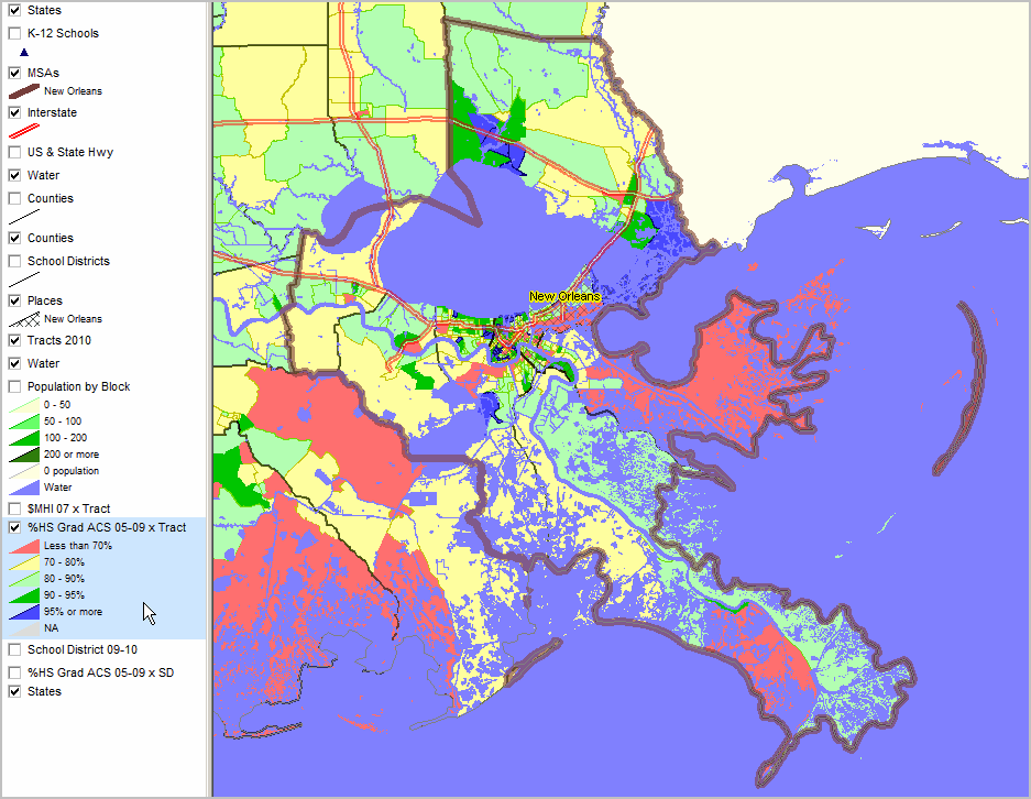
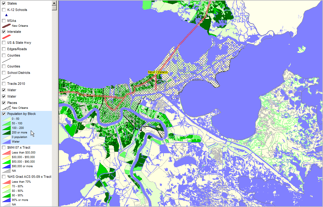
Educational Attainment by Census Tract Percent high school graduate (population 25 years and over) by census tract. Data based on 2009 American Community Survey (http://proximityone.com/acs.htm) 5-year estimates, centric to mid-2007.
|
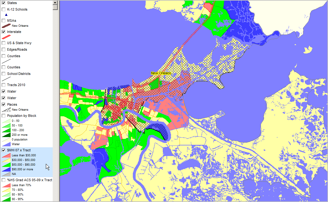
Median Household Income ACS 2005-09 (mid-2007) ... using ACS census tract estimates released December 2010 (http://proximityone.com/acs.htm).
|

|
|
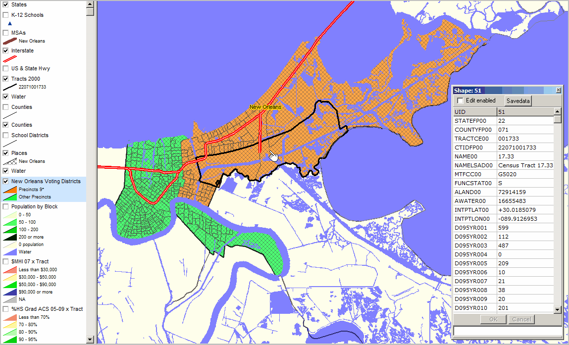
Precincts 9* - orange fill pattern black boundary Other precincts - green fill pattern black boundary Census 2000 tract 22071001733 (bold black boundary encompassing multiple precincts/blocks) CV Identify Tool used to show ACS demographic profile for this tract. Item descriptions: http://proximityone.com/dep1.htm (D095YR001 is total population 599). This census tract was restructured for Census 2010 tabulations.
|
|
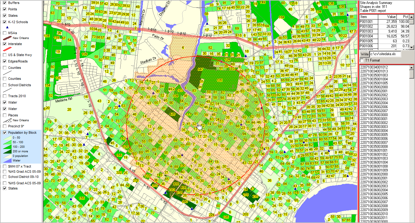
Area similar to previous view. CV Site Analysis operation applied to census block layer; blocks touching 1 mile radius from arbitrary point. In the graphic below, table in upper right shows 911 blocks in this study area.
Aggregate demographics are shown in the mini table below that count: 27,359 total population in this set of blocks (p001001); 16,025 "Black population of one race" (p001004) in this set of blocks. (Item names shown in left column of profile defined at http://proximityone.com/cen2010_blocks.htm.)
List of geocodes for blocks included shown in lower right mini table. By clicking "Write" button, the summary data are written to specified spreadsheet file (see below map graphic).
|