Mid-Missouri

Contents
Selected CommunityViewer project/application views in Missouri.
Click toggle in Table of Contents at left to view sub-state applications.
Integrating Census 2010 TIGER Shapefiles, ACS 2009 5-year demographics, Census 2010 demographics and related data..
See related interactive ranking tables:
| • | Missouri school district demographics: http://proximityone.com/sd_mo.htm. |
| • | Missouri census tract demographics: http://proximityone.com/ustr0509_mo.htm. |
| • | Census 2010 demographics: http://proximityone.com/cen2010_pl94171.htm |
(all US geography: state, congressional district, county, school district, city/place, metro)
Examining city boundary change (from 2000 to 2010) using GIS ...
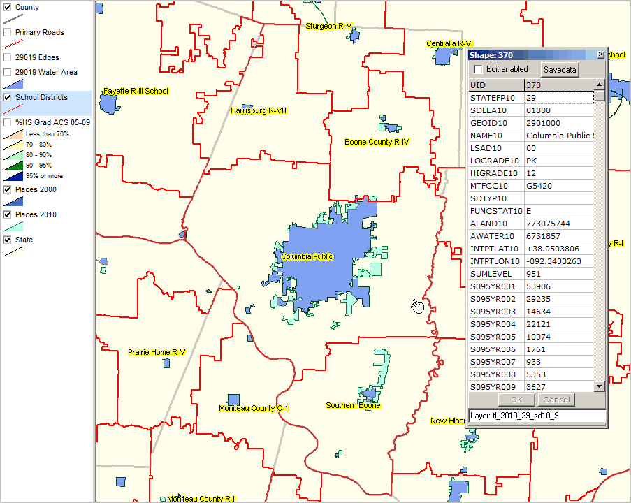
The next view is focused on the Boone County, MO area -- counties have gray boundary.
| • | Cities shown with boundary as of 2000 (darker blue) and 2010 (lighter blue). |
| • | School districts shown with red boundary (2009-10 school year) and name labels. |
CV Identify tool used to show profile of Columbia Public Schools district
-- integrated demographics from 2009 ACS (http://proximityone.com/acs.htm) 5-year estimates shown in table
-- example: S095YR001 (53,906 total households) ... see full item list .. http://proximityone.com/dep2.htm
See related Missouri school district demographics ranking table http://proximityone.com/sd_mo.htm.
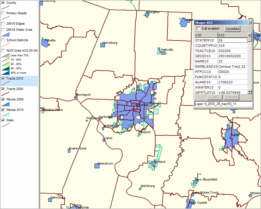
Examining Census Tract Boundary Change 2000 - 2010
-- based on Census 2010 TIGER/Line shapefiles -- http://proximityone.com/tigerline.htm
In the next view Census 2010 tract boundaries (red) and Census 2000 tract boundaries (black) are generally the same for most of the area shown.
But at least two tracts have changed boundaries 2000 to 2010. See area above pointer. In two instances, two tracts from Census 2000 have been combined into one tract for Census 2010. The identify tool is used to profile new Census 2010 census tract 22 comprised of Census 2000 census tracts 4.01 and 4.02.