Houston Area -- Census 2010 & ACS 2005-09

Contents
Selected CV XE GIS project/application views in Texas.
Click toggle in Table of Contents at left to view sub-state applications.
Integrating shapefiles, ACS demographics, Census 2010 demographics, estimates & projections and related data.
See related interactive ranking tables:
| • | Texas school district demographics: http://proximityone.com/tx_sdc.htm. |
| • | Texas census tract demographics: http://proximityone.com/tracts11dp1.htm. |
| • | Census 2010 demographics: http://proximityone.com/s&o_comparative_profiles.htm |
(all US geography: state, congressional district, county, school district, city/place, metro)
Join the conversation .. ProximityOne on Twitter -- https://twitter.com/ProximityOne
The toggle graphic -- ![]() -- indicates an expanding section. Click the toggle or toggle line to view/close expanding sections.
-- indicates an expanding section. Click the toggle or toggle line to view/close expanding sections.
|
Clear Creek ISD school district; southeast Harris County area. School districts appear with bold black boundary. Showing all roads
|

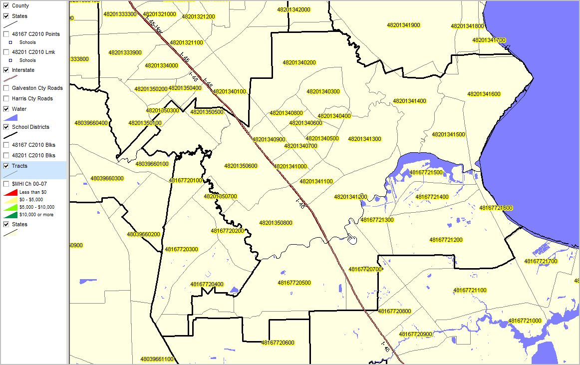
Tracts appear with lighter black boundary; census tract geocode shown as yellow label. Pointer is at Harris/Galveston county line.
|
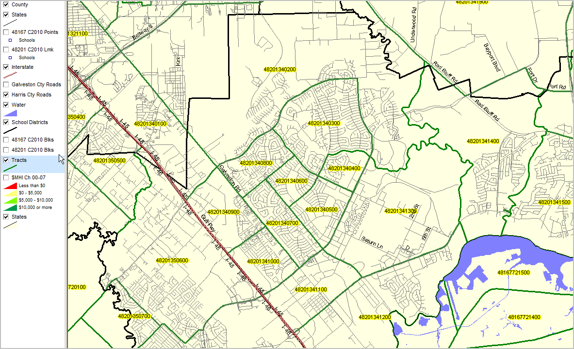
Tracts appear with bold green boundary. All roads shown -- Harris Cty Roads checked on in legend panel.
|
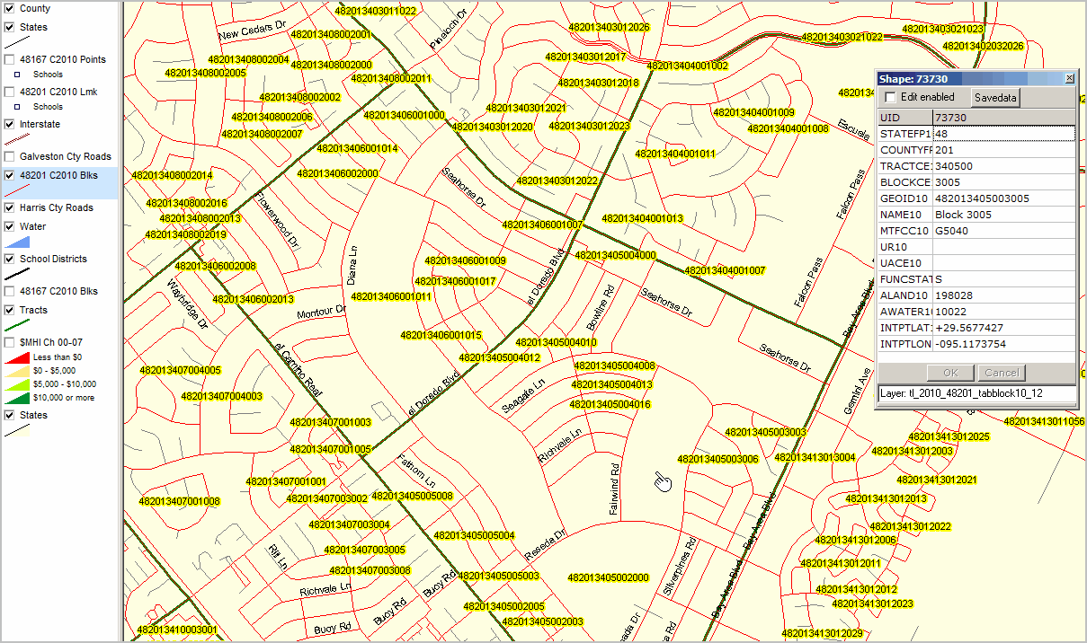
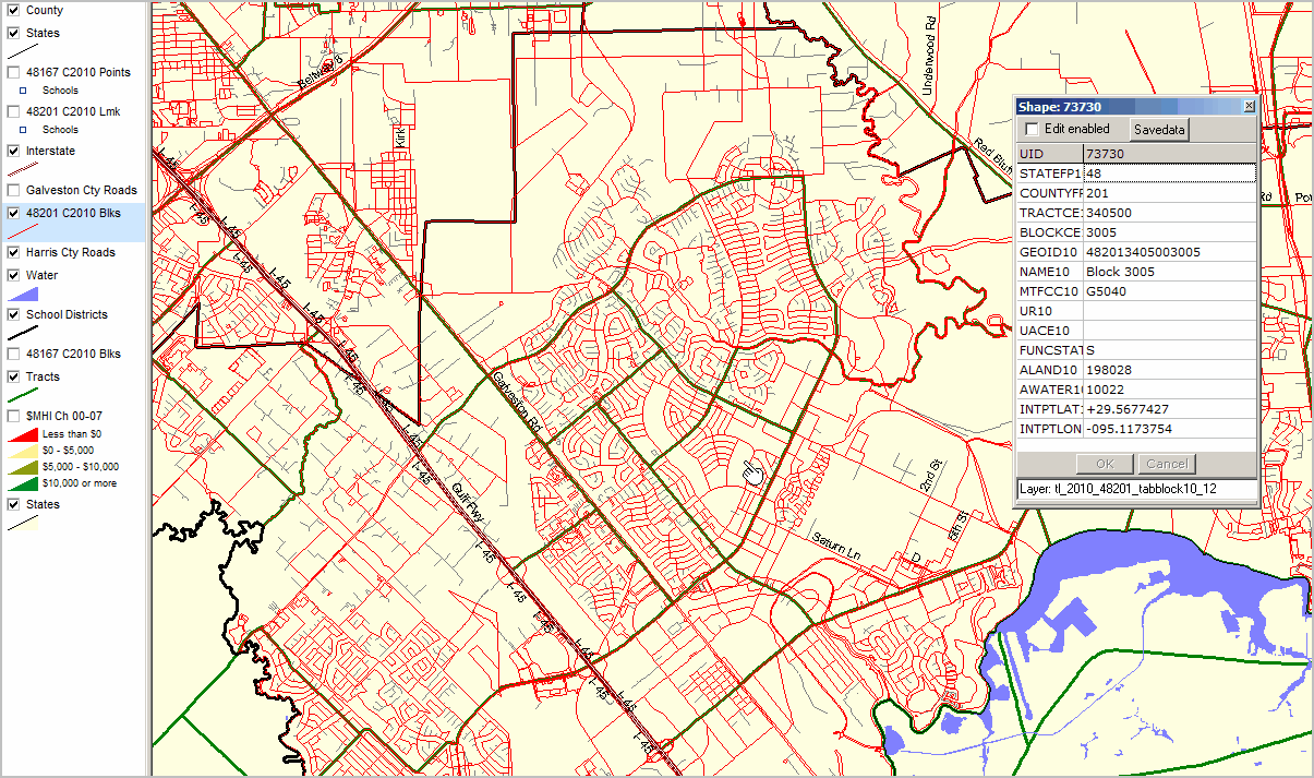
Census blocks shown with red boundary. Identify tool used to show mini-profile of sample block.
|
Census block code shown as label in census block (not all appear due to overlap control setting).
|