San Antonio

Contents
Selected CV XE GIS project/application views in Texas.
Click toggle in Table of Contents at left to view sub-state applications.
Integrating shapefiles, ACS demographics, Census 2010 demographics, estimates & projections and related data.
See related interactive ranking tables:
| • | Texas school district demographics: http://proximityone.com/tx_sdc.htm. |
| • | Texas census tract demographics: http://proximityone.com/tracts11dp1.htm. |
| • | Census 2010 demographics: http://proximityone.com/s&o_comparative_profiles.htm |
(all US geography: state, congressional district, county, school district, city/place, metro)
Join the conversation .. ProximityOne on Twitter -- https://twitter.com/ProximityOne
The toggle graphic -- ![]() -- indicates an expanding section. Click the toggle or toggle line to view/close expanding sections.
-- indicates an expanding section. Click the toggle or toggle line to view/close expanding sections.
San Antonio/Bexar County, Texas Area
Colleges shown as red and white markers; Identify tool used to show mini-profile.
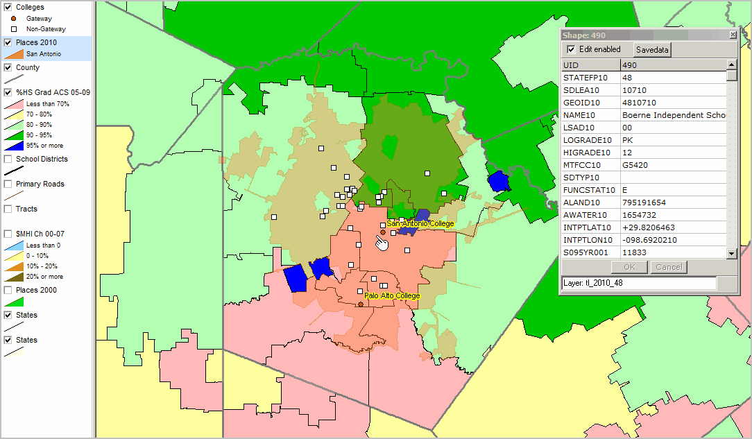
Shows thematic pattern of educational attainment by school district (see legend at left of map).
Percent high school graduate (population 25 years and over) by school district.
Data based on 2009 American Community Survey (http://proximityone.com/acs.htm) 5-year estimates, centric to mid-2007.
See related ranking table http://proximityone.com/sd_tx.htm.

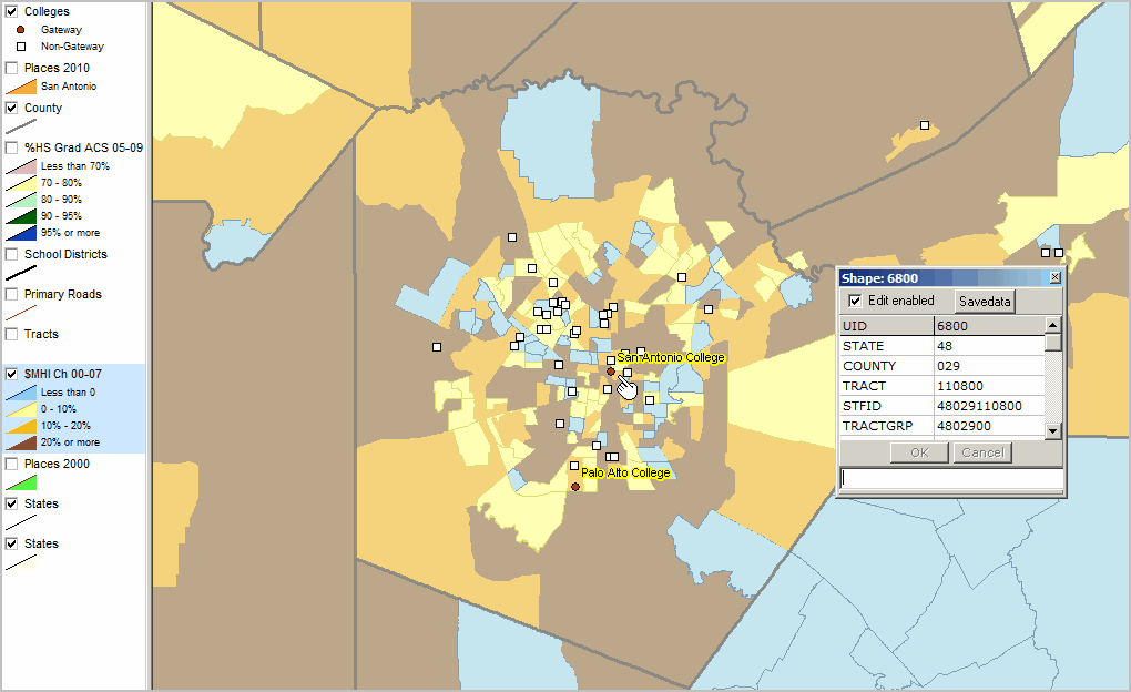
Similar view to above; shows semitransparent view of San Antonio city
Mini-profile for associated school district.
Change in Median Household Income Since Census 2000 by Census Tract
Thematic pattern shows census tracts; median household income change since Census 2000
Data based on Census 2000 and 2009 American Community Survey (http://proximityone.com/acs.htm) 5-year estimates, centric to mid-2007.
See related ranking table http://proximityone.com/ustr0509_tx.htm.
Mini-profile for census tract where Gateway institution located.
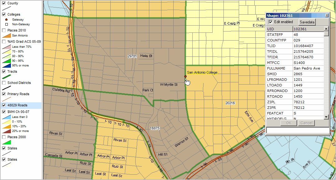
Zoom-in to San Antonio College Location with Street Segment Detail
Thematic pattern shows census tracts; median household income change since Census 2000 (as above).
Tracts shown with green boundary and labeled with median household income 2009 ACS estimate.
All roads layer added. Identify tool used to show mini-profile of road segment where San Antonio College located.