|
Roads 2007 to 2008 Comparison |
  
|
|
Roads 2007 to 2008 Comparison |
|
Especially in Hawaii, but in many other areas through the U.S., roads shapefiles based on the pre-MTAIP completion rendered them of limited value for many mapping and geospatial analyses. This section illustrates how the quality of the streets shapefiles has changed (MTAIP completion). Before and after the December 2008 vintage TIGER/Line edges shapefiles are compared.
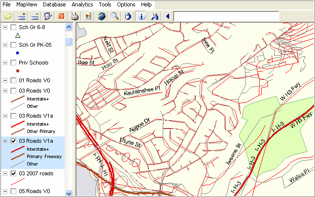
In the the following Honolulu view, the more detailed streets are shown as red lines (2007 vintage) and as gray lines (2008 version). Even at this zoom scale, it is clear that many do not match as to geographic position. 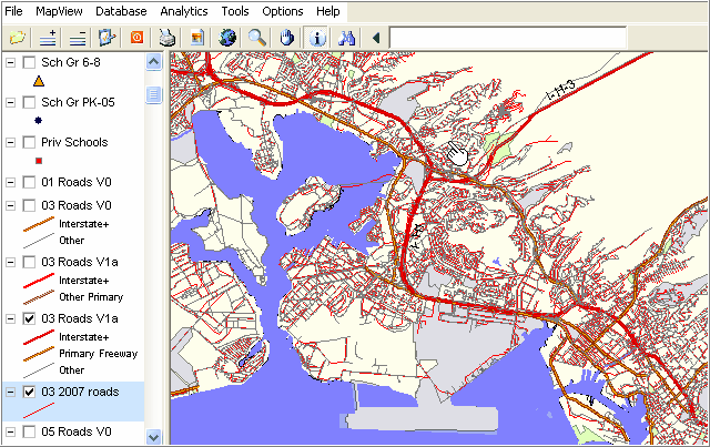
Zoom in View (see pointer in above graphic)
Detail red lines are 07 streets version prior to MTAIP completion
Detail gray lines are 08 streets version after MTAIP completion
With CV running and the hawaii1.gpr project open, experiment with creating similar views.
Page url: http://proximityone.com/hidmi/guide/index.html?roads_0708.htm