|
Updating Roads/Streets |
  
|
|
Updating Roads/Streets |
|
This section addresses the issue of updating roads, based on the Edge2Street derived roads shapefile, in Honolulu County. There are two general areas of updates required. One, there are many road segment coding that are incomplete. Important examples of incompleteness updating include missing street/inaccurate road names, to-from addresses and status codes. Some of these updates can be made using automated CV features. Two, there is the need to update roads as the road segment characteristics change over time -- mainly issues where new and restructured road development is taking place. This form of updating requires a close tie-in with local sourced county road shapefiles..
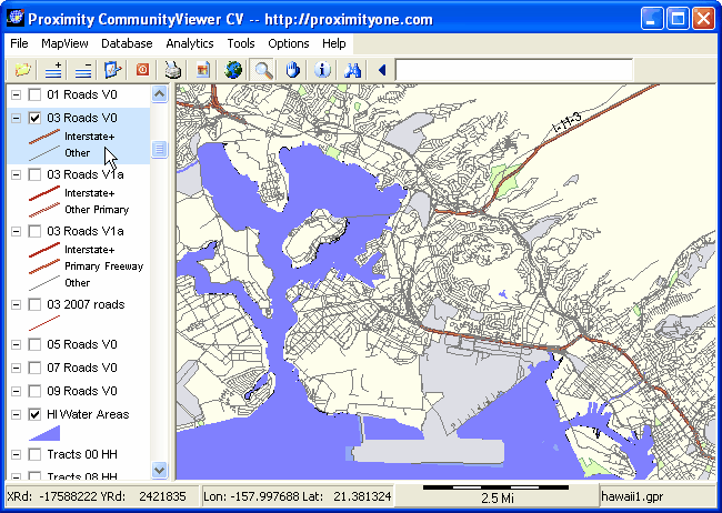
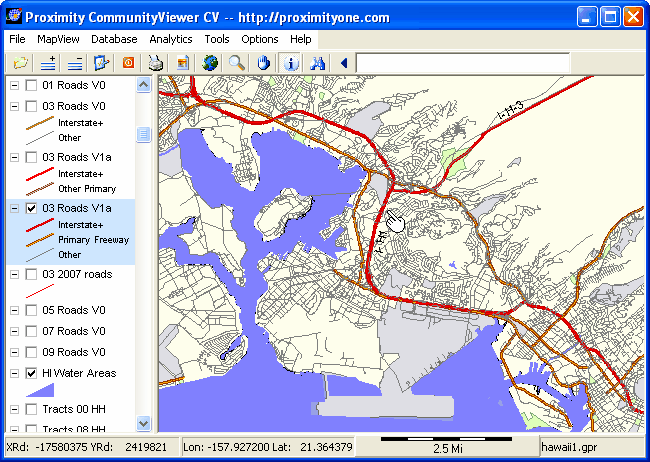
To illustrate, the following examples show updating of segments requiring updating due to status codes. With absent or incorrect status codes (MTFCC and otherwise) major roads cannot be depicted as a class category; e.g. Interstate versus non-Interstate. The graphics shown below show a zoom-in view using the V0 and V1a layers. With CV running and the hawaii1.gpr project open, experiment with creating similar views. Note the standout differences of the appearance of H1 interstate
County 03 Roads V0 Roads TIGER/Line Edges shapefile
The layer editor has been used to set the active layer queries:
| • | Interstate+ -- MTFCC like 'S11%' |
| • | Other roads -- MTFCC like 'S1%' and MTFCC not like 'S11%' |
County 03 Roads V1a Roads TIGER/Line Edges shapefile
The layer editor has been used to set the active layer queries:
| • | Interstate+ -- MTFCC like 'S11%' |
| • | Other roads -- MTFCC like 'S1%' and MTFCC not like 'S11%' |
Page url: http://proximityone.com/hidmi/guide/index.html?roads_updating.htm