|
Tax Parcels, Streets and Schools |
  
|
|
Tax Parcels, Streets and Schools |
|
Extending on the previous roads comparison section, this section adds a City and County of Honolulu tax parcel layer. Tax parcels are important in many applications that extend well beyond their use for tax administration. For example, land use pattern analyses can help with applications ranging from health to environment to education. School properties, as an example, can be identified and viewed/analyzed in context of attendance zones, traffic patterns, and other factors relevant to education facility planning and operation.
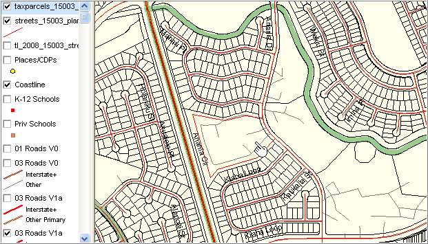
The following view shows the same area as in the previous section with addition of the County tax parcels layer. The census block 1004 area shows here as a single tax parcel.
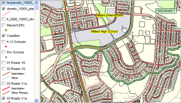
The next zoom-out view (see block 1004 topical area toward center bottom) show the geospatial relationship between school properties as conveyed by the TIGER/Line landmark areas shapefile and the County tax parcel shapefile. Pointer shows Mililani High School identified separately and nearly identically by both shapefiles
Page url: http://proximityone.com/hidmi/guide/index.html?roads_tax_parcels.htm