Fresno, CA

Contents
Selected CV XE GIS project/application views in California.
Click toggle in Table of Contents at left to view sub-state applications.
Integrating shapefiles, ACS demographics, Census 2010 demographics, estimates & projections and related data.
See related interactive ranking tables:
| • | California school district demographics: http://proximityone.com/ca_sdc.htm |
| • | California census tract demographics: http://proximityone.com/tracts11dp1.htm |
| • | Census 2010 demographics: http://proximityone.com/s&o_comparative_profiles.htm |
(all US geography: state, congressional district, county, school district, city/place, metro)
Join the conversation .. ProximityOne on Twitter -- https://twitter.com/ProximityOne
View demographic-economic trends profile for Fresno County, CA; access other county demographic profiles via ranking table links.
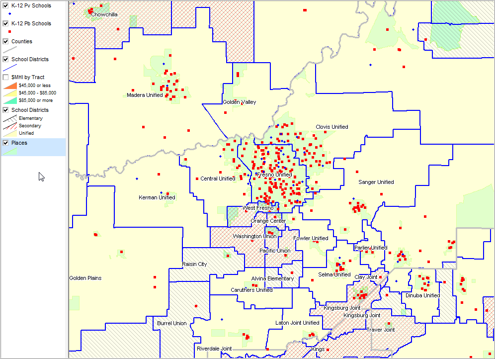
School districts shown by type; see legend at left. Places shown with green fill pattern; K-12 public & private schools shown as markers.
|
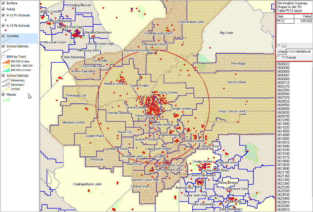
Illustrates using the Site Analysis feature to draw a 25 mile radius circle from center of Fresno.
|
||||||||||||
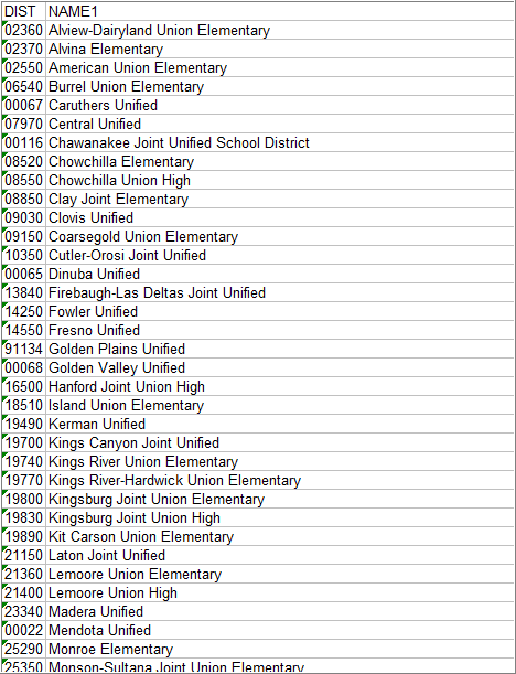
Partial list of 53 school districts in set of selected districts. Illustrates how the selections shapefile dbf can be opened using (for example) Excel and view just selected items.
|