Riverside County, CA

Contents
Selected CV XE GIS project/application views in California.
Click toggle in Table of Contents at left to view sub-state applications.
Integrating shapefiles, ACS demographics, Census 2010 demographics, estimates & projections and related data.
See related interactive ranking tables:
| • | California school district demographics: http://proximityone.com/ca_sdc.htm |
| • | California census tract demographics: http://proximityone.com/tracts11dp1.htm |
| • | Census 2010 demographics: http://proximityone.com/s&o_comparative_profiles.htm |
(all US geography: state, congressional district, county, school district, city/place, metro)
Join the conversation .. ProximityOne on Twitter -- https://twitter.com/ProximityOne
View demographic-economic trends profile for Riverside County, CA; access other county demographic profiles via ranking table links.
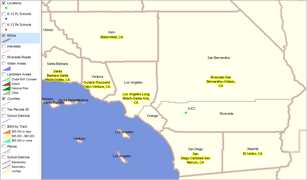
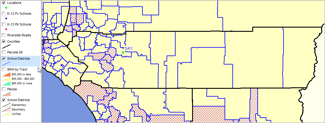
Metropolitan Statistical Areas (MSAs) shown with bold red-brown boundary. Riverside County part of Riverside-San Bernadino-Ontario, CA MSA. Location of San Jacinto Community College shown as green marker (a focus are in next graphic - Site Analysis).
|
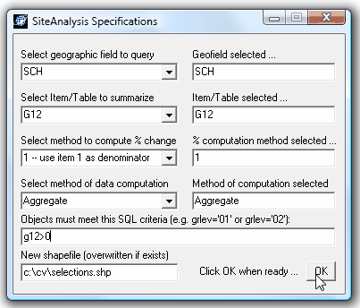
A site analysis is performed to count the number of students a certain distance from a college. The K-12 public schools layer is selected to analyze. The SiteAnalysis Specifications are set as shown in form below. The number enrolled in G12 (grade 12) will be aggregated. Only select schools having 12th grade enrollment.
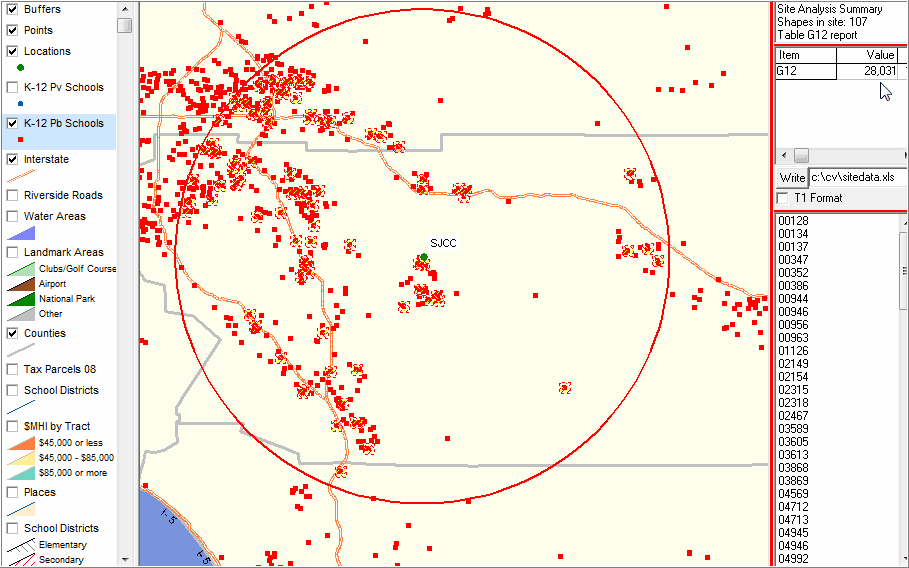
In the map view panel, the mouse is used to drag/draw a circle (40 mile radius). Upon releasing the mouse, schools (red markers) are cross hatched that meet the criteria (G12>0) The count (107 schools) and Grade 12 enrollment (28,031) are shown in upper right panel. The lower right panel lists the schools (by code) included in the selection. These schools are written to an Excel file and a schools selected shapefile is created for possible subsequent use.
|
|
|
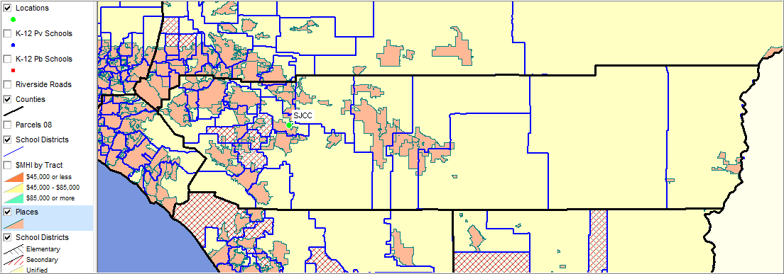
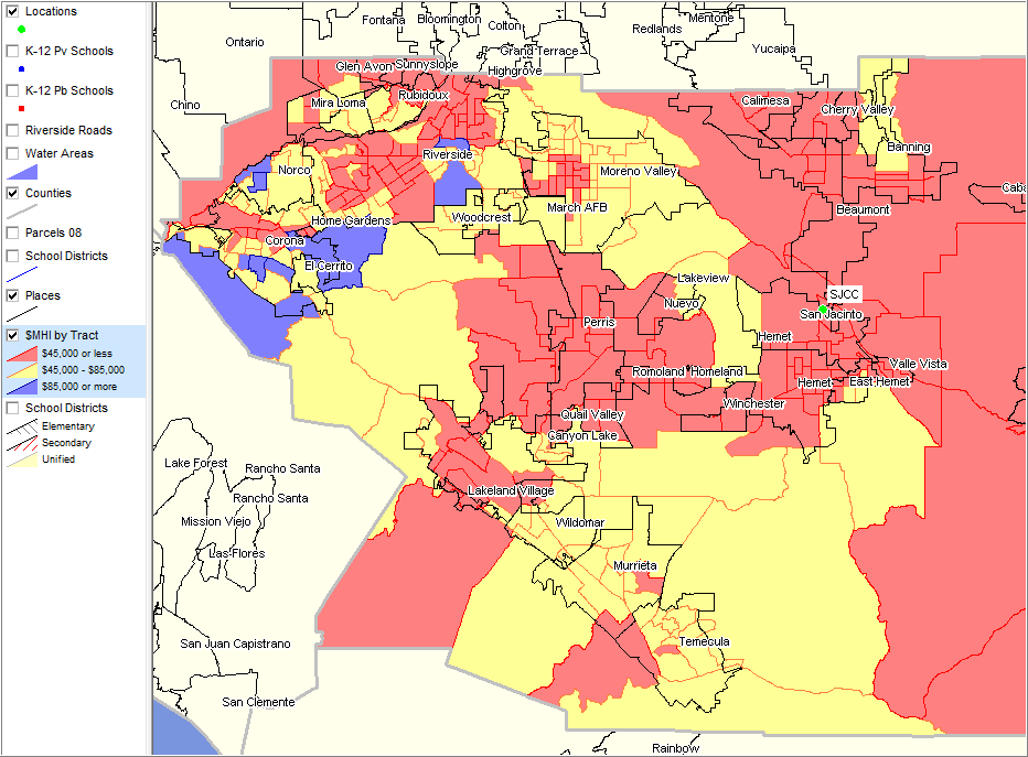
Places - names as labels; black boundaries Median Household Income (Census 2000) by census tract - see legend for pattern/intervals
|
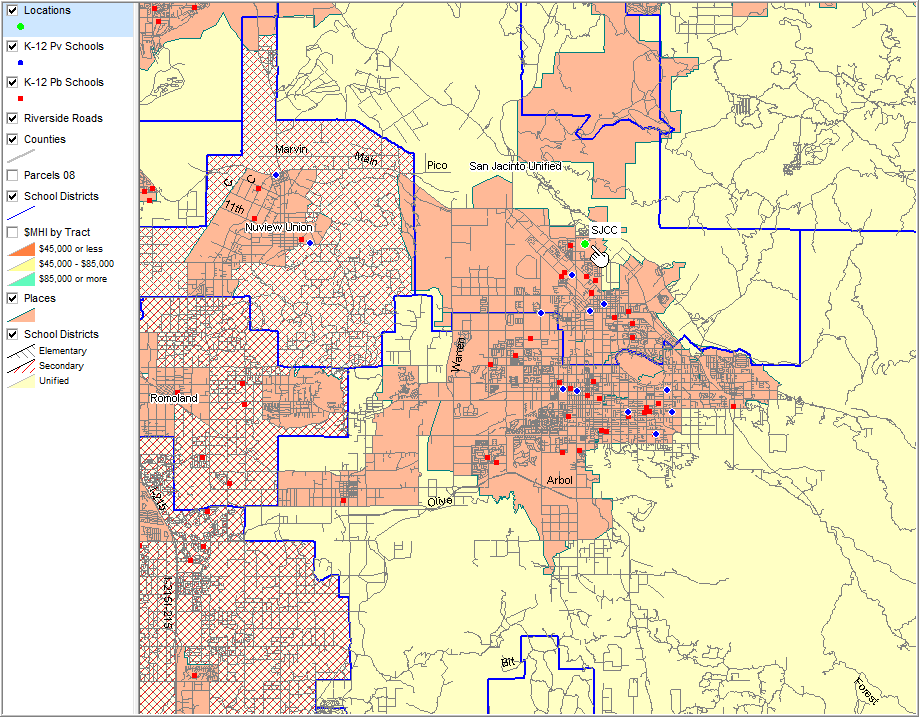
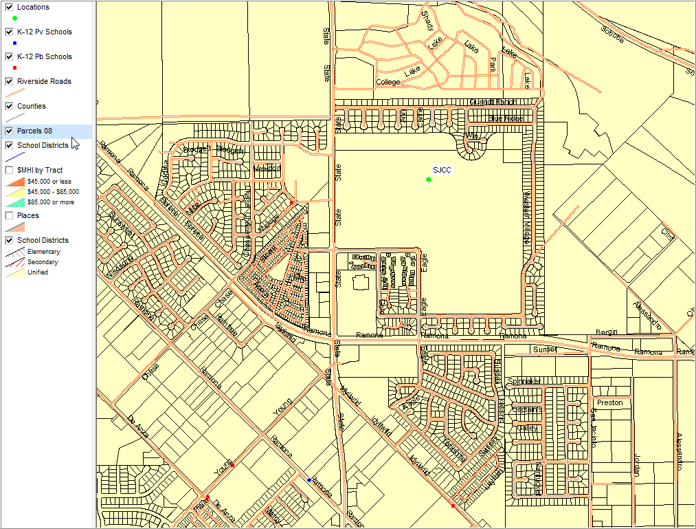
Places - orange K-12 private and public schools - red/blue markers School districts - blue boundaries School districts - crosshatching to show type of district (E,S, U) - see legend Roads
|
Drill down to area near pointer in previous view More than 700,000 tax parcels in Riverside County Tax Parcels - black boundaries Roads - white line with red edge
|
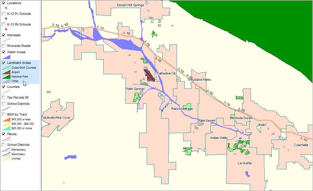
Places with water and landmark areas and Interstate highway
|