|
San Diego Project |

|

|

|

|

|

|
|
|
San Diego Project |

|

|

|

|

|

|
San Diego Project
| Decision-Making Information | |
|
Contact Proximity for information resources and solutions ... (888) DMI-SOLN (888) 364-7656 |
Updates and Use
The CV GIS San Diego, CA project fileset is frequently updated. CV Level 2 and CV Level 3 users may download and use the San Diego, CA project fileset.
Users with San Diego-specific geodemographic-economic analysis interests have a ready-to-use foundation. Add your data. Extend the scope of analysis.
Project Start-up
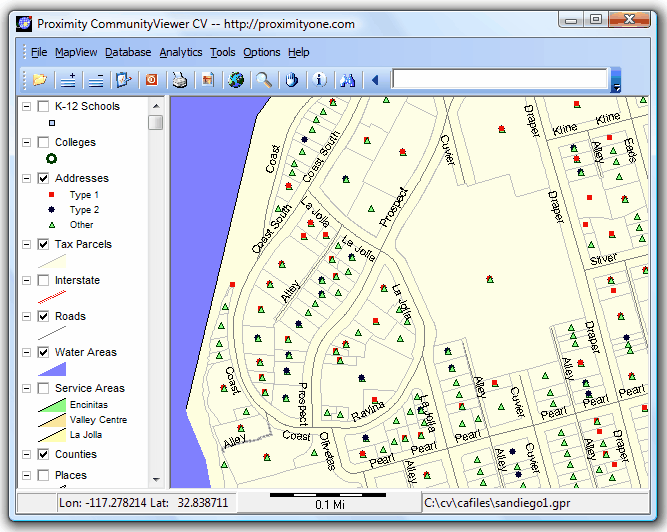
The CV GIS San Diego project file is named sandiego1.gpr. The default drive/folder for this project and related files is c:\cv\cafiles. The geographic extent of the project is the U.S. and Mexico. Most layers are focused on the San Diego county area. Access layer illustration views and attributes by expanding (click +) on the San Diego Project in the navigation panel at left.
A similar project can be developed for and county or region in the U.S. Contact Proximity for details.
CV SanDiego1 Start-up View
