|
|
China Focus Related Resources CommunityViewer GIS Site Analysis Related Applications Hawaii K-12 Schools School Districts |
China Decision-Making Information
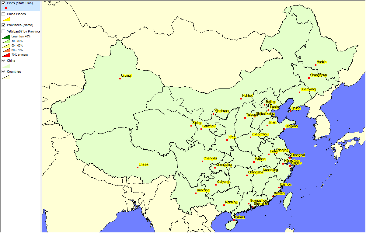
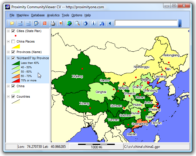
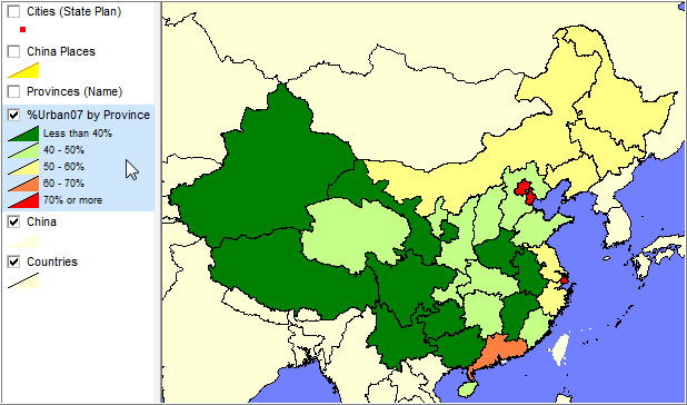
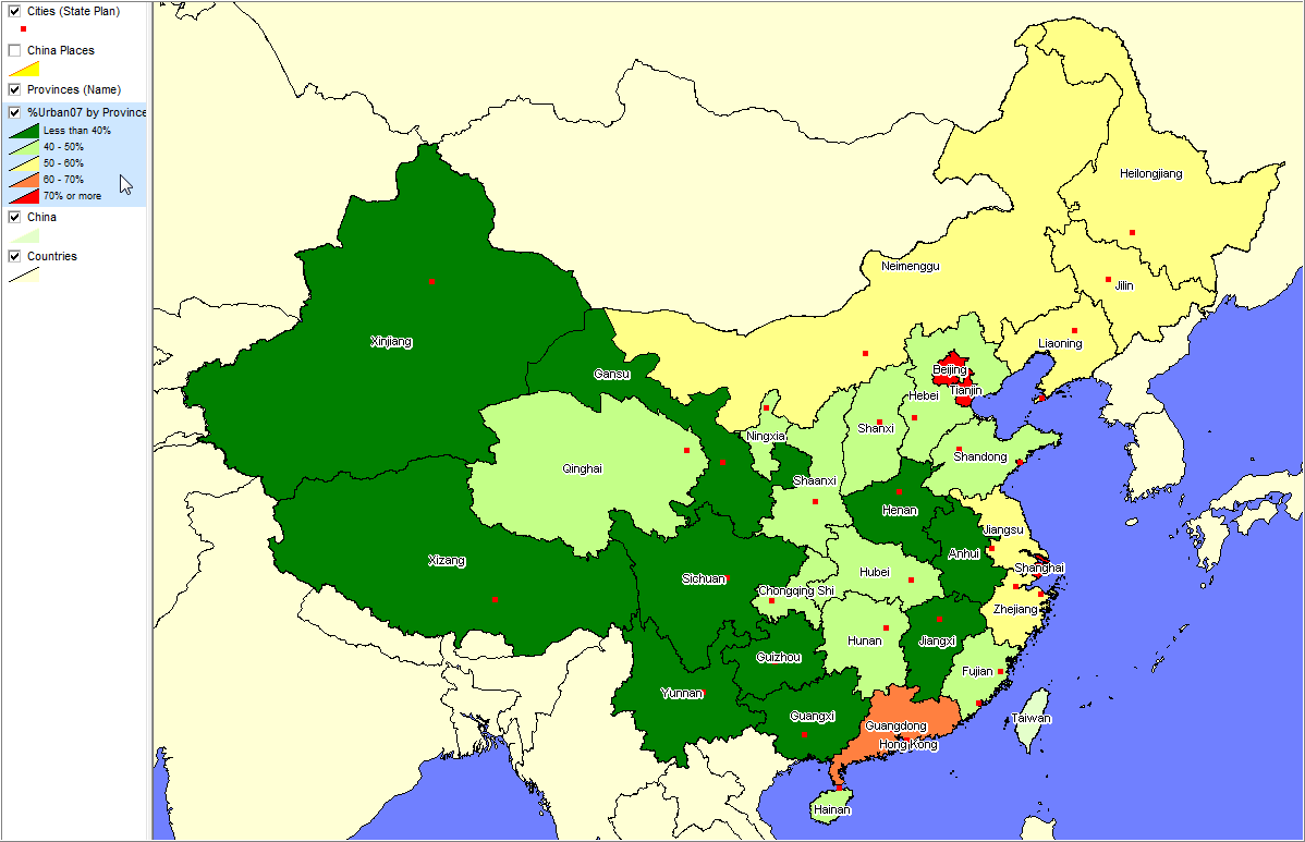
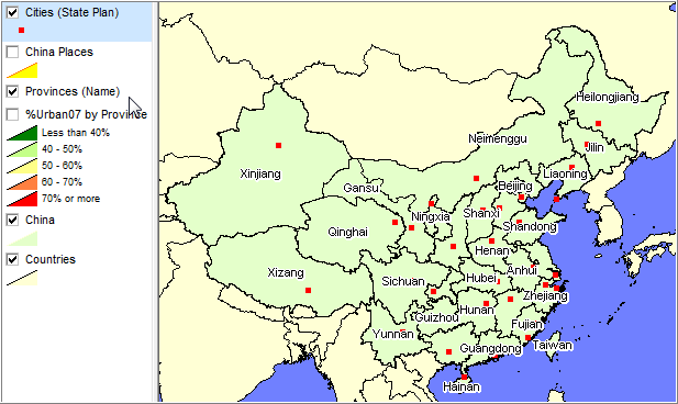
CommunityViewer GIS Project & Applications Web-based interactive mapping applications, such as the China Google Maps API sections, provide one way to present location-based information in the context of a map view. There are many advantages including ease of use, almost no learning, computer-platform indepedence, among others. At the same time there are many limitations to the Google Maps API applications including difficulty/inability to add map layers, inability to create effective thematic maps, inability to perform geospatial analysis, limited ability to add/remove/modify labels, among many others. Geographic Information Systems (GIS) software offer an extended capability to analyze geodemographics. This section provides access to China city/province geodemographic data in the form of a CommunityViewer GIS project. Download and use the associated no fee, no registration GIS project; view/analyze city locations in context of other geography. CV GIS China GeoDemographics Project ... download & use this GIS project ... Terms of Use and Related Information show Install and use the no-fee, no registration CommunityViewer China GeoDemographics Project on your computer to flexibly create thematic maps like those shown below. Create different thematic map views. Zoom, label, capture for your presentations. Use in live/dynamic presentations. Choose from wide range of subject matter items; create algebraically computed values to display. • Start-up View show • View 1. Percent Urban Population 2007 by Province show • View 2. Provincial Capitals and State Plan (2007) Cities show Installation Steps Step 1. If you do not already have CommunityViewer (CV) GIS installed, run the CV setup/install first (take all default settings). Step 2. Install the China GeoDemographics CV GIS Project After installing CV, expand the China GeoDemographics CV project zip file to c:\cv\china. - the files must be expanded to c:\cv\china for the operations to work correctly. - this project runs with all versions of CommunityViewer. Step 3. Using the China GeoDemographics CV Project After the China GeoDemographics CV project is installed, proceed to use the project as follows: - start CV software (use desktop shortcut). - from the CV main menu, use File>Open and open the project file c:\cv\china\china1.gpr. - the start-up view appears as shown Start-up View (see above). - to show View 1 (see above) ... click off layers "Cities (State Plan)" and "Provinces (Names)" in legend panel - see more about CV navigation operations. - display a thematic map using any of the items in the U.S. by State Dataset (see items listing below) - see more about using the CV Layer Editor to modify an existing layer. - more live assistance is provided in no fee CV Webinars conducted most Tuesdays - if you need help now, call Proximity -- (888) 364-7656 Subject Matter Items/Fields • World by Country GeoDemographics Dataset Subject Matter Items/Fields show • China GeoDemographics Province Dataset Subject Matter Items/Fields show • China GeoDemographics Cities Dataset Subject Matter Items/Fields show Additional Information Proximity develops geodemographic-economic data and analytical tools and helps organizations knit together and use diverse data in a decision-making and analytical framework. We develop custom demographic/economic estimates and projections, develop geographic and geocoded address files, and assist with impact and geospatial analyses. Wide-ranging organizations use our tools (software, data, methodologies) to analyze their own data integrated with other data. |
|
|
 Larger View
 Larger View