
|
|
|
119th Congressional Communities The 119th Congressional Communities subdivide the 119th Congressional Districts exactly using census block geography. The 119th Congressional Communities boundary files are a resource developed by the nonprofit organization Congressional Communities. Congressional Communities provide a way to differentiate the demographic and economic attibutes of the corresponding CD. The 119th Congressional Communities boundaries have been developed in May 2025 updating the previsous version. The 119th Congressional Communities boundaries (shapefile) reflect a total of 7,407 CCs. The boundaries account for changes in CD boundaries from 118th to 119th (5 states) and methodology changes in selected states. The number of CCs per CD range from 15 to 18. This section reviews how you can use the 119th CCs, the scope of geometry and the subject matter integrated from the Census 2020 and American Community Survey. • 01 119th Congressional Communities using iVDA -- interactive map using the VDAGIS Base project • 02 119th Congressional Communities using iVDA -- grid/table view • 03 Census 2020 Block to 119th Congressional Communities Equivalence File -- census block level • 04 119th Congressional Communities with Integrated Census 2020 Demographics • 05 119th Congressional Communities with Integrated American Community Survey Demographics • 06 119th Congressional Communities & 119th Congressional Districts with Projections • 07 Future enhancements Interactive mapping is provided using the Base project with the iVDA (https://proximityone.com/ivda.htm) embedded Web application. 119th Congressional Communities (lower 48 states) using iVDA interactive map using the VDAGIS Base project 119th Congressional Communities (lower 48 states) using iVDA - grid/table view .. goto top -- static graphic; use above iVDA frame to generate this view -- shows use of Table/Grid .. activate by selecting layer then clicking Query button below table -- illustrates use of search tool to locate a CC by name of area -- Riley County, KS selected and shows profile (lower left) -- main grid shows all CCs, illustrating ranked all CCs total population in descending order (click header) 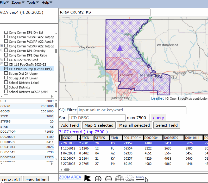
Census 2020 Block to 119th Congressional Communities Equivalence File .. census block level .. goto top .. file containing relationship between each census block and 119th CC/CD .. sample file shown here; entire file is 300+ MB in zip form .. file associates each Census 2020 census block with each Congressional Community with each 119th Congressional District. .. illustrative view of ZIP file: 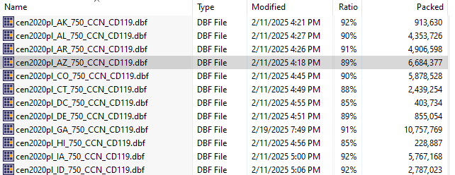 .. illustrative view of Arizona file showing by in CC 0101: 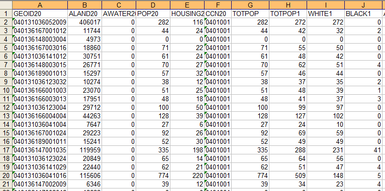 119th Congressional Communities with Integrated Census 2020 Demographics.. goto top The layer with caption "CC 119/2025 Pop (Cen20 DP1)", as used in the top two examples, is the 119th Congressional Communities shapefile with integrated Census 2020 Demographic Profile (DP1). The DP1 dataset is comprised of 160 Census 2020 statistical subject matter items as described below. .. DP1 data 119th Congressional Communities with Integrated American Community Survey Demographics.. goto top The layer with caption "CC 119/2025 ACS23 Itemset1" is the 119th Congressional Communities shapefile with integrated, annual updated, American Community Survey Itemset1. The Itemset1 dataset is comprised of selected demographic, social, economic and housing items as described below. .. Itemset1 Data These data are derived from the Demographic Profile datasets updated annually. They are released for public use at the tract level in December. The latest data are for the 2023 ACS 5-year tract level data that correspond to the respondent years 2019 through 2023 -- a 5-year period with data centric to 2021. The tract level data are used to develop 119th CC area estimates. Values for tracts that are entirely contained within a CC are added. Values for tracts that are split by a CC boundary are estimated by using a proportion of population for the blocks contained within the CC. 119th Congressional Communities & 119th Congressional Districts with Projections.. goto top As it stands now, in 2025, the available data for the 119th CCs are Census 2020 and ACS 2023 5-year estimates. For the 119th Congressionnal Districts, Census 2020 data were released by Census on December 7, 2024 and 2023 ACS 1-year estimates were released on January 12, 2025. In review, the latest 119 CC data are centric to 2021 and the latest 119th CD data are for 2023. We need 2025 estimates (at minimum) for both CCs and CDs. We develop the 2025 estimates and projections to 2030 for total population and total housing units using a model and combination of Ceneus 2020, ACS annual data, and other data resources. Future enhancements The annual CC and CD estimates and projections to 2030 are updated annually as new historical data are released. ProximityOne User Group .. goto top Join the ProximityOne User Group to keep up-to-date with new developments relating to metros and component geography decision-making information resources. Receive updates and access to tools and resources available only to members. Use this form to join the User Group. Support Using these Resources .. goto top Learn more about accessing and using demographic-economic data and related analytical tools. Join us in a Web session. No fee. Each informal session is focused on a specific topic. The open structure also provides for Q&A and discussion of application issues of interest to participants. Additional Information .. goto top ProximityOne develops geographic-demographic-economic data and analytical tools and helps organizations knit together and use diverse data in a decision-making and analytical framework. We develop custom demographic/economic estimates and projections, develop geographic and geocoded address files, and assist with impact and geospatial analyses. Wide-ranging organizations use our tools (software, data, methodologies) to analyze their own data integrated with other data. Contact ProximityOne (888-364-7656) with questions about data covered in this section or to discuss custom estimates, projections or analyses for your areas of interest. |
|
|