
|
|
|
The Supplemental Nutrition Assistance Program (SNAP) is the largest anti-hunger program in America. It is designed to help low- and no-income individuals and families afford the nutritious food essential to health and well-being. SNAP provides monthly financial assistance specifically for purchasing groceries. SNAP benefits are distributed on an Electronic Benefit Transfer (EBT) card, which works like a debit card at authorized stores. SNAP is the current official name, but it often is called "Food Stamps." To qualify, households must generally meet specific income and resource limits, which are uniform federally but administered by state-level agencies. This section provides access to summary charateristics about SNAP recipients based on the ACS 2023 data. We start with VDA (Visual Data Analysis) geospatial tools to analyze Congressional Communities in context of Congressional Districts. Do not miss the more recent U.S. by county interactive table enabling another type of analysis for a different level of geography. Using VDA to Examine SNAP Participation by Congressional Community ACS2023 .. the starting view shows the lower 48 states. .. the view provides summary characteristics about SNAP households based on ACS 2023. .. patterns (see legend, slide down) of the number of SNAP households by 119th Congressional Community (CC). .. use VDAW4 for full-screen view. See below for more detail. .. click a CC of interest and view profile in lower left panel. Or, enter your address and press Enter. then scroll down to view the number of SNAP Households (E074) and other atttibutes. SNAP Operation SNAP is a federal-state program. At the federal level SNAP is overseen by the Food and Nutrition Service (FNS), U.S. Department of Agriculture. USDA/FNS sets national rules and regulations for eligibility, benefit levels, and administrative procedures, funds the program, and authorizing and monitoring the retail stores. State agencies processing applications and determining the eligibility of households, calculating the monthly benefit amount for eligible households, issues the benefits onto the Electronic Benefit Transfer (EBT) cards and administering the program at the local level through county or city offices. The current SNAP costs approximately $100 billion annually, mostly distributed to recipients. The average recipient (person) recieves $188. SNAP Participation On average, around 42 million Americans received SNAP benefits per month in recent fiscal years (FY 2023-24). The share of population receiving SNAP is 1 in 8 Americans, or about 12.3% of the U.S. population. The national participation rate was estimated at 88% of all eligible individuals. The age distribution of SNAP beneficaries is children (under 18) 39%, working age adults (18-59) 42%, and older adults (60+) 19%. American Community Survey SNAP Data Characteristics of household's receipt of Supplemental Nutrition Assistance Program (SNAP) are determined by a question collected annually as a part of the American Community Survey program. These data are used to create statistics about participation in food assistance programs for planning and funding government programs. Question as it Appears on ACS Questionnaire 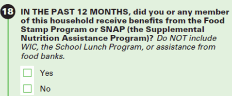 The ACS data are published in several tables as shown in the Federal Statistical System -- Data Access & Use resource. Data for these tables maybe be retrieved using the ProximityOne Demographic Economic Data Explorer (DEDE) for multiple geographic levels, SNAP Participation by Congressional Community ACS2023 .. this map provides summary characteristics about 2023 SNAP recipients based on ACS 2023. .. data are shown for Congressional Communities that are precise subdivisions of 119th Congressional Districts. .. patterns (see legend) shows the number of SNAP households by 119th Congressional Community. .. click for larger view with 119th Congressional Districts .. see below for more detail. 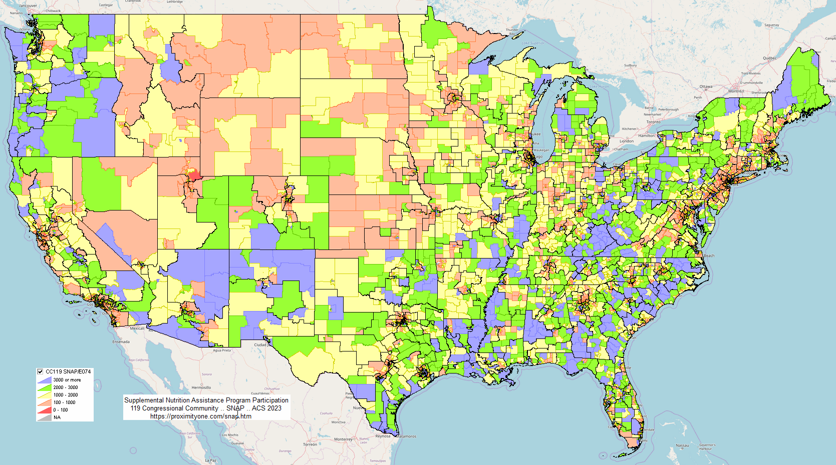
SNAP Participation per Household by Congressional Community ACS2023 .. this map provides summary characteristics about 2023 SNAP recipients based on ACS 2023. .. data are shown for Congressional Communities that are precise subdivisions of 119th Congressional Districts. .. patterns (see legend) shows 100*SNAP households/total households by 119th Congressional Community. .. click for larger view with 119th Congressional Districts 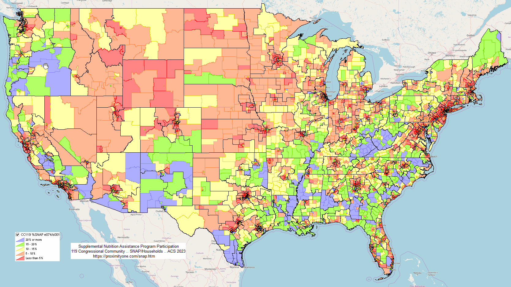
U.S. by County SNAP Participation Interactive table goto top three ways to view Median Household Income (MHI) by county. data based on 2023 American Community Survey 5-year estimates. negative values indicate data not available. click column header to sort; again to sort other direction. click ShowAll/Reset button between queries to refresh table. Usage notes below table. Usage Notes • State-County Names & FIPS Codes • Metro Names & Codes Use VDA GIS for Further Analysis The Visual Data Analytics (VDA) Geographic Information System (GIS) was used to develop the above maps. You can use VDA GIS to develop variations of the maps; different intervals, colors, zooms, etc. There is nothing to install. VDAGIS tools and data have been developed and are updated/supported by Warren Glimpse/ProximityOne/Alexandria, VA USA and Takashi Hamilton/Tsukasa/Osaka, Japan. ProximityOne User Group .. goto top Join the ProximityOne User Group to keep up-to-date with new developments relating to metros and component geography decision-making information resources. Receive updates and access to tools and resources available only to members. Use this form to join the User Group. Support Using these Resources .. goto top Learn more about accessing and using demographic-economic data and related analytical tools. Join us in a Web session. No fee. Each informal session is focused on a specific topic. The open structure also provides for Q&A and discussion of application issues of interest to participants. Additional Information .. goto top ProximityOne develops geographic-demographic-economic data and analytical tools and helps organizations knit together and use diverse data in a decision-making and analytical framework. We develop custom demographic/economic estimates and projections, develop geographic and geocoded address files, and assist with impact and geospatial analyses. Wide-ranging organizations use our tools (software, data, methodologies) to analyze their own data integrated with other data. Contact ProximityOne (888-364-7656) with questions about data covered in this section or to discuss custom estimates, projections or analyses for your areas of interest. |
|
|